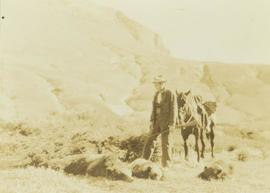
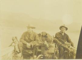
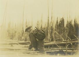
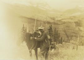
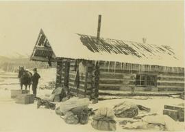
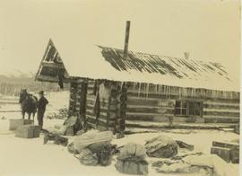
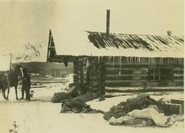
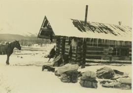
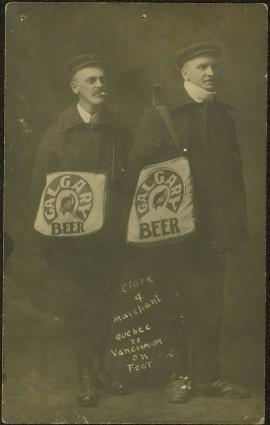
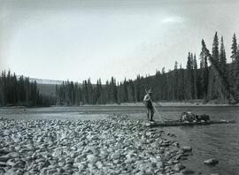
Photograph depicts two men posed with "CALGARY BEER" bags slung over shoulders. Handwritten annotation on verso of photograph: "Clark & Marchant Quebec to Vancouver on Foot", on recto: "To H F Glassey With Every Good wish. from Leo Marchant. Pearson's Magazine 1909."
Photograph depicts a power dam near Cascade, BC.
Item is a preliminary plan showing traveled route of the Bedaux Sub-Arctic Expedition in 1934.
Photograph depicts a man who is probably Prentiss Gray standing over three felled grizzly bears. The man is holding onto the reins of a horse and a rifle while a mountain range rises up in the background.
Photograph depicts a man, probably Prentiss Gray, standing over three felled grizzly bears while holding the reins of his horse and a rifle. In the background a mountain side rises up in the distance.
Photograph depicts a man who is probably Prentiss Gray standing over three felled grizzly bears. The man is holding the reins of a horse while a mountain rises in the distance.
Photograph depicts Prentiss Gray (left) and Mac McGarvey (right) seated in a boat on the Peace River.
Photograph depicts Prentiss Gray climbing over fallen logs in an area of windfall.
Photograph depicts Prentiss Gray standing with his rifle and horse in a grassy field. In the background a forested valley and snow-covered mountain range is visible.
The Prince George Railway & Forestry Museum Society Collection consists primarily of textual, photographic, and cartographic records related to the regional developments of the railway industry in Northern BC. A predominant portion of the collection is made up of material from the Canadian National Railway; other railways represented include the Pacific Great Eastern Railway, the British Columbia Railway (BC Rail), the Grand Trunk Pacific Railway, the Grand Trunk Railway, the Intercolonial Railway, and the Okanagan Express. Significant geographical areas covered include Prince George, the Peace River Region, Terrace, Bulkley Valley, Hazelton and Prince Rupert.
The forestry industry is represented in the collection with operational and financial records from Fyfe Lake Sawmill Ltd., which operated southwest of Prince George in the 1950s.
The collection has been organized into series according to creator, each of which also has been arranged to subseries, file and item level, where applicable. This collection consists of eight series, as follows:
1) Canadian National Railway
2) Grand Trunk Railway
3) Pacific Great Eastern Railway
4) British Columbia Railway (BC Rail)
5) Canadian Pacific Railway (CPR)
6) Intercolonial Railway
7) Fyfe Lake Sawmill ltd.
8) PGRFM
9) Photographs
File consists of notes and reproductions relating to the planning of the Prince George townsite. Includes material on surveyors, Fred Burden, and town planners working with the landscape architects Brett and Hall on the development of the townsite. File predominantly consists of Kent Sedgwick's handwritten notes on townsite planning in Prince George. Includes a clipped article from the Prince George Citizen newspaper "Town planners involved landscape architects" (4 Nov. 2006).
Photograph depicts silhouette of Prince Rupert BC buildings and the view looking beyond to the water.
Photograph depicts view of Prince Rupert harbor from a deck.
Photograph depicts a view from the water looking into Prince Rupert harbor.
Photograph depicts a view from the shore looking out into Prince Rupert harbor.
Photograph depicts the profile of a pack horse bearing Prentiss Gray's tripod and camera equipment on a special saddle.
Photograph depicts a ptarmigan in the foreground, two men on foot, leading a packhorse across a meadow.
Photograph taken during European Sports Tour with Team Canada.
Photograph depicts a long row of buildings bordering a river.
Photograph depicts a long row of buildings bordering a river. A scow is anchored near the river bank.
File consists of notes, clippings, and reproductions relating to Quesnel, Barkerville, and Wells. Includes: "An Historic Walk of Carson Avenue, Quesnel, B.C". pamphlet prepared by the Quesnel Branch Cariboo Historical Society (1990); "Wells, B.C". pamphlet by the Wells Historical Society (1980); "Cottonwood House Provincial Historic Park" pamphlet by the Province of British Columbia (1980); and vol. 1 of the Cariboo Gazette newspaper (2002). Also includes a map depicting Bowron Lake Park in British Columbia (1968).
Photograph depicts several buildings lining the river bank at Quesnel BC.
Photograph depicts a view of buildings lining the river bank, a steamship is anchored near shore.
Photograph depicts a man steering a wooden raft loaded with two bag through a shallow section of Finlay River that runs along a forested shoreline.
Photograph depicts the Grand Trunk Pacific Railway Bridge crossing the Bulkley River. A smaller bridge speculated to be used by pedestrians stands below and parallel to the railway bridge. Photo was taken from shore, with opposite shore crossing midground. Trees in foreground, mountains in background. A small building can be seen at opposite end of bridge. Other sections of railway can be seen on hill in background. Handwritten annotation on verso of photograph: "HAZELTON BULKLEY BRIDGE."
Typed on verso of ticket: "CANADIAN NATIONAL RAILWAYS WESTERN REGION" "EMPLOYES TRIP PASS - FIRST CLASS" "SUBJECT TO CONDITIONS ON BACK" "PASS (1) Miss V. B. Taylor, ACCOUNT Stenographer -- C.N.R. TO Vancouver, B.C. FROM Prince Rupert, B.C. via Jasper, Alta." "DATE ISSUED} June 14th/27. EXPIRES END OF} July. 1927" "ADDRESS Prince Rupert. REQD BY V.B.T." "HONORED ON TRAIN NO. [6]". Verso has been signed by the conductor (illegible) and dated "Jun 18".
Typed on recto of ticket: "PASS ONE WAY ONLY TW IN ACCORDANCE WITH ACCOMPANYING PASS, BUT IN OPPOSITE DIRECTION" "VOID IF DETACHED" "143518". Stamped annotation on recto: "[ISSUED BY] W. H. TOBEY". Handwritten annotation on recto: "OFF SNOWSHOED NO 5 JULY 13 [WM?]". Ticket has been punched with four different shapes.
Photograph depicts building on the left, forest and mountains in the background.
Photograph depicts a cleared field in the foreground, barns and buildings on the left and trees in the background.
Photograph depicts a view of a herd of cattle from behind. A ranch hand is mounted on a horse on the left. There is a sparsely treed landscape in the midground and low treed hills in the distance.
Photograph depicts a snowy mountain peak viewed from a rocky ridge.
Photograph depicts a mountain ridge viewed from the opposite side of the valley.
Photograph depicts looking up to a range of snowy peaks from subalpine terrain.
Photograph depicts looking up to a range of snowy peaks from alpine terrain.
Photograph depicts a snowy mountain ridge viewed from nearby alpine terrain.
Photograph depicts a snowy mountain ridge viewed from alpine terrain. Foreground depicts canvas tents set among the alpine trees.
Photograph depicts trekking supplies piled outside Alex Nelles' log cabin. An unidentified man is standing outside the cabin with a horse.
Photograph depicts a man and horse standing outside a log cabin covered in snow and icicles. In the foreground of the image several loaded packs are laid out surrounding the cabin. The cabin belonged to ranger Alex Nelles' and was located at Willow Creek.
Photograph depicts ranger Alex Nelles' log cabin covered in snow and ice. Beside the cabin is an unidentified man standing next to a horse with travel packs in front of the cabin.
Photograph depicts ranger Alex Nelles' log cabin covered with snow and ice. Surrounding the cabin are cabin are several loaded packs and a horse.
Item is a photograph of Ray Williston in Fredericton, NB.
Photograph depicts a large semicircle of tethered horses. Loaded packs are arranged near each horse. Men, boys and a border collie are in the foreground, low mountains in the background.
Photograph depicts the rear view of a pack horse laden with Prentiss Gray's camera equipment. In the background of the image a snow-covered forest is visible.
Photograph depicts five men repairing a boat pulled up on a snow covered shoreline beside the river at Finlay Forks.
File consists of the following materials:
- Letter to Vernon C. Brink from the National Archives of Canada re: Knox McCusker holdings (March 1, 1999)
- Photocopy of article: "Living Landscapes: Exploring the wilds of northeaster BC" by Ross Peck and Brian Apland
- Some materials for an article on Knox McCusker, D.L.S.
- Material about the life of Knox Freeman McCusker
- Letter to Mrs. Rutherford (Oct. 5, 1999) re: access to interview of Knox McCusker by Frank Willis
- Accession information print-out re: interview of Knox McCusker by Frank Willis in 1954
- National Archives of Canada accession information print-out re: Dominion Land Surveyor Diaries, 1881-1930
- Mary Henry / Knox McCusker "Team" (April 19, 1998)
- Letter to Mrs. Rutherford from George Ungar re: background information on Knox McCusker
Item is a photograph of a road sign in North Dakota stating the distance to Ray and Williston.
Photograph depicts a road through a forest.
Photograph depicts a snow-covered rock formation on the north side of Sentinl Peak
File consists of notes and reproductions relating to the Royal Engineers and Henry Spencer Palmer, a British Army military engineer and surveyor. Henry Spencer Palmer was sent to British Columbia and completed a report in 1863 on Wiliams Lake, the Caribou Districts, and the Fraser River from Fort Alexandria to Fort George. File primarily consists of Kent Sedgwick's handwritten notes on Henry Palmer and his work in British Columbia.