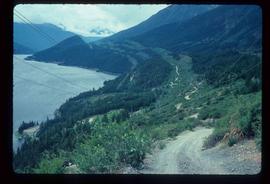
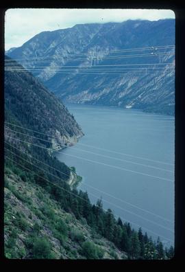
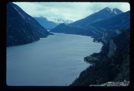
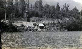
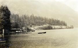
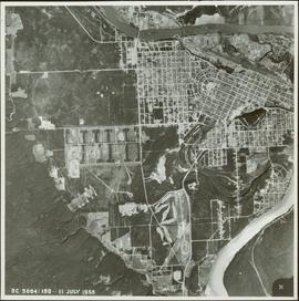
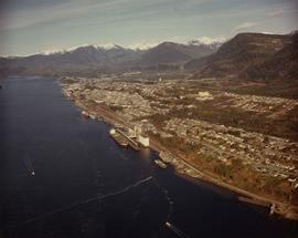
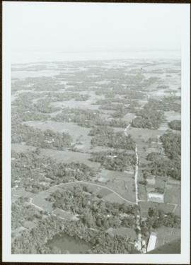
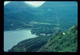
Image depicts a view of D'Arcy, located on the southern end of Anderson Lake.
Image depicts a vehicle on a bridge somewhere near Anderson Lake in the Seton Portage area.
Image depicts power lines running alongside Anderson Lake near Seton Portage, B.C.
Image depicts the Anderson Lake.
Image depicts a view of Anderson Lake near Seton Portage, B.C. A vehicle on a mountain road is also visible.
Image depicts a view of Anderson Lake near Seton Portage, B.C.
Photograph depicts a railway water tower, a small building, and a rail line along a lake shore. This is a close-up of the area depicted in image 2020.08.84. The water tank is a typical PGE 25,000 gallon water tank. The station would be a little over 400 feet south of the tank.
Photograph depicts a couple in a row boat (likely the same couple depicted in image 2020.08.59) near Alta Lake shore docks and buildings. A rail line and a railway water tower are visible in the background. The water tank is a typical PGE 25,000 gallon water tank. The station would be a little over 400 feet south of the tank and is hidden by the stand of trees.
Image depicts the Alkali Lake Ranch in Alkali Lake, B.C.
Photograph depicts snow covered trees and forest.
Photograph depicts an open field with a fence, house and shed in the midground, low treed hills in the background.
Image depicts some farmland near Alexandria, B.C.
Photograph of a stone monument atop a small hill on a forested shoreline. Annotation on recto reads: "Alexander Mackenzie Monument, Dean Channel, Near Ocean Falls, BC."
Photograph depicts several carved totem poles and house posts in a clearing with a forested area in the background. Photographer’s stamp on verso: “W.E. Nicholson, 268 E. 10th, Vancouver 10, B.C.”
Image depicts the Alcan smelter in Kitimat, B.C.
Image depicts a small section of the Alaska Highway somewhere near Whitehorse, Y.T. The slide also appears to be labelled "army washing" for unknown reasons.
Image depicts the ferry to Alaska in the port of Prince Rupert, B.C.
Image depicts an old convenience store, with a sign on it labelled "Al Crosina." It is located at the 153 Mile House.
Item is a photograph of Prince George taken from the air.
Item is a photograph of Prince George taken from the air on August 2, 1965.
Item is a photograph of Prince George taken from the air.
Image depicts a marker for aerial photography at an uncertain location. The slide labels it as "Elizabeth Station."
Image depicts an aerial view of a forest somewhere in the area of Divide Lake.
View of summit lake from above, many small tree-covered islands and peninsulas visible. Handwritten caption beside this photo reads: "Sumit Lake".
Photograph depicts an aerial view of the proposed site for the Fairview general cargo dock elevator site.
Photograph depicts an aerial view of the Prince Rupert shoreline.
Aerial view of Prince George featuring roadways and the confluence of the Fraser and Nechako rivers.
Annotation on verso: “Prince George from air 1936”.
Image depicts an aerial view of the land in the area of Divide Lake.
Photograph depicts an aerial view of the Haida Gwaii shoreline near Kiusta.
Item is a photograph of forests and farms from the air.
Photograph depicts an aerial view of the Fairview container terminal in Prince Rupert
Photograph is one of seven images believed to have been taken on a Canadian University Service Overseas (CUSO) mission in Mozambique; see also items 2009.6.1.483 - 2009.6.1.489.
Air photograph depicts a segment of the West Coast Trail showing the beach area around Tsusiat Point Hole in the Wall. Coding on aerial is "BCO 389".
Air photograph depicts a segment of the West Coast Trail showing the beach area around Tsusiat Falls. Coding on aerial is "BCO 387".
Air photograph depicts a segment of the West Coast Trail showing the beach area around Tsusiat Falls. Coding on aerial is "BCO 388".
Air photograph depicts a segment of the West Coast Trail showing the beach area around the cabins at Nitinat Narrows. Coding on aerial is "BCO 390".
Air photograph depicts a segment of the West Coast Trail showing the beach area around the Carmanah Point Light Station. Coding on aerial is "BCO 391".
Photograph of the bay at dusk. Trees and distant machinery are silhouetted against a cloudy sky and dark waterfront. Annotation on recto reads: "Across the Bay, Prince Rupert, BC No 4466."
Front view of an abandoned log building. The door is open or missing, the front window glass is broken, the area in front of the building is littered with antlers, boxes and wood. The tree next to the building has grown too close the building and roof. Handwritten annotation on verso in pen reads: “Laketon, Dease Lake, BC. Court house & jail June ‘62”
Image depicts an old and abandoned, collapsing church at an uncertain location.