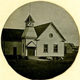
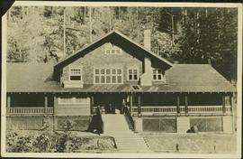
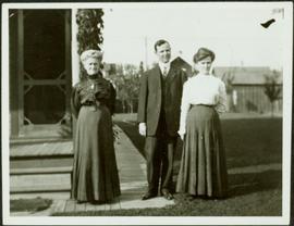
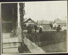
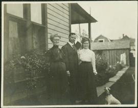
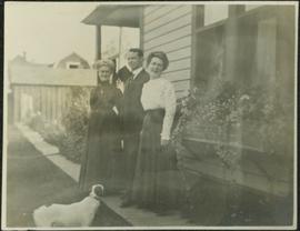
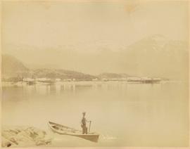
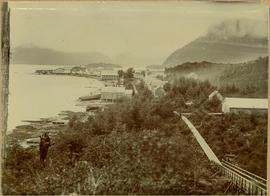
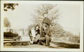
Unknown buildings can be seen in background.
Shoreline perspective of an unidentified coastal village situated on B.C.’s north coast. European style houses run parallel to a rocky shore. Seven men and one child stand within this frame and totem poles and a mortuary pole are also visible along the shoreline.
Photograph depicts a woman holding fur, standing beside three men on steps to unidentified building. Door and windows in background.
Photograph depicts unidentified man with glasses reclining on blanket, coats hanging behind him. Some type of shelving or roofing can be seen in background. Man is wearing pants, belt, and striped shirt with a pencil in the pocket. It is speculated that this man may be Bert Youngstrom, (see items 2005.3.4 & 2005.3.59).
Photograph depicts an unidentified man standing on the porch of a large house in front of a forest.
Photograph depicts an empty canoe floating beside a canoe full of fish. Hills visible on opposite shore in distance.
Handwritten annotation on verso reads: "Loaded with fish - Nass River".
File consists of clippings and notes relating to unions, trade, and tariffs in Prince George, including material on the International Woodworkers of America Canadian sector, lumber trading with the United States, and United States tariffs on lumber. Includes the following clipped articles from the Prince George Citizen newspaper: "IWA leadership: Controversies of the '40s" (20 May 2000); "American tariffs have long history" (7 Apr. 2001); and "IWA contract first for Interior" (28 Apr. 2001).
Photograph depicts a man and woman standing beside an elderly woman on wood boardwalk near front porch. Neighbouring yards in background.
Photograph depicts a man and woman standing beside an elderly woman on grass lawn. Wood boardwalk runs beside house, steps and porch featured on left. A jack russell terrier stands at their feet. Neighbouring yards in background.
Photograph depicts a man and woman standing beside an elderly woman on wood boardwalk near front porch. Window plants hang beside them and a jack russell terrier sits at their feet. Neighbouring yards in background.
Photograph depicts a man and woman standing beside an elderly woman on boardwalk running alongside house. Window plants in foreground, neighbouring yards in background. A jack russell terrier stands in left foreground.
Landscape featuring town buildings below on right. A farmyard can be seen in foreground.
Photograph depicts town buildings and church on shore to right of river winding through hills. Metal bar speculated to be part of a bridge crosses foreground.
Buildings and harbour visible across water. Unknown man stands in a small boat in foreground, mountains visible in background.
Photograph depicts a woman in visiting attire with hat and umbrella. Sandy area in foreground. Fence, trees, building, and wagon in background.
Photograph depicts two women standing on wood boardwalk with a jack russell terrier. Bushes and neighbouring yards in background.
Photograph depicts an elderly woman standing beside two younger women who kneel beside small girl on front yard. Trees, car, road, and neighbouring yards visible in background. Young girl speculated to be also featured in item 2009.5.2.5.
File consists of:
- List of communities on the Upper Fraser
- "Sawmill & Town Inventory"
- Photocopied excerpt from "Mile by mile details on driving to best sightseeing, camping, hiking, rockhounding, exploring fishing, hunting, picnicking." by Ken & Kathy Bernsohn
- "General Community Information" document regarding the Upper Fraser
- Photocopied excerpt from the Regional District of Fraser-Fort George's 1974 "Resource Community Structure - Phase I: Case Study of Upper Fraser Valley"
- Photocopied excerpts from various other published works
File consists of:
- Upper Fraser Historical Geography Project backgrounder and summary document
- Letter-size maps of the Upper Fraser River community area created for the project
File consists of two editions of a brochure created for the Upper Fraser Historical Geography Project.
The Upper Fraser Historical Geography Project was conducted by UNBC faculty and a team of researchers between 1999 and 2002. The lead researchers were Aileen Espritiu, Gail Fondahl, Greg Halseth, Debra Straussfogel, and Tracy Summerville. The project resulted in the creation of 93 oral history records and their transcripts. Participants included regional forest industry executives, politicians (including former MLA Ray Williston, local mayors and Fraser Fort George Regional District representatives), forest industry workers, and former and contemporary Upper Fraser community residents. The oral histories document the rise, consolidation and demise of the forestry-based settlements along the Upper Fraser River between 1915 and 2000.
File consists of:
- A digital file of the Upper Fraser Historical Geography Project database contained on a 3.5" floppy from July 2002
- Database print-outs
- Printed email correspondence
File consists of:
- "Upper Fraser Historical Geography Project Interview Etiquette"
- Blank consent forms
- Blank interview checklists
- A hand-out for a May 15, 1999 Oral History Workshop organized by the Prince George Oral History Group
File consists of a oral history transcription index for the project, as well as copies of the interview summaries created for each of the oral histories.
File consists of:
- Directory of Upper Fraser Historical Geography Project oral history interviews
- Printed email correspondence
- Status update documents on the project
- "Textual History of Upper Fraser" based off of Northwood textual files
- Handwritten notes
File consists of documents containing the questions created for use in the project's oral history interviews.
File consists of notes and reproductions relating to the Upper Fraser townsite. Includes photographs depicting the Upper Fraser townsite (2003).
File consists of notes, clippings, and reproductions relating to Valemount. Also includes a photograph depicting the Valemount autowrecker (2005).
Item is a hand drawn and coloured map by the City of Prince George Planning Department depicting existing land use for the Van Bow neighbourhood area.
Item is a hand drawn and coloured map by the City of Prince George Planning Department depicting existing zoning for the Van Bow neighbourhood area. Also includes two hand-drawn mylar overlays for the map; one showing "Opportunities & Constraints" such as housing age and condition and the other showing "Subdivision Activity" over decades of development in the Van Bow area.
Item is a map depicting the Vancouver Carney study neighbourhood area in Prince George.
Item is a map depicting land use in the Vancouver Carney study neighbourhood area in Prince George. Also includes two mylar overlays that show the outlines of "unit 2" and "unit 3" development areas.
File consists of material relating to the town of Vanderhoof. Materials include newspaper clippings, pamphlets, booklets, correspondence, a manual, postcards, and reproductions of articles. Highlights include:
- Vanderhoof District Chamber of Commerce, "Vanderhoof", [198-?] (welcome par-folio)
- District of Vanderhoof, "Resource Manual", 1988 (booklet)
- District of Vanderhoof, "Vanderhoof and area", [198-?] (pamphlet)
- CO-OP, "50 Proud Years with Vanderhoof co-operative Association", 1994 (newsletter)
- Alcan Smelters and Chemicals, "Happy Birthday Vanderhoof", 1976 (newsletter)
- Yellowhead Highway 16, "Gateway to Alaska", [198-?] (pamphlet)
- District of Vanderhoof, "1st Memorial Church", [198-?] (booklet)
- Vanderhoof Chamber of Commerce, "In the Geographic Centre of Beautiful British Columbia", [198-?] (pamphlet)
- Nechako Neyenkut. Neyenkut Newsletter, [198-?]
- NorthWest Interior Region, "Enterprise North West British Columbia", 1986 (fact sheet)
Photograph taken during European Sports Tour with Team Canada.
Photograph taken during European Sports Tour with Team Canada. See also item 2009.6.1.241 for image featuring similar content.
Handwritten annotation on verso reads: "Budapest". See also item 2009.6.1.238 for image featuring similar content. Photograph taken during European Sports Tour with Team Canada.
Hand coloured view of early Prince Rupert with row of tents facing large Hotel. Printed annotation in red ink on recto reads: “The Beginning of Prince Rupert B.C.: Grand Trunk Pacific Hotel in foreground”.
Lofty view of South Fort George, river and treed hills in the background. Printed annotation on verso reads: “South Fort George - 1913.” Handwritten message on recto is addressed to “Ethel M. Heurris Norton Maps Bristol County" reads: "11-1-13 an excellent view of south Fort George taken recently. Power Station at cross near water. This does not give all the south residence view. Population approx 1500”.
Lofty view of Fort George, B.C., river and paddle wheeler on right. Treed hills can be seen in background. Printed annotation on verso reads: “Fort George B. C.”
View of town on shore, from above. Boats docked along piers and buildings. Hills visible on either side of water in background.
Handwritten photo captions with arrows pointing to sections of image read: "General Merchandise", "Fort Wrangell Hotel".
Town on right, water on left, mountains in background. Forest trees in foreground.
Handwritten photo caption below image reads: "Port ESSINGTON".
Photograph depicts buildings along shore; bridge and boardwalk cross forest in right foreground. Hills visible in distance.
Handwritten annotation below image reads: "Port Essington from bridge"; on verso: "Heading or full page Illustration Chapter XXIII No2".
Photograph depicts shore and village with a treed hill in the background. Water and boats in foreground. Handwritten annotation in ink on verso of photograph: "Port Simpson B.C.". Semi-legible annotation on recto notes the postcard was addressed to London, England.
Photograph depicts Port Simpson in winter. Water crosses midground, hills stand in background.
Handwritten photo caption below image reads: "Port Simpson".
View of pier, cluster of houses and trees with snow topped mountains in background. Handwritten annotation on verso reads: “Hospital” with an arrow pointing to the building. Postage cancelation stamp on verso reads: "PORT ESSINGTON B.C. JUL 7 07". Handwritten annotation on recto reads: “PORT SIMPSON. Mrs. Noble Port Essington B. C. Hope you are feeling better. I am doing splendidly have not felt so well for years. Dr. advises me to stay at least another month A.W.B.”
Boardwalk in foreground, buildings and roads in mid ground, cut banks in background. Printed annotation on recto reads: “Prince George. B.C. 1921 by Moore”. Handwritten annotation in ink on verso reads: “The Netchaco river is between the mountain and the city and the C.N.R. runs along the river bank nearest the city. This picture is taken looking north.”
River in foreground, railroad and city in mid ground and hill in background. Printed annotation on recto reads: “Prince George. B.C. 1924”