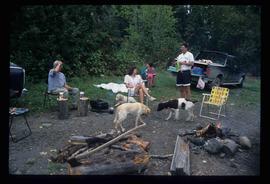
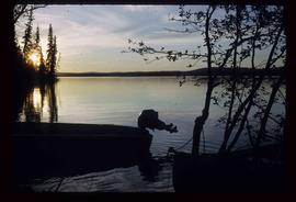
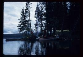
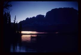
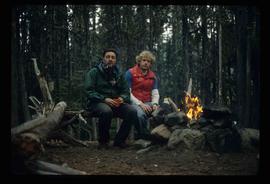
Image depicts Kent Sedgwick (the man with a pipe in green) and an unknown individual sitting around a campfire somewhere in South Tweedsmuir Provincial Park.
Image depicts a man at a campsite somewhere near Murray Ridge.
Image depicts Sue Sedgwick seated in a lawn chair near a campfire and several other unidentified individuals, as well as three dogs. The location is uncertain.
Image depicts numerous piles of wood planks at the Canadian National Railway Yards in Prince George, B.C. The cutbanks are seen in the background.
Image depicts the BC Packers Ltd. cannery in Prince Rupert, B.C.
Image depicts a house located somewhere in or near Canoe Creek.
Image depicts a view of Canoe Creek.
Image depicts a view of the ridge above the Fraser River which forms the Grand Canyon, B.C.
Image depicts a car on a dirt road leading through a forest.
Image depicts Bennett Lake near Carcross, Y.T.
Image depicts a log house at an uncertain location; the slide is simply labelled "Cariboo."
Image depicts the Cariboo Falls.
Image depicts the Cariboo Lake, with the roof of an old log cabin visible.
Image depicts the Cariboo River.
Image depicts the old, grown-over Cariboo Road at an uncertain location.
Image depicts the Cariboo Road south of Williams Lake.
Image depicts the Cariboo Road at Hat Creek Ranch, near Highway 99 on the way to Lillooet.
Image depicts the Cariboo Road in Soda Creek, B.C.
Image depicts a small slope on Carney Hill in Prince George, B.C.
Image depicts miocene gravels on Carney Hill in Prince George, B.C.
Image depicts Carp Lake.
Image depicts two boats on the shore of Carp Lake.
Image depicts a campsite on the shore of Carp Lake.
Image depicts Carp Lake at dusk.
Image depicts a green canoe sitting in the water on the shore of Carp Lake.
Image depicts a man holding a chain of fish on the shore of Carp Lake.
Image depicts a low rain cloud over Carp Lake.
Image depicts a low rain cloud over Carp Lake, and a man on a boat on the lake.
File consists of a typescript report in a duotang titled "Carp Lake Park Report: 1973" by Leon E. Pavlick.
File contains slides depicting images of areas in the Carp Lake Provincial Park.
Image depicts a truck parked on the side of the Cassiar Highway.
Image depicts the Catholic Church in Penny, B.C.
File contains slides depicting a caving group in various places in West Virgina, USA.
Image depicts Cayoosh Creek.
Image depicts Cayoosh Creek from a bridge in Cayoosh Valley.
Image depicts a bridge over Cayoosh Creek.
Image depicts a view of the scenery surrounding Cayoosh Creek.
Image depicts a view of Cayoosh Valley.
Image depicts a view of Cayoosh Valley. Cayoosh Creek is visible in the bottom left corner of the image.
Image depicts Cayoosh Valley.
Image depicts a mountain side in Cayoosh Valley.
Image depicts a road in Cayoosh Valley.
Image depicts an individual crouching in an old cemetery located somewhere in the coastal forest on Haida Gwaii, B.C.