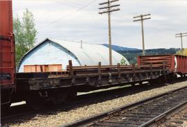
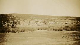
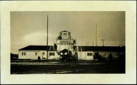
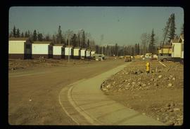
Image depicts trailer homes in Prince George, B.C.
Image depicts a number of trailer homes in Tumbler Ridge, B.C.
Image depicts Upper Fraser residential area during demolition of town site. Map coordinates 54°06'51.6"N 121°56'26.3"W
Photograph depicts a tangle of fallen logs and growing trees.
Photograph of a team of sled dogs pulling a load, followed by a group of men. Mountains are visible in the background. Printed annotation on recto reads: "Trail Over Bitter Creek Glacier to the Naas."
Image depicts a patch of snow-covered ground with a sign that reads "Trail of 98," somewhere along the White Pass railway.
Photograph depicts trail making on summit between John Brown and Kitseucla creeks. Survey of 55th parallel.
Photograph depicts a narrow wood plank walkway with small thick trees on each side, the ocean harbour and mountains in the distance. Handwritten annotation below photograph reads, "Trail - Naas Harbour".
Photograph depicts a wooden walkway with trees crowding close. Handwritten annotation below photograph reads, "Trail, Echo Canyon".
Photograph depicts fishing territory at waterfall rapids in Bulkley River, B.C. Highway and buildings on opposite shore in background.
Photograph depicts an unidentified individual standing on cliff above waterfall at Bulkley River, B.C. Fishing territory visible below; highway, buildings, and hills visible in background.
Photograph depicts man standing in front of log building with the sign "RCMP" above center window. Moose antlers mounted on roof. Forest visible in background on right.
Image depicts a tractor with a claw lifting logs at a saw mill in Prince George, B.C.
Photograph depicts a tractor owned by G. Wellburn at the Duncan Forest Museum.
Photograph depicts a rear view of 4 of the 6 traction engines in Nanton, Alberta. The left engine was built by Reeves and Co. in Columbus, Indiana, U.S. Its identification is #4438, it has 2 cylinder simple, and a roof. The next engine was built by Waterloo Mfg. Co. Ltd. in Waterloo, Ontario and has a single cylinder. The third engine was built by Sawyer Massey. The engine on the right side is a Gaar Scott, built in 1913, and has 25 horsepower on the drawbar and 75 horsepower on the belt.
Photograph depicts traction engines owned by Jack Burrows in Nanton, Alberta. There are six in this photo, all of which appear could be steamed, another two in derelict condition, and one in the village in working order. Running from front to rear in the photo: 1) Reeves with roof, U.S. 2) Waterloo, Ontario, Canada 3) Massey, Canada 4) Gaar Scott with roof, U.S. 5) Massey, Hamilton, Canada 6) Gaar Scott, U.S.
Photograph depicts a traction engine built by Sawyer Massey in Hamilton, Ontario. It has a single cylinder and large fire box for burning wood or straw. The engine is located in Nanton, Alberta.
Photograph depicts a traction engine at a ranch on Nicola Lake, near Merritt. The engine was made by Nichols-Shepard Co. at Battle Creek, Michigan and named the "Red River Special." It is undated and has 2 cylinders, side tanks, 16-10 horse power, wood burner, firebox 5 ft. long.
Photograph depicts lettering on several ballast cars which were headed by a tracktor and tailed by a caboose.
Photograph depicts tracks made by machinery in an earth road turning left in forest.
Photograph depicts a "trackmobile" in the CNR Boston Bar yard. Work on replacing ties was being carried out 5-10 miles to north.
Photograph taken near Manning Park.
Photograph depicts spike pulling machines proceeding south. Part of the first operation of dismantling the KVR line.
Photograph depicts the trackage in the mid section of the McCulloch depot area. The left line is a passing track, the mid line is the mainline, and the right track is for storage. The depot is located at mile 76.6, on the Carmi Subdivision. The view is looking north.
Photograph depicts trackage near the CPR depot in Salmon Arm.
Photograph depicts the track transfer transporter at the Canadian National Railway (CN) repair shops at Port Mann.
Photograph depicts the track transfer transporter at the Canadian National Railway (CN) repair shops at Port Mann, showing the east face of the main building.
Photograph depicts a track shed about 1 mile south of Beaverdell or at about mile 43.25 on the CPR line in the Carmi Subdivision. Despite the open doors and ease of access, it was the only hut on the line found to contain track materials and correspondence. It retained 50 memos addressed to the Section Foreman [at Beaverdell?].
Typed caption glued to album page directly below photograph reads: "51. Tract-laying west of Fort Fraser." Photograph depicts a man looking at a section of railway track, a large steam powered machine is in the background. Photographer: Dominion Stock & Bond Corporation.
Track laying machine situated on a large mound of earth which is surrounded by (flood?) water.
Ten men working with a large mechanical track layer to lay down the ties for the PGE line.
Photograph depicts a CN Track Geometry 'Test" car for Western Canada. Built in 1954 as "Cape Race." In 1983 it was a VIA sleeper/buffet/lounge.
Photograph depicts a track car model (in fact, the base to the lamp shade).
Photograph taken about 2 miles west of Princeton. Depicts track beside the Tulameen River. Taken, looking west, form a ridge holding on the Princeton to Hope highway.
Photograph depicts the Cassiar townsite in foreground. Mill, dry rock storage building, and tailings pile can be seen in background. Handwritten annotation on verso of photograph: "1958 [1961 crossed through]."
Caption: "Ocean Falls from Jap-town [Japan town]. Mt. Baldy in the background."
Photograph depicts the town of Lytton in October 1936.
Photograph depicts the town of Hope in October 1936.
Photograph depicts the town of Clinton. Wyness noted on the photograph verso that the survey crew had dinner here on their return trip in October 1936. In addition, the album caption notes that Clinton was the location of British Columbia's oldest hotel.
Photograph depicts six of more fishing boats in a row on open water, fog and mountains in the background. Handwritten annotation below photograph reads, "Towing in fishing boats".
Photograph depicts horse and rope in Fraser River. Hill on opposite shore in background.
Photograph depicts a tower controlling the C.P.R. grade crossing at Alexander St. in Vancouver, B.C.
Handwritten photo album caption below this photo reads: "Tower & Adm. Bldg, Ft. Nelson." Photograph depicts long white building with tower raised in middle, ladders and scaffolding in front. Trucks and groups of men in foreground, some on building itself. Power poles in foreground and background.
Royal Canadian Air ForceCaption: From Out-look Rest, Kubicek Pass; looking towards Kitchener Lake. The nice open looking country is the valley is unfortunately wet. Item is a panoramic photograph of a mountain range and valley.