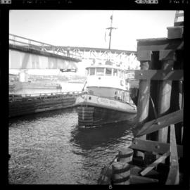
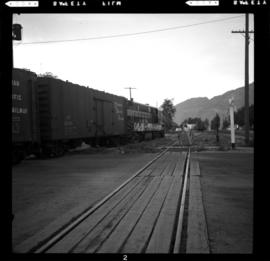
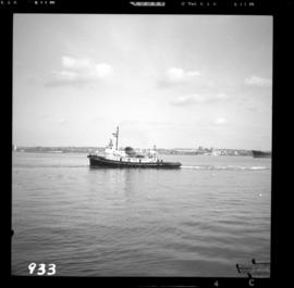
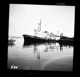
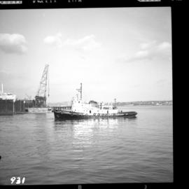
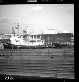
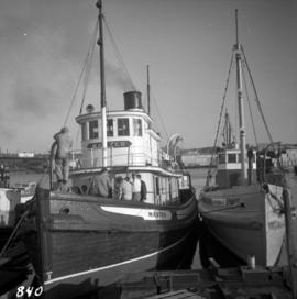
Photograph depicts a steam tugboat named "Master" owned by the World Ship Society (Vancouver Chapter). Photograph taken during Carnival and Regatta week in Vancouver.
Photograph depicts the tugboat "Island Sovereign" going to turn starboard after backing out from the dock. The view is looking southeast.
Photograph depicts the tugboat "Island Sovereign" moored at a dock in North Vancouver, 200 yards west of the Burrard Dry Dock, 2 days in service after refit.
Photograph depicts the tugboat "Island Sovereign" backing out at North Vancouver.
Photograph depicts the tugboat "Island Sovereign" with Burrard floating dock in the background.
Photograph depicts the tugboat "Gulf Margaret" with a Straits scow leaving the north arm of the Fraser River and entering the main river at New Westminster, travelling upstream. The tug belongs to the Gulf of Georgia Towing Company.
Photograph depicts a tugboat named "Gillking" docked at an unknown location.
Photograph depicts the tugboat "Brunette" at Westview Harbour, Powell River. It is registered in Vancouver.
Photograph depicts a small tugboat rescuing a motor cruiser that had been swept downstream in the Annacis Channel against a bridge, about 1.5 miles southwest of the Patullo Bridge, New Westminster.
Photograph depicts a tug towing gravel scow that was used to make concrete. Photograph taken at a BCER swing bridge.
Photograph depicts a small tug being completely renovated on a floating scow.
Photograph depicts a tug at Kingcome Navigation Dock in Vancouver Harbour.
Photograph depicts a truss bridge over the Salmon River near Kelsey Bay, North Vancouver Island.
Photograph depicts truss bridge over Lois River looking north. Bridge is about 2-4 miles north of Saltery Bay, leading to Powell River.
Photograph depicts men and haul trucks visible in distance on snowy road in tree-covered hills.
Item is a photograph of a truck hauling logs from the shores of a lake.
Photograph depicts an old truck that was found besides a logging yard and CNR trackage.
Photograph depicts a truck at the Teepoortens Truck and Equipment Rentals Ltd., located at 950 West 6th Ave. in Vancouver, BC
Photograph depicts the Trout Creek CPR bridge near Summerland, about 9 miles north of Penticton. It is about 620 ft. long and the creek is 240 ft. below it. It was part of the Kettle Valley Railway.
Photograph depicts the Trout Creek CPR bridge near Summerland, about 9 miles north of Penticton. It is about 620 ft. long and the creek is 240 ft. below it. It was first crossed by the Chief Engineer's train on October 25, 1913. The view is looking south east.
Photograph depicts Trout Creek Bridge of the KVR.
Image depicts a group of people preparing to depart on a trip. Location is uncertain, though it is possibly in Prince George, B.C.
Photograph depicts a trestle on the ex CPR Coquihalla line of the Kettle Valley Railway. It is a famous view spot because the trestle has a waterfall behind it. It is now the only intact trestle on the line because even the very small ones were demolished after the line closed on 23 November 1959. It is located about mile 21.7 from Brookmere. The grade here is about 1 in 53.
Photograph depicts a trestle of the Great Northern Railway, main line to Blaine, curving towards the southwest from the south end of the New Westminster rail bridge.
Photograph depicts the trestle leading to the Canadian National Railway (CN) swing bridge across the north arm of the Fraser River. The view was taken on Lulu Island, looking northeast. The ground on each side of the trestle is peaty and springy when walked on.
Photograph depicts a trestle on the south bank of the north arm of the Fraser River leading from the C.N.R. swing bridge, approximately 5 miles southeast of New Westminster, looking south.
Photograph depicts a trestle bridge on the old CPR Kettle Valley Railway. It is about 5 miles southeast of Brookmere, between Thalia and Spearing on the Princeton Subdivision.
Photograph depicts the CPR Kettle Valley Railway in Myra Canyon. This is one of the nine wooden trestles between mile 85 and mile 86.4
Photograph depicts the CPR Kettle Valley Railway in Myra Canyon. It shows the a wooden trestle fitted with a sidewalk, which at 434 ft. long is the longest one in the canyon. It is located at mile 85.9. The view is looking south.
Photograph depicts the CPR Kettle Valley Railway in Myra Canyon. The view is looking north at the trestle located at mile 85.4
Photograph depicts the CPR Kettle Valley Railway in Myra Canyon. It shows the a wooden trestle fitted with a sidewalk, which at 434 ft. long is the longest one in the canyon. It is located at mile 85.9. The view is looking south.
Photograph depicts the CPR Kettle Valley Railway in Myra Canyon. It shows the a wooden trestle fitted with a sidewalk, which at 434 ft. long is the longest one in the canyon. It is located at mile 85.9. The view is looking north.
Photograph depicts a trestle bridge for road traffic leading to the Second Narrows Bridge in Vancouver, BCThe shot is taken from the south bank.
Image depicts a green car among some trees on Cottonwood Island.
Large tree trunk and smaller saplings silhouetted against Summit Lake, forest visible on opposite shore. Handwritten caption beside this photo reads: "Sumit Lake."
Image depicts two unidentified individuals examining a thick log still attached to the machine that cut it down. It is located somewhere in Prince George, B.C.
Photograph depicts trains switching at Osoyoos, BC.
Image depicts trains at the Grand Trunk Pacific railway roundhouse in Prince George, B.C.
Image depicts several trains at the Giscome mill site in Giscome, B.C. Map coordinates 54°04'19.7"N 122°22'04.7"W
Image depicts a train and a group of unknown individuals at the GTP roundhouse in Prince George, B.C.
Image depicts a train carrying logs somewhere in Prince George, B.c.
Photograph of a train traveling through Prince Rupert. Several people are gathered on the dock and around various buildings. Two small vessels are docked in the harbour. Annotation on recto reads: "Prince Rupert, Waterfront. Allen Photo May '4."
Image depicts a train transporting wood planks, possibly in Prince George, B.C.
Front view of a stretch of railroad passing through a forested area. Photograph shows a mountain in the background.
Image depicts a train track and several buildings in an unknown location.
Photograph depicts the junction station of the Esquimalt and Nanaimo Railway at Parksville on Vancouver Island. The view is looking south.
Image depicts a train and several unidentified individuals who appear to be waiting for it as it passes through Sinclair Mills, BC.
Photograph depicts the engine and first two cars of a railway train in left foreground. Water crosses midground, hills stand on opposite shore in background. Handwritten annotation on recto of mounted slide reads: "Lejak [sic] & Fraser Lake in [?]" See also item 2006.20.1.196 for image featuring similar content.
Postcard depicts a train oustide a snowshed in Glacier, BC. It was thought the view was looking south with Glacier Hotel in the middle distance at the head of the 180 degree loop. Outside trackage was built alongside sheds in the summit area of Rogers Pass.