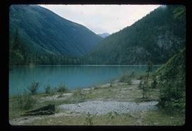
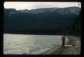
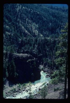
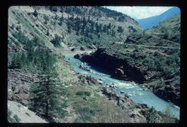
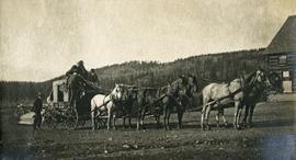
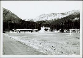
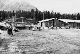
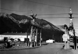
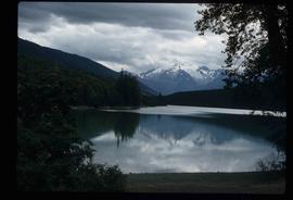
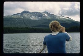
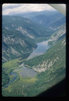
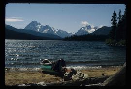
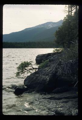
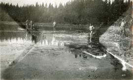
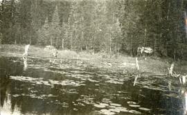
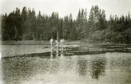
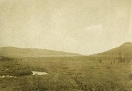
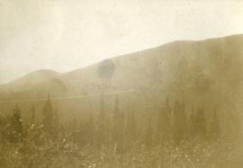
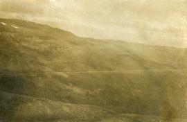
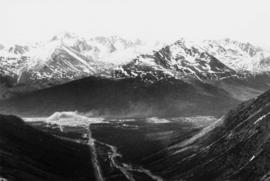
Image depicts what is possibly Melita Lake. The mountain in the background is possibly Tseax Cone, the volcano responsible for the existence of the Tseax lava flow.
Image depicts a lake somewhere near Mt. Robson; it is possibly Kinney Lake.
Image depicts a lake in South Tweedsmuir Provincial Park.
Image depicts a lake in South Tweedsmuir Provincial Park. There is an unknown individual present in a canoe with the camera-man.
Image depicts a lake in South Tweedsmuir Provincial Park.
Image depicts a lake in South Tweedsmuir Provincial Park. There is an unknown individual present in a canoe with the camera-man.
Image depicts an aerial view of a lake in South Tweedsmuir Provincial Park.
Image depicts a lake in South Tweedsmuir Provincial Park. There is a canoe present on the shore.
Image depicts a lake in South Tweedsmuir Provincial Park.
Image depicts a lake in South Tweedsmuir Provincial Park. An unknown individual is walking along the shore.
Image depicts a lake at an uncertain location.
Image depicts three people standing at the front door of a house at an uncertain location.
Image depicts a hotel in what appears to be a small community, possibly an outlying area of Bralorne, B.C.
Image depicts a horse on Cottonwood Island.
Image depicts a stretch of highway, possibly Highway 29 or 97.
Photograph depicts A. H. Holland standing under a tarp with a border collie dog. A pile of firewood is also under the tarp.
Image depicts what appears to be a ferry crossing a river at an uncertain location.
Image depicts a creek somewhere near Bralorne, B.C.
Image depicts a cow at an uncertain location.
Image depicts a church at an uncertain location.
Photograph depicts open fields, cleared land, rolling hills and a river. There is a fence across the middle of the field and a building near the riverbank.
Image depicts a camper and a man and woman at an uncertain location, possibly somewhere near Meldrum Creek, B.C. The woman in the image is Sue Sedgwick.
Elevated view of various buildings and vessels along the Prince Rupert waterfront. Several piles of lumber can be seen in the foreground. Printed annotation on recto reads: " Prince Rupert B.C., A busy day on the Waterfront."
Image depicts a truck on a bridge, possibly crossing over the Peace River.
Image depicts a bear, possibly a grizzly. The location is uncertain.
Photograph depicts four men bathing in a backwater or lake. One clothed man stands on the shore.
Photograph depicts two men wading and bathing in shallow water with lily pads.
Photograph depicts three men standing on the banks of a backwater or lake, with clothing piled on the ground.
Photograph depicts a stage coach harnessed with six horses, a fence and a log building in the background.
Street view photograph of the construction of 5th Street in Stewart, BC. Visible businesses include the "Hotel King Edward" and "Empress Theatre." Printed annotation on recto reads: "5th St. Stewart B.C. Hughes #46."
Handwritten annotation on recto of postcard reads: “Were there’s a will there’s a way, 5th Street, Prince Rupert, B.C., F. Button photo Pr. Rupert. No. 514.” Handwritten annotation in pen on verso of postcard reads: “Miss Belding, 33 Marlbro Avenue, Hull Yorkshire, England. S.S. Prince George. Dec. 1918. Dear Bertha, This is a street in the centre of the town Prince Rupert. There is a capacity list of passengers on board. The boat is registered to hold 384. We left at midnight and exped to arrive in Vancouver tomorrow at 3:30 pm. Love from Edie.”
Photograph depicts dense undergrowth near the Bulkley River, mountains in the distance.
Photograph depicts bare mountain ridges near the Bulkley River and 55th parallel.
The topographic map shows mine and campsite holdings within the proposed mine site. Asbestos deposits, the tramline and water bodies, such as Troutline Creek, are also included.
Annotations include certain lot titles being crossed out as well as as indication of missing survey information.
Photograph depicts brown and white building similar to the "Director's Lodge" at Cassiar, B.C. (see items 2000.1.1.3.19.88 and 2000.1.1.3.19.89). Station wagon parked in driveway behind short fence in foreground. Trees in foreground, forest and mountains visible in background. Handwritten annotation on verso of photograph: "Cassiar June 15 71".
Photograph depicts flowing water believed to be Troutline Creek which ran south of Cassiar, B.C. Tailings pile and plant buildings visible behind forest in midground, northern mountain range in background. Handwritten annotation on verso of photograph: "Cassiar June 15 71".
Photograph depicts flowing water speculated to be Troutline Creek which ran south of Cassiar, B.C. Forest on opposite shore and mountains in background. Handwritten annotation on verso of photograph: "Cassiar June 15 71".
Photograph depicts tramline buckets and tower on plantsite. Vehicles, building materials, and unidentified buildings also visible on plantsite (including what appears to be a water tower). Mountains and valley in background. Handwritten annotation on verso of photograph: "Cassiar June 15 71".
Photograph depicts long bunkhouse buildings located between the Cassiar plant and townsite. They were originally used seasonally by university students, or by new employees on waiting lists for the more accommodating panabode "Winter Bunkhouses" (see item 2000.1.1.3.19.113). These buildings are speculated to be bunkhouses number 86, 87, and 88. Trees cross midground; new mill building, tailings pile, and mountains visible in background. Handwritten annotation on verso of photograph: "Cassiar June 15 71".
Photograph depicts two unidentified men on front deck of building behind trees. Road and car in foreground, mountains visible in background. Handwritten annotation on verso of photograph: "Directors Lodge Cassiar June 15 71". Building also known as "House 130".
Photograph depicts fenced church building with what appears to be speakers mounted on roof above main entry. Road and trees in foreground, mountains in background. Handwritten annotation on verso of photograph: "Cassiar June 15 71".
Photograph depicts mine valley and road in foreground. Cassiar plant visible in left midground, townsite in right midground. Southern mountain range in background.
Photograph depicts building containing Cassiar's bar and snackbar, visible across ball field. This building originally housed school classrooms, movie theater, barber shop, and rec centre with three pool tables. Private liquor store originally located in far right of building. Liquor store was known to be the only legal bootleg liquor business in the province at the time, before it was transferred to Cassiar's government liquor store and replaced with a Sear's office. Catholic church and other buildings are visible behind trees in right midground. Road and field in foreground, valley and mountains in background. Community Centre located behind photographer, out of frame, curling rink on photographer's right.
Photograph depicts men's ball game in foreground, spectators and cars visible behind backstop net. Bar and snackbar building in right midground, trees and mountain base in background. See item 2000.1.1.3.19.52 for information regarding bar and snackbar building.
Photograph depicts a gravel road passing under crossing. Sign posted to pole reads "CAUTION TRAMLINE CROSSING CAUTION AVIOD PASSING UNDER MOVING BUCKETS". Garage stands in left midground, mountains in background. Handwritten annotation on verso of photograph: "1961".