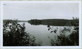
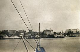
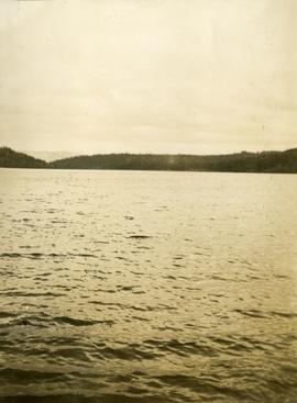
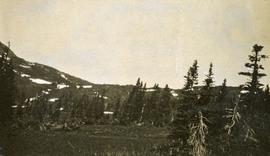
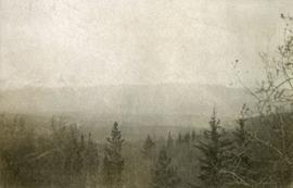
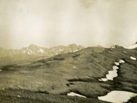
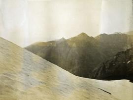
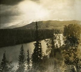
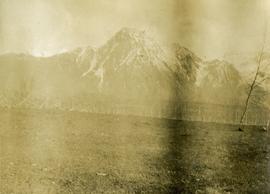
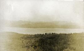
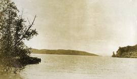
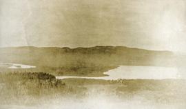
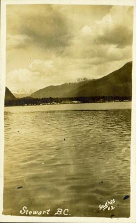
Distant photograph taken from the water of Stewart, BC. Several mountains are visible in the background. Printed annotation on recto reads: "Stewart B.C. Hughes #2."
Handwritten caption beside this photo reads: "Sumit Lake." Trees can be seen on shore jutting into the lake on left, as well as on opposite shore in distant background. Unidentified objects can be seen in distance, possibly buildings on far shore.
Handwritten caption beside photograph reads: "Sumit Lake." Branches of trees in foreground, forest on opposite shore reflected in water.
Image depicts a view of Tabor Mountain in Prince George, B.C.
Handwritten photo album caption below this photo reads: "Above the Rockies at 12 000 feet." Photograph depicts the Rocky Mountains from a distance. As the photograph was taken from the inside of an airplane, the plane's wing tip can be seen on the far right of the image. A sun circle is also visible in the top center.
Royal Canadian Air ForcePhotograph depicts a small building in low valley, tall hills in background, trees in foreground.
Photograph depicts a view of Victoria from a ship in the Inner Harbour. Visible on the shore, from right to left, are: the Empress Hotel, the Belmont, the Customs Building, and other buildings along Douglas Street.
Handwritten photo album caption below this photo reads: "Whitehorse, & Alaska Highway, from below R.C.A.F. Barracks." Photograph depicts the cityscape of Whitehorse in valley. Alaska Highway can be seen in left foreground behind road railings in mountainside.
Royal Canadian Air ForcePhotograph depicts community buildings on shoreline, water in foreground.
Handwritten annotation on image reads: "Wrangle, Alaska."; on verso: "Fort Wrangle, Alaska Territory. visited by W.H.Collison, C.M.S. 1877. Prior to the establishment of any mission, [...? illegible] 1875 - 1876. Presbyterian. Insert this illustration of Wrangle on Page 77 as marked."
Image depicts a view south, possibly of an abandoned grade for the BCR; possibly somewhere near Woodpecker, B.C.
Photograph depicts looking across the water of Babine Lake toward low forested hills. [55th parallel]
Photograph depicts looking down on a snowy mountain ridge.
Photograph depicts looking up a snowy slope to a rocky peak.
Photograph depicts a view from a mountain summit looking across the valley to forested mountain slopes with snowy mountain tops.
Photograph depicts an alpine meadow with a mountain ridge in the background.
Photograph depicts a few of forest in the foreground, a snowy mountain range in the distance.
Photograph depicts summit between John Brown and Kitseucla creeks.
Photograph depicts a view from the summit between John Brown and Kitseucla creeks.
Photograph depicts views from the summit between John Brown and Kitseucla creeks.
Photograph depicts a view looking down on the river with Hudson Bay mountain in the background.
Photograph depicts a view from the summit between John Brown and Kitseucla creeks.
Photograph depicts views from the summit between John Brown and Kitseucla creeks, Hudson Bay mountain.
Photograph depicts a view from the summit between John Brown and Kitseucla creeks.
Photograph depicts view of an alpine meadow, alpine trees and mountains in the background.
Photograph depicts scrub alpine trees with a layer of snow in the foreground and several mountain ranges in the distance.
Photograph depicts a view from a high mountain ridge looking down on forest, river and snowy mountain peaks in the distance.
Photograph depicts an alpine meadow in the foreground, forest, river and mountains in the distance.
Photograph depicts view of an alpine ridge with an alpine meadow in the foreground.
Photograph depicts alpine meadow in the foreground, forest, river and mountains in the distance.
Photograph depicts a view of a lake and river from a high hill. Treed hills in the background.
Photograph depicts a view of immense rolling, treed hills.
Photograph depicts treed hills in the foreground. Buildings on a field near the river in the midground. Treed hills and a body of water in the background.
Photograph depicts a lake in the foreground, treed hills in the background.
Photograph depicts a view of a lake and river from a high hill. Treed hills in the background.
Photograph depicts water in foreground, bayside village in background.
Postcard overview of the Bulkley River running closely past the village of Telkwa. Handwritten annotation in pen on verso reads: "Don Choracy [?] Prince Rupert, B.C. c/o Wrathall's Photo Shop. Aug. 9 Lake Kaetlyn. We had to drive all the way to Telkwa the other nite for postcards, imagine. We were sure glad and surprised to see Jack & Dick drive in at 7 to-nite. Just like being home. We are having so much fun. The boys are out on Lake to-nite, went to visit Dr. Macdonald's me thinks. I have bad head cold so have to stay home first nite at home I've since we came, Dieks is taking me on Lake tomorrow I hope, Love Bea-P."
Twenty-three year old Violet stands wearing a polka dot dress in a group of unidentified men, women and children. Body of water and tree-covered hill on opposite shore in background. Handwritten caption below this photo reads: "Pr. Rupert, 1928 End of Road Construction".
Photograph depicts a vista from the Canadian Rockies with patches of snow.
Drawing depicts visual notes taken at the 2020 Public Health Summer Institute with the theme "Think Globally, Act Locally: Public Health and the Anthropocene". Themes related to the COVID-19 pandemic are depicted.
This street map of the VLA area in Prince George includes property outlines and street numbers.
Item is a hand drawn and coloured map by the City of Prince George Planning Department depicting the VLA neighbourhood proposed zoning in 1976.
Item is a hand drawn and coloured map by the City of Prince George Planning Department depicting zoning proposed by Prince George Alderman A. Stauble for the VLA neighbourhood.
Item is a hand drawn and coloured map by the City of Prince George Planning Department depicting zoning proposed by the Prince George City Planner for the VLA neighbourhood.
Item is a hand drawn and coloured map by the City of Prince George Planning Department depicting public representations at the VLA neighbourhood zoning hearing that occurred on April 12, 1976.
Photograph depicts two men in uniform standing beside a white building or steamboat. There is a water, likely the Chilcotin River, and trees in the background.
Photograph depicts Wabco in left foreground in front of shop building, tractor, and miscellaneous supplies. Mine valley and mountains in background. Handwritten annotation on recto of photograph: "Cassiar B.C. 1970 June 23 by Tom Kiefer".
Image depicts the W.A.C. Bennett Dam on the Peace River in Hudson's Hope, B.C.
Item is a photograph of the Bennett Dam.