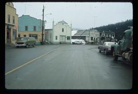
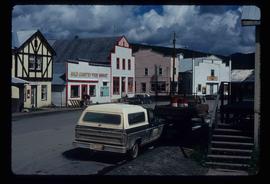
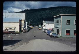
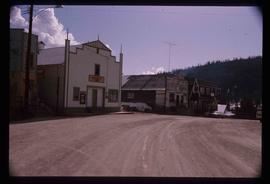
The item is a photograph of Aces Pawn Shop Second Hand Cash Loaned store, a barber shop and one empty commercial building for rent on 3rd Avenue in Prince George.
The item is a photograph depicting an old, abandoned wooden house on Holzworth homestead in the Fort George Canyon.
The item is a photograph depicting an old, abandoned wooden house on the Holzworth homestead in the Fort George Canyon.
The item is a photograph depicting an old, abandoned wooden house and barn on Holzworth homestead in the Fort George Canyon.
Image depicts the interior of a house that appears to be abandoned and in disrepair in Island Cache.
Image depicts an old and abandoned duplex somewhere in Wells, B.C.
Image depicts the interior of an old, abandoned church at an uncertain location; possibly somewhere between Lillooet and Kamloops.
Image depicts an old and abandoned, collapsing church at an uncertain location.
Image depicts several abandoned and collapsing cabins in Quesnelle Forks, B.C.
Image depicts part of a path leading to some abandoned cabins in Quesnelle Forks, B.C.
Image depicts an old, abandoned cabin with ivy growing up the side. The location is uncertain.
Image depicts an old and abandoned cabin with ivy growing up the side. The location is uncertain.
Image depicts an abandoned cabin in Quesnelle Forks, B.C.
Photograph depicting an abandoned building in Soda Creek, the building surrounded by overgrown grass and trees.
Photograph depicts an abandoned and worn out wooden building in a flat field.
Photograph depicts an abandoned and worn out grain elevator, with three buildings in a row and the elevators going down towards the ground.
Photograph depicts an abandoned and worn out grain elevator from the side.
Photograph depicts an abandoned and worn out grain elevator, with three buildings in a row and the elevators going down towards the ground.
File consists of a report titled "A Study of Land Settlement in the Prince George-Smithers area, British Columbia" by W.J. Anderson and published by the authority of the Right Hon. James G. Gardiner, Minister of Agriculture in Ottawa, Canada (Oct. 1947).
Image depicts a street in Wells, B.C.
Image depicts a street in Wells, B.C. The Sunset Theatre and Gold Country Food Market are both present in the image.
Image depicts a street in Wells, B.C. The Wells Hotel is present in the image.
Image depicts a street in Wells, B.C.
Image depicts a street in Wells, B.C. The Sunset Theatre is located on the left of the image, and the Jack O' Clubs Hotel is the building with the green roof on the right. The hotel burned down on February 14th in 1994.
Image depicts a street in Island Cache.
Image depicts what appears to be a shed at an uncertain location.
Image depicts a saw and numerous wooden boards at an uncertain location.
Image depicts a road somewhere in Tumbler Ridge, B.C. There are numerous construction vehicles present.
Image depicts a road somewhere in Tumbler Ridge, B.C. There are three bush planes in the image.
Image depicts a road somewhere in Tumbler Ridge, B.C.
Image depicts what appears to be a type of log bridge crossing a river somewhere on Haida Gwaii.
Image depicts a river in South Tweedsmuir Provincial Park. There is an unknown individual present in a canoe with the camera-man.
File consists of a spiral bound booklet titled "A Report on the Historic Fort Mcleod's History and Archaeological Potential" by William George Quackenbush for Simon Fraser University.