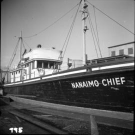
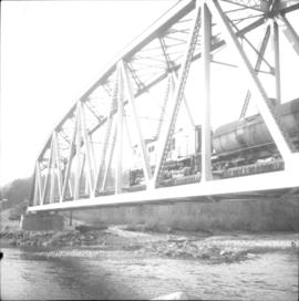
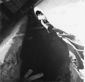
Photograph depicts a plaque attached to the east side girder of bascule section of the Second Narrows railway bridge in Vancouver, BC
Photograph depicts Pier B of C.P.R., just west of the C.P.R. railway station. This is the only pier accessible to ocean going passenger liners and is used by P&O vessels. Facilities generally in adequate for the 1960s.
Photograph depicts Pier B in Burrard Harbour, Vancouver. The photo shows the inside the main roadway and the CPR trackage.
Photograph depicts Pier #2 in Vancouver at the north end of Columbia St. It shows disconnected trackage on the east side of the pier that was formerly serviced by the CPR. It has not been in use for some years. The switch fittings were made by the Nelson Iron Works in Seattle.
Photograph depicts a Pacific Great Eastern bridge over the Capilano River in northwest Vancouver. Also visible is a switching locomotive.
Photograph depicts a partially demolished Great Northern Railway depot and Canadian National Railway (CN) depot behind it, in Vancouver.
Photograph depicts a painting on the fence outside a courthouse on Howe and Granville St. In Vancouver, B.C. Each artist was granted a permit and panel by City Council.
Photograph depicts a painting on a fence outside a courthouse on Howe St. in Vancouver, B.C. The painting shows the natural grandeur of B.C. partially blocked out by a super motel with a bewildered moose forced to become an ornamental fountain. The whole forecourt is being bulldozed to make way for the Centennial fountain.
Photograph depicts a liner called the "Pacific Princess." It was built in 1971 in West Germany. The liner was one of the 8-day summer crusises that travelled from Vancouver to Alsaska. Owned by P & O and registered "London."
Photograph depicts the Pacific Press Ltd. Vancouver Sun building at Beatty and West Pender St. The view is looking northeast from Beatty St. It was vacated by the Vancouver Sun at Christmas 1965 with the neon "Sun" sign on the tower removed.
Photograph depicts the Pacific Great Eastern yards at North Vancouver. In the picture is Locomotive #1002 built by the Montreal Locomotive Works.
Photograph depicts that Pacific Great Eastern depot at Horseshoe Bay, awaiting the dayliner to Quesnel. A two-coach Budd car runs from North Vancouver to Lillooet, and then a different 1-coach Budd car continues to Quesnel. It is possible to do a roundtrip from North Vancouver to Lillooet in one day.
Photograph depicts the Pacific Coast Terminals in North Vancouver. Shay locomotive #115 is in the yards.
Photograph depicts Pacific Coast Terminals in North Vancouver. A Shay #1115 is spotting cars carrying potash, sulphur etc. onto the tippler.
Photograph depicts the Pacific Coast Bulk Terminals on the North Shore, 1 mile east of Lions Gate Bridge in Vancouver. Previously owned by Hillcrest Lumber #11 and Merrill & Ring #5. In the foreground is 90-ton Shay locomotive #115 from the Railway Appliance Research Ltd. It was built by Lima Locomotive Works in 1929 and is builders #3350. It was last owned by Canadian Forest Products on Nimpkish Valley Railway on North Vancouver Island, up until at least the mid-1960s.
Photograph depicts the Pacific Coast Terminals in North Vancouver. A Shay #115 is spotting a string of cars onto tippler.
Photograph depicts a P & O liner, the "Oriana,"departing from CPR Pier C.
Photograph depicts the Orient/P & O line, the "Oriana," that was built in 1960 by Vickes Armstrong. It was turbine driven.
Photograph depicts a P & O liner, the "Oriana," backing out from CPR Pier C in Vancouver. Minor assistance was needed from two cates tugs.
Photograph depicts a liner called the "Oriana."
Photograph depicts a P & O liner, the "Oriana," passing outward bound from Vancouver between Brockton Point and the Lion's Gate Bridge. Taken from Stanley Park.
Photograph depicts a P & O liner, the "Orcades," at CPR Pier B. It was about to sail to Hawaii and New Zealand.
Photograph depicts a P & O liner, the "Orcades," at Pier B of the CPR, about to depart for direct passage from Hawaii to Sydney.
Photograph depicts the Orient Line "S.S. Oronsay" leaving Vancouver Harbour.
Photograph depicts the Orient Line "Chusan" at the C.P. Pier . It is unloading cargo and taking on fuel.
Photograph depicts an old truck in daily use on East Hastings St. in Vancouver, BC
Photograph depicts one of the few surviving old style garages in west end Vancouver on Barclay St.
Photograph depicts an old hotel sightseeing bus built prior to 1923. It is located at the Cowichan Valley Forest Museum.
Photograph depicts an old gas station at 1603 West 3rd Ave. and Fir St. in Vancouver, BC
Photograph depicts the end of the old Coal Harbour extension of the C.P.R. line from Vancouver. It was disused for several years. The view is looking east with Woodward's Marina behind.
Photograph depicts an old church or school being demolished at 1701-1721 West 3rd Ave. (and Pine), in Vancouver, B.C.
Photograph depicts an old building at 119 Water St. in Vancouver, B.C.
Photograph depicts a notice posted in Stanley Park at the head of Coal Harbour, Vancouver, B.C. Notice is for summer visitors only.
Photograph depicts the notice on the outer door of the Great Northern Railway depot in Vancouver.
Photograph depicts a Northland steam tug at Vancouver. The tug, "Commodore Straits," one of the largest on the coast of B.C.
Photograph depicts the north end of the False Creek trestle, looking east towards the C.P.R. yards in Vancouver.
Photograph depicts the construction of a new deep sea wharf on the site of an old Hastings mill in Vancouver, B.C. The forepart is to be dirt filled. The view is looking northeast.
Photograph depicts the site of a new deep water ship wharf with Centennial Pier in the background, looking east. Left of the wall is the sea and the right side will be dirt filled.
Photograph depicts the site of a new deep water ship wharf. The left of the wall is sea and the right will be filled in with dirt. The view is looking east and shows the Centennial Pier in the background.
Photograph depicts the construction of a new deep sea wharf on the site of an old Hastings mill, at the foot of Dunlevey St., in Vancouver, B.C. The forepart is to be dirt filled. The view is looking northeast.
Photograph depicts a new Canadian Navy Oceanographic vessel at C.P.R. B Pier (east side) in Vancouver.
Photograph depicts Nelson St., facing west between Bidwell and Denman St. Photo, and was taken during snowfalls between 23 December 1965 and 5 January 1966. During this period 40 inches of snow fell on the west end. The lampstands are typical of this area and are about to be replaced by February 1966 by a newer type.
Photograph depicts the "Nanaimo Chief" at Granville Island, False Creek, Vancouver.
Photograph depicts the "Queen of Victoria" 24 hours after it had collided with a freighter. Visible is damage that was caused by the freight's bow. Taken looking outwards from the main car dock.
Photograph depicts the "Queen of Victoria" that had been damaged after it had collided with Russian freights in an Active Pass. Damage displayed imprints of the freight's bow. 3 were declared dead. Photograph taken from a floating steam crane at the Burrard Dock that was used to remove mangled automobile through the gaping whole, as shown.
Photograph depicts the "Queen of Victoria" of B.C. Ferries at the Burrard Dry Dock after it had been spit in half and had an extra section insterted. The section unpainted contrasts with the white portions of the original slip.
Photograph depicts the "Queen of Victoria" at Burrard Dock, 24 hours after it had collided with a freighter. Imprints of the latter's bows were clearly seen on the main deck of the ferry.