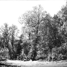
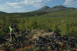
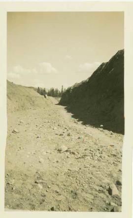
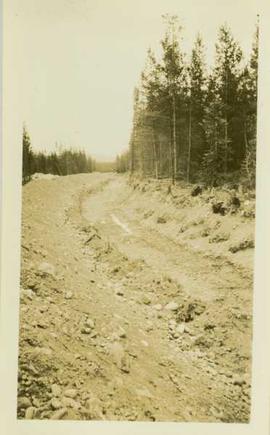
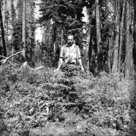
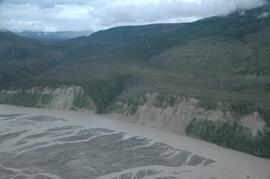
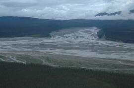
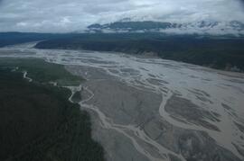
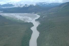
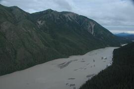
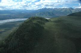
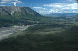
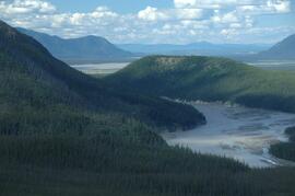
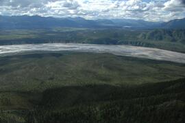
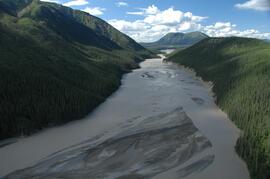
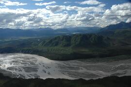
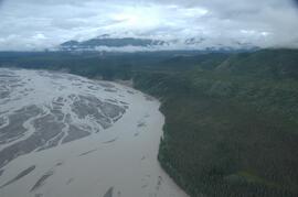
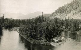
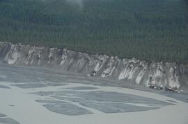
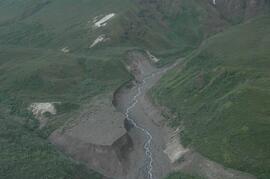
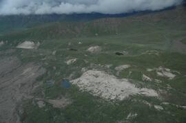
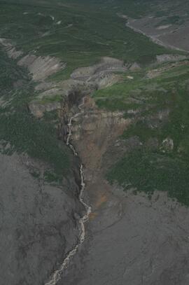
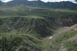
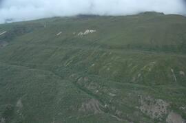
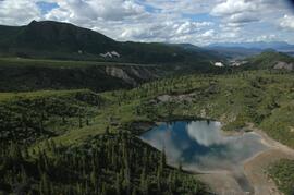
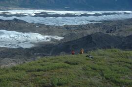
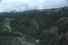
Item is an original report by Grant Hazelwood entitled "Winter Flight Report: Fiddler Creek, February 27 and March 3, 1997". Includes original photographic prints pasted into the report as well as an accompanying map.
Caption describing photograph: "Typical of wetter ground of lacustrine deposits, originally willow and alder with scattered low quality conifer col (spruce). (Skunk Cabbage) (Urtica) (A-D) 1922 burn Giscome. Definitely higher use is grazing or forage prod."
Item is an original report entitled "Wildlife of the Bowron Lakes Region" by R.Y. Edwards.
Item is a reproduction of a "Wildlife Management in Park Act Land Designations" document by the BC Ministry of Lands, Parks and Housing - Parks and Outdoor Recreation Division.
Series consists of textual material regarding wildlife and habitat in British Columbia created or collected by Grant Hazelwood. Predominantly includes reports (published and draft), discussion papers, article reprints, memoranda, and booklets.
File consists of records and textual material related to rare and endangered species (predominantly in British Columbia) collected by Grant Hazelwood. Highlights include:
- John Kelson for Kitamaat Village Council, "Investigation of Potential Marbled Murrelet Utilization of Lots 305 and 306", 1995
- Listings of rare and endangered species in British Columbia, various years
- Robert Jacobsen, "Legal Aspects of Critical Habitat Determinations", 1978? (reproduction)
- Grant Hazelwood and P.J. Bandy, "Wildlife Management Plan and Policy for Non-Game Species" (draft), 1973
- W. Grant Hazelwood, "Species of Management Concern on Kitsumkalum & Zymacord Drainages", Sept. 2001
File consists of records and textual material related to wildlife population collected by Grant Hazelwood. Includes journal reprints, reports, and leaflets. Highlights include:
- John G. Stockner, "Phytoplankton heterogeneity and paleolimnology of Babine Lake, British Columbia, Canada", Nov. 1975 (journal reprint)
- Western Guides and Outfitters Association, "Aims, Objectives and Policies", Oct. 1980 (reproduction)
- Information summary sheet leaflets for threatened and endangered Canadian wildlife including the white pelican, sea otter, Vancouver Island marmot, and wood bison, 1979
- D. Blower, "Population estimates for April 1977 caribou map", June 1977
Also includes a map:
- B.C. Fish and Wildlife Branch, "Wildlife Distribution Mapping - Big Game Series: Black Bear", 1978
File consists of records and textual material related to mammals (predominantly in British Columbia) collected by Grant Hazelwood. Highlights include:
- Robert E. LeResche, "Social and Ethical Considerations in Conservation" (reproduction)
- Grant Hazelwood, Resource Biologist, Northwood Pulp and Timber, "Fisheries Inventory - Driftwood River", 1981 (reproduction)
- Grant Hazelwood, Resource Biologist, Northwood Pulp and Timber, "Effect of Cut Block Size on Streams", 1981 (reproduction)
- David S. Shea, "A Wintertime Ecological Evaluation of the North Fork Flathead River Drainage, Glacier National Park", April 1976 (reproduction)
- A.L. "The Southern Half of the Alaska Highway and its Mammals", 1943 (reproduction)
- John P. Kelly, "Ecology of the Pine Marten (Martes americana) in North Central B.C.", 1977? (reproduction)
- V. Geist, "On the Management of Large Mammals in National Parks" in Park News, July 1972 (reproduction)
File consists of records and textual material related to wildlife collected by Grant Hazelwood. Includes journal reprints, reports, and conference papers. Highlights include:
- John Madson and Ed Kozicky, "The Principles of Game Management -- Stocking"
- Ian McTaggart-Cowan, "The Gamble of Game Management"
- R.Y. Edwards and C. David Fowie, "The Concept of Carrying Capacity"
- Maynard M. Nelson, "In Defense of the Sport Hunter" (reproduction)
- V. Geist, "On the Management of Large Mammals in National Parks" (reproduction)
- J. Hatter et al., "Inventory and Evaluation of Wildlife Resources of British Columbia", B.C. Natural Resource Conference Transactions, 1956
- Glen F. Cole, "Population Regulation in Relation to K", paper presented at the annual meeting of the Montana Chapter of the Wildlife Society, Bozeman, Montana, 22 Feb. 1974
- Patrick W. Martin, "Distribution and Abundance of Big Game Animals in B.C.", 1963
- D. Robinson, "Inventory and Evaluation of Wildlife Resource of British Columbia", B.C. Natural Resource Conference Transactions, [1962?]
- Donald A. Spencer, "Vertebrates: A Resource Needing Management", 1972 (reproduction)
- BC Fish and Wildlife Branch - Department of Recreation and Conservation, "Migration of British Columbia Birds and Mammals" (reproduction)
- BC Fish and Wildlife Branch - Department of Recreation and Conservation, "A Brief History of Game Administration in British Columbia", [1971 or 1972] (reproduction)
- BC Game Department, "Report Re: General game conditions in the Penticton Detachment", 1961 (reproduction)
- R.Y. Edwards, "Wildlife and People in Northern British Columbia", a paper for the 13th BC Resources Conference, 1961
- R.Y Edwards and R.W. Ritcey, "Importance of Environment in Big Game Studies", a paper presented at Ottawa to a technical meeting of Canadian wildlife biologists, 1958
- Richard DeGraaf and Jack Ward Thomas, "Wildlife Habitat in or near Human Settlements", 1976 (reproduction)
- Paul Edgerton and Jack Thomas, "Impacts of Silviculture on Wildlife Habitats in the Blue Mountains", 1977
- P.T. Gregory, "Report on Research on Ecology of Snakes and Frogs in Provincial Parks", [1978 or 1979] (reproduction)
- I.D. Smith, "Alternatives for Wildlife Inventory", 1974 (reproduction)
- Ian Cowan, "Preliminary Study of the Ashnola Herd of California Bighorn Sheep", 1950 (reproduction)
- Fisheries and Oceans Canada, "StreamTalk: The Newsletter for Salmonid Enhancement", Vol. 10 No. 3, Spring 2003
- Correspondence between Grant Hazelwood, Parks Biologist, and G.F. Buydens of the Parks Branch "Re: Woodpecker damage to water tank at Sproat Lake Park", 1978
File consists of records and textual material related to wildlife conservation and game management collected by Grant Hazelwood. Includes journal reprints, reports, and conference papers. Highlights include:
- James Hatter, "Fish and Wildlife in Natural Resources Development, 1966 (reproduction)
- "Pollution Control in British Columbia", [after 1967]
- Fish and Wildlife Branch, "Wildlife Resources in the Kootenay Region in British Columbia"
- J. Hatter, "The Function of the Provincial Wildlife Biologist", 1958 (reproduction)
- Jan Sawitski, "Plant Communities of the Nass - and Park Ranges of Central British Columbia", 1972 (reproduction)
- "Social and Ethical Considerations in Conservation" (reproduction)
File consists of records and textual material related to wildlife in conjunction with estuaries, grazing, and wetland habitat collected by Grant Hazelwood. Includes journal reprints, reports, and conference papers. Highlights include:
- "The National Wildlife Refuges of the Willamette Valley Oregon: An Example for the Lower Fraser Valley?", 1980
- "The Recommendations of the Fraser Valley Wetlands Habitat Committee", 1980
- "A Response to 'Sanctuary Needs of the Lower Fraser Estuary - A Discussion Paper", Dec. 1979
- Lower Mainland Regional Wildlife Association, "Log Boom Storage in Estuaries", 1973 (reproduction)
- R.Y. Edwards and P.W. Martin, "The Cariboo Method for Evaluating Browse Ranges", 1955
- Fish and Wildlife Branch, "Prevent Logging Damage to Streams" promotional leaflet, 1971
- Proceedings from Kamloops meeting re: interactions between cattle and wild ungulates in Southern B.C., 1972 (reproduction)
- "Brief: An Examination of B.C. Forest Service Guidelines for Streambank and Shoreline Protection" (reproduction)
- "Brief: Estuaries in British Columbia", 1973 (reproduction)
- Fish and Wildlife Branch, "Estuaries - The Case for Regulated Development", 1973 (reproduction)
- Fisheries and Environment Canada, "Planning Work Near the Water?" informational leaflet, 1978
File consists of records and textual material related to Northern BC wildlife corridors collected by Grant Hazelwood. Includes manuscripts, notes, and summary documents. Discusses the following wildlife corridors:
- "Fort Nelson - 94 J (Alaska Highway)"
- "Charlie Lake - 94 A (Alaska Highway)"
- "Trutch - 94 G (Alaska Highway)"
- "Halfway River - 94 B (Alaska Highway)"
- "Alternate Corridor - Chetwind > Fort St. John by Dawson Creek"
- "Hart Highway Corridor 'A'"
- "Alaska Highway Corridor 'B'"
Also includes a 1972 photocopied document titled "Wildlife Oriented Sites within Corridor of Alaska Highway (Wildlife Sites Outside of H.S.S.A.'s).
File consists of records and textual material collected by Grant Hazelwood related to BC Provincial Museum wildlife reports. Includes correspondence, news releases, and reports. Highlights include:
- Ministry of Environment, "Wolf Research Released" news release, Jan. 1984
- Grant Hazelwood, Director of the B.C. Wildlife Federation, "Wilderness" paper and "Proposed Wilderness Policy" (reproduction)
- Grant Hazelwood, species sightings in British Columbia lists, 1980 (reproduction)
- British Columbia Provincial Museum, "Higher Vertebrates of British Columbia, 1986
- R. Wayne Campbell and Alton Harestad, BC Provincial Museum, "Proposal for an Atlas of British Columbia Vertebrates", May 1981 (reproduction)
Photograph depicts a wide ditchline cut into a rocky environment with a line of trees located in the background.
Photograph depicts a wide gravel pathway that has been cleared through a wooded landscape.
Caption describing photograph: "White Spruce within 20' of pine (see GBW Film 3 Frame 1 - 2007.1.30.2.026). Same age, same site. Height 5' 1966 leader 6". Adelges." Harry Coates stands in the photograph for scale.
This image is part of the outbound sequence of aerial images obtained on the helicopter flight to the Klutlan Glacier study site. The sequence starts from the base camp at the White River crossing on the Alaska Highway and heads south, to a point just upvalley of the debris-covered terminus (approx. 10-15 km from Alaska border), and turning back north to the landing spot on the Generc River floodplain close to the study site (see Fig. 1 in paper).
This image is part of the return trip sequence of aerial images obtained on the helicopter flight leaving the Klutlan Glacier study site. On the return leg at the end of the day, the flight initially went upvalley to pick up another party. This image was taken after the helicopter turned north to return to base camp.
This image is part of the outbound sequence of aerial images obtained on the helicopter flight to the Klutlan Glacier study site. The sequence starts from the base camp at the White River crossing on the Alaska Highway and heads south, to a point just upvalley of the debris-covered terminus (approx. 10-15 km from Alaska border), and turning back north to the landing spot on the Generc River floodplain close to the study site (see Fig. 1 in paper).
Photograph depicts a jut of treed land in the Kettle river.
This image is part of the outbound sequence of aerial images obtained on the helicopter flight to the Klutlan Glacier study site. The sequence starts from the base camp at the White River crossing on the Alaska Highway and heads south, to a point just upvalley of the debris-covered terminus (approx. 10-15 km from Alaska border), and turning back north to the landing spot on the Generc River floodplain close to the study site (see Fig. 1 in paper).
This image is part of the return trip sequence of aerial images obtained on the helicopter flight leaving the Klutlan Glacier study site. On the return leg at the end of the day, the flight initially went upvalley to pick up another party.
This image is part of the outbound sequence of aerial images obtained on the helicopter flight to the Klutlan Glacier study site. The sequence starts from the base camp at the White River crossing on the Alaska Highway and heads south, to a point just upvalley of the debris-covered terminus (approx. 10-15 km from Alaska border), and turning back north to the landing spot on the Generc River floodplain close to the study site (see Fig. 1 in paper).
Photograph depicts the West peak of the Cassiar mine, pit partially visible below. Drill visible in left foreground at highest elevation of mine, north west mountain range in background.
Photograph depicts the West peak of the Cassiar mine, pit partially visible below. Mining equipment barely visible in foreground at highest elevation of mine, north west mountain range stands in background, and mine valley crosses midground.
Item is an original "West Nass Wildlife Survey, February 27, 1990" by Grant Hazelwood.
File consists of correspondence regarding West Fraser Mills' Forest Development Plan for T.F.L. 41 (1996-2001). Also includes attachments regarding the plan and comments regarding the operating area watershed and specific blocks.
Publication is entitled "West Coast Oil Ports Inquiry Statement of Proceedings", a summary of the proceedings of the inquiry commissioned by the Government of Canada into oil tanker ports and tanker traffic on the Canadian west coast.
File contains original handwritten metereological registers.
File contains maps and information related to climate station installation, including reports and tables.
Series contains photocopied correspondence relating to climate monitoring stations.