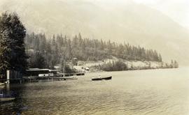
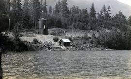
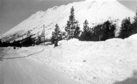
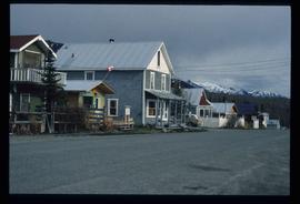
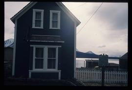
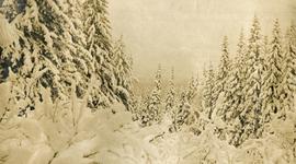
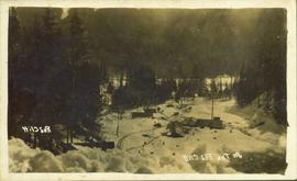
Photograph depicts snow covered trees and forest.
Image depicts the Alkali Lake Ranch in Alkali Lake, B.C.
Photograph depicts a couple in a row boat (likely the same couple depicted in image 2020.08.59) near Alta Lake shore docks and buildings. A rail line and a railway water tower are visible in the background. The water tank is a typical PGE 25,000 gallon water tank. The station would be a little over 400 feet south of the tank and is hidden by the stand of trees.
Photograph depicts a railway water tower, a small building, and a rail line along a lake shore. This is a close-up of the area depicted in image 2020.08.84. The water tank is a typical PGE 25,000 gallon water tank. The station would be a little over 400 feet south of the tank.
Item consists of three maps pieced together to depict Anahim Lake, Bella Coola, and Quesnel in British Columbia originally published by the Department of Lands, Forests and Water Resources in Victoria B.C.
Item is an original 1989 map depicting Anahim Lake in British Columbia, published by Energy Mines and Resources Canada.
Image depicts the Anderson Lake.
Image depicts a view of Anderson Lake near Seton Portage, B.C. A vehicle on a mountain road is also visible.
Image depicts a view of Anderson Lake near Seton Portage, B.C.
Image depicts power lines running alongside Anderson Lake near Seton Portage, B.C.
Image depicts a view of D'Arcy, located on the southern end of Anderson Lake.
Image depicts a vehicle on a bridge somewhere near Anderson Lake in the Seton Portage area.
File consists of photocopies of various report front covers and references to Knox McCusker from 1926-1931.
Collection of four photographs of the Prince Rupert dry dock. Printed annotation on recto reads: "Dry Dock and Ship Building Plant, Prince Rupert BC."
Image depicts another train on the White Pass railway along a forested mountain side.
Image depicts what appears to be an apartment building among several others in an uncertain location.
Image depicts numerous buildings on the shore of Haida Gwaii as the ferry approaches.
Photograph depicts snow-plowed road lined with trees, valley and mountain in background. Believed to have been taken from vehicle. Handwritten annotation on recto of photograph: "Approach to Quartz Rock Creek".
Photograph depicts view from the steamboat deck approaching Cottonwood Canyon.
Photograph depicts a view from the steamboat deck approaching Cottonwood Canyon.
Photograph depicts a view of the river shore, a few scattered buildings and tents are near the shore. A footpath leads from the water's edge between the dwellings and through the newly cleared land.
Photograph of Archdeacon WH Collison reclining against a large tree with a group of friends and family. Handwritten annotation on verso reads: "Arch. Collison with sons Max & Arthur & friends in mountains above Portland [?] Canal Me."
Village can be seen in distance. Large church building stands in centre, hills in background.
Handwritten annotation on verso reads: "For heading of Page 18. Kincolith or 'The Rock of Scalps.' Section of Kincolith [...]"
Village can be seen in distance. Large church building stands in centre, hills in background.
Handwritten annotation on verso reads: "Grand Dad on beach at Kincolith".
Photograph depicts twenty-eight or more people standing on the river's edge, a stack of wood is ready for loading on the steamer that is anchored near the shore.
Postcard featuring a photograph of a photograph of the arrival of the first stage coach at the Hotel Northern in South Fort George, BC on 19 October 1911. Handwritten annotation on recto of photograph reads: “Arrival of first stage at So. Ft. George B.C. Oct. 19, 1911. 28” Printed caption on the recto of the postcard reads: “First stage coach Prince George, B.C.” Handwritten annotation in pen on verso of postcard reads: “Mrs. C. Morris, Box 925, Penticton, BC. Thurs. 6pm, Dear Mother. Arr. Safely, good trip (bad pen!) Lovely weather. Hope all are well. Bia (?) Mary & Ed”
Photograph depicts A. H. Holland viewing North Fork valley from a high mountain ridge.
Series consists of a photograph album from A. H. Holland, a British Columbia Land Surveyor, that was created while working in the Central Interior, the Cariboo, the Chilcotin and southeast British Columbia. This album visually documents steamboat, stagecoach and horse travel in British Columbia and some First Nation village sites. It also captures preparatory survey work and dawn of the age of rail travel.
Collection consists of a photograph album from A. H. Holland, a British Columbia Land Surveyor, that was created while working in the Central Interior, the Cariboo, the Chilcotin and southeast British Columbia. This album visually documents steamboat, stagecoach and horse travel in British Columbia and also captures the prepatory work and dawn of the age of rail travel.
Holland, Arthur H.File consists of the following items:
- "Mac" by D.L. Surveyor
- "Knox (Mac) McCusker: Dominion Land Surveyor" by E.L. Rutherford, V.C. Brink, R.S. Silver and M.Z. (Smokey) Neighbour
- Excerpts from Men and Meridians by Don W. Thomson
- Article re: Knox McCusker written on the occasion of his death (April 14, 1955)
- "McKusker (sic) to open up Blueberry Mountain Area" (Alaska Highway News, June 8, 1950)
- "McCusker was surveyor, big game guide….also rancher and trail blazer"
- "Knox Freeman McCusker" written on the occasion of his death (The Canadian Surveyor, July 1955)
- "Veteran Surveyor - Alaska Highway Stories"
- Memories of Knox McCusker by his oldest niece Betty (McCusker) Rutherford
- "Veteran Surveyor prefers horses for long bush treks" by Eric Young (Edmonton Journal)
- Eulogy for Knox McCusker read by Stanley D. Seif at Burch Presbyterian Church in Fort St. John, B.C.
- Eulogy for Gwendolyn Dorothy McCusker (July 1997)
- "Tropical Valley No Myth: amazing story of woman who lived there" by Thomas A. Wayling (Vancouver Sun)
- Photocopy of section of map: "Topographical sketch map showing route traversed by the Bedaux Sub-Arctic Expedition 1934 through the Rocky Mountains" (by Frank Swannell, March 27, 1935)
- Memories of Knox McCusker by Bill McCusker, his oldest nephew
- "There is always a reason; destiny made it a date. The corridor of the Alcan didn’t just happen" (Fort St. John publication)
- Article on Knox McCusker (ALS News, Winter 1983)
File consists of the following articles and speeches written by Knox McCusker:
- "Reminiscences of Knox McCusker" (63 typewritten pages)
- "Back and Beyond the Peace" by K.McCusker (taken from the Toronto Star Weekly Saturday May 5, 1928) – retyped
- "The Alaska Highway" by Knox F. McCusker, D.L.S. (The Canadian Surveyor, July 1943)-photocopy
- Mr. McCusker's speech (5 pages)
- “Tropical Valleys of B.C.” (4 pages)
- "The president has called me an old old surveyor…" speech written by K. McCusker
- "In the early days of my career in the Surveying profession…" written by K. McCusker
Image depicts Ash Street and Patricia Boulevard in Prince George, B.C.
File contains slides depicting buildings and places in and around Ashcroft, Kamloops, and Hat Creek, B.C.
Photograph depicts rolling hills with dry vegetation and river in the background.
Photograph of several log buildings and mining equipment in winter. Printer annotation on recto is mirrored and reads: "At The Red Cliff Red Cliff."
Image depicts a dock on the shore of Atlin Lake, as well as a building that may have once been a hospital. The slide is simply labelled "hospital."
Image depicts a back street in Atlin, B.C.
Image depicts an old building undergoing a restoration process, possibly in Atlin, B.C.
Image depicts numerous old buildings on a main street in Atlin, B.C.
Image depicts a building which once served as the residence for two nurses in Atlin, B.C. A sign in front of the house reads: "Grateful Atlinites built this house in 1902 for their first missionary nurses, Helen Bone and Elizabeth Mitchell, who came here in 1899 and lived in a crude shack while valiantly and humanely caring for sick and dying pioneers."
Image depicts an old boat on the shore of Atlin Lake.
Image depicts the post office in Atlin, B.C.
Image depicts a boat named "the Tarahne," which is located in Atlin, B.C. Atlin Lake and Mountain are visible in the background.
Image depicts what is possibly Atlin Lake, with numerous mountains in the distance and Atlin Mountain visible on the right of the image.
Image depicts Atlin Lake as well as a small section of Atlin, B.C. The mountain is possibly Atlin Mountain.