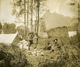
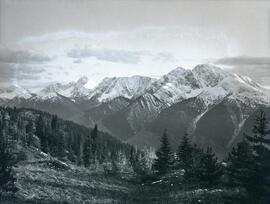
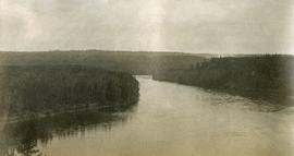
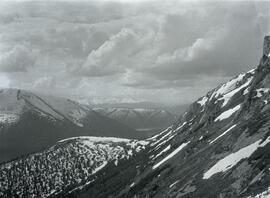
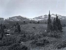
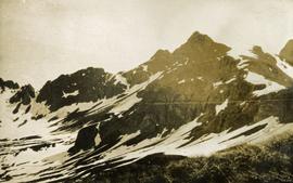
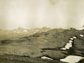
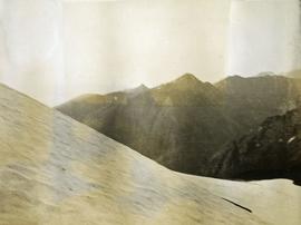
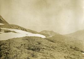
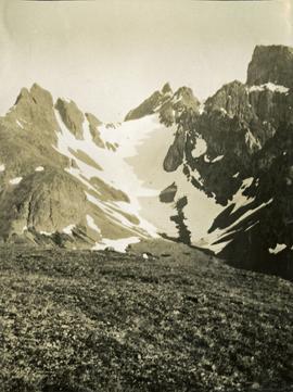
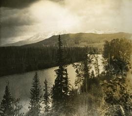
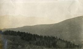
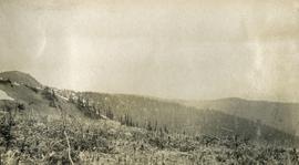
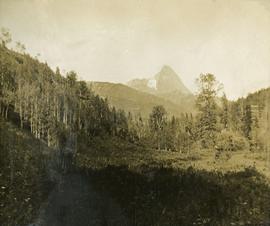
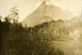
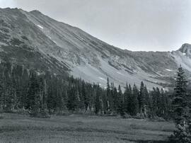
Photograph depicts lush undergrowth with trees and a mountain peak in the distance, valley of Kitseucla creek looking north from 55th parallel.
Photograph depicts four men in center of photograph, several canvas tents erected nearby, high mountain peak in the background.
Photograph depicts lush meadow with trees and a mountain peak in the distance.
Photograph depicts the view from Germansen Lodge of Omineca River with a forested shoreline and mountain ranges in the background.
Photograph depicts a valley with sparse patches of snow in front of the McCorkell mountain range.
Photograph depicts Two Brothers Lake set within a forested environment with a mountain range visible in the background.
Photograph depicts two men (Bill McPhee and Shorty Weber) standing at the summit of Copper Mountain with a snowy mountain range visible in the background of the image.
Photograph depicts (from left to right) Bill McPhee, Frank 'Shorty' Weber, and another man resting along the rocky terrain on the west slope of Copper Mountain with a forested area at the base of the mountain. In the background of the image another mountain range is visible. The location of the photograph is noted to be at Copper Mountain; however, that name does not appear to be in current use. Location is assumed to be somewhere in the vicinity of 55.979291, -125.208415, near what is currently named Wasi Peak.
Frank ‘Shorty’ Weber had a trapline on the upper Ingenika for over 30 years. and he was well-known in the Finlay River area.
Photograph taken during European Sports Tour with Team Canada.
Photograph taken during European Sports Tour with Team Canada. See also item 2009.6.1.241 for image featuring similar content.
Handwritten annotation on verso reads: "Budapest". See also item 2009.6.1.238 for image featuring similar content. Photograph taken during European Sports Tour with Team Canada.
Photograph depicts Copper Mountain with forested area at base and grassy area in the foreground.
Photograph depicts Lheidli T'enneh Nation burial grounds in foreground, Hudson Bay Company buildings in background.
Photograph depicts a snowy mountain range to the south of Wedge Creek with a forested area at the base.
Photograph depicts a view of Nechako River near junction of Stuart River.
Photograph depicts a view of lot 912 near Nechako River.
Photograph depicts a man standing on the deck of a ferry boat. A long row of building line the riverbank in the background.
Photograph depicts a view of the south slope of Duncan Mountain near Thutade Lake.
Photograph depicts a view of the snow-covered north slope of Duncan Mountain near Thutade Lake.
Photograph depicts a view of the southeast slope of Duncan Mountain near Thutade Lake.
Photograph depicts a view of Victoria from a ship in the Inner Harbour. Visible on the shore, from right to left, are: the Empress Hotel, the Belmont, the Customs Building, and other buildings along Douglas Street.
Photograph depicts a view of of the tree-covered slope with Duncan Lake below.
Photograph depicts a wide view of the Omineca River with a man standing on a boat in the right corner of the image. In the background the river a forested shoreline and mountain range are visible.
Photograph depicts three men sitting in a circle in a clear area near a sparsely forested area in front of a snowy mountain range. The location of the photograph is noted to be at Duck Creek at Copper Mountain; however, those names may no longer be in current use. Location is assumed to be approximately 55.979291, -125.208415 near what is currently named Wasi Peak.
Photograph depicts two men near their CF-AAM float plane on Thutade Lake in Sand Bay in front of their Consolidated Mining and Smelting Company of Canada Ltd. (CMS) camp site.
Photograph depicts looking across the water of Babine Lake toward low forested hills. [55th parallel]
Photograph depicts looking down on a snowy mountain ridge.
Photograph depicts looking up a snowy slope to a rocky peak.
Photograph depicts a view from a mountain summit looking across the valley to forested mountain slopes with snowy mountain tops.
Photograph depicts an alpine meadow with a mountain ridge in the background.
Photograph depicts a few of forest in the foreground, a snowy mountain range in the distance.
Photograph depicts summit between John Brown and Kitseucla creeks.
Photograph depicts a view from the summit between John Brown and Kitseucla creeks.
Photograph depicts views from the summit between John Brown and Kitseucla creeks.
Photograph depicts a view looking down on the river with Hudson Bay mountain in the background.
Photograph depicts a view from the summit between John Brown and Kitseucla creeks.
Photograph depicts views from the summit between John Brown and Kitseucla creeks, Hudson Bay mountain.
Photograph depicts a view from the summit between John Brown and Kitseucla creeks.
Photograph depicts view of an alpine meadow, alpine trees and mountains in the background.
Photograph depicts scrub alpine trees with a layer of snow in the foreground and several mountain ranges in the distance.
Photograph depicts a view from a high mountain ridge looking down on forest, river and snowy mountain peaks in the distance.
Photograph depicts an alpine meadow in the foreground, forest, river and mountains in the distance.
Photograph depicts view of an alpine ridge with an alpine meadow in the foreground.
Photograph depicts alpine meadow in the foreground, forest, river and mountains in the distance.
Photograph depicts a view of a lake and river from a high hill. Treed hills in the background.
Photograph depicts a view of immense rolling, treed hills.
Photograph depicts treed hills in the foreground. Buildings on a field near the river in the midground. Treed hills and a body of water in the background.