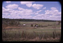
Image depicts the location of a slump type of landslide at Moose Heights, north of Quesnel, B.C.
Image depicts numerous wood piles near the sawmill somewhere in Quesnel, B.C.
Image depicts a sawmill somewhere in Quesnel, B.C.
Image possibly depicts the Fraser River from Highway 97 near Quesnel, B.C.
Image depicts the Fraser River from Highway 97 near Quesnel, B.C.
Image depicts a farm on the west side of the Fraser, south of Quesnel, B.C.
Image depicts an aerial view of Diamond Island, near Quesnel, B.C.
Image depicts the Cottonwood House Historic Site along Barkerville Highway, east of Quesnel, B.C. A sign posted by the fence reads: "For over half a century the Boyd family operated this haven for man and beast. Here weary travellers found lodging, food, and drink. Here fresh horses were hitched to stage-coaches and miners bought supplies. This historic road-house, built in 1864, stood as an oasis of civilization on the frontier of a rich new land."
Image depicts a basalt landform somewhere in or near Quesnel, B.C.
Image depicts a view of the property at 153 Mile House, near Quesnel, B.C.