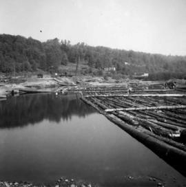
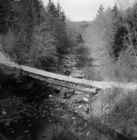
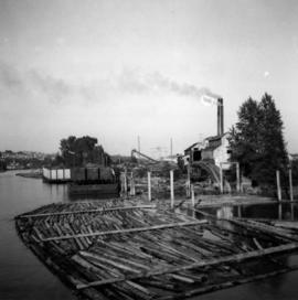
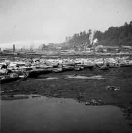
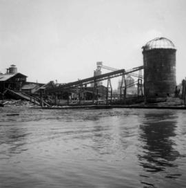
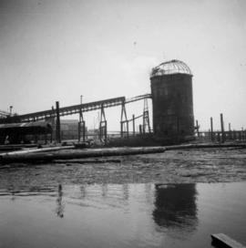
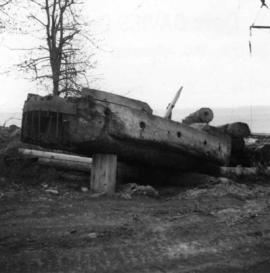
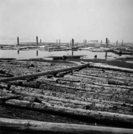
Photograph depicts a log boom probably in the Lower Mainland or on Vancouver Island.
Photograph depicts a log dump on seashore about 5 miles north of Powell River and opposite Hardwood Island. The view is looking north.
Photograph depicts a log on an old trailer bed.
Photograph depicts logger sports at Squamish, B.C.
Photograph depicts pole climbing in logger sports probably at Squamish, B.C.
Photograph depicts a logging bridge over Lois River between Saltery Bay and Lang bay, south of Powell River.
Photograph depicts a logging museum in Ladysmith on Vancouver Island.
Photograph depicts logging on a side road on the Sechelt Peninsula about 2 miles southeast of Halfmoon Bay.
Photograph depicts dumping logs at Gold River on the west coast of Vancouver Island.
Photograph depicts a mill on the north stream of the north arm of the Fraser River, looking east from the Fraser St. bridge.
Photograph depicts a lumber mill probably in the Lower Mainland.
Photograph depicts a lumber yard on the north side of Porpoise Bay in Sechelt on the Sechelt Peninsula. The tank in the photograph is about 8 to 10 feet in diameter.
Map depicts rail lines in the BC lower mainland, including BC Hydro Railway, Burlington Northern Railway, the Canadian Pacific Railway, the Canadian National Railway, and the Pacific Great Eastern Railway.
Map depicts the routes of the Pacific Great Eastern Railway, showing stations, railway connection, and the PGE Microwave Communication System.
Photograph depicts the mine buildings of the mine at Coal Creek that closed in 1959. The newer buildings date to circa 1930. Much of the standard gauge trackage of Morrissey, Fernie, and Michel railway (subsidiary of the Great Northern Railway) in mine area remains. The track between Coal Creek and Fernie has not been lifted.
Photograph depicts a mine car at Moyie mine, at Moyie, 20 miles south of Cranbrook. The mine produced silver, zinc, and lead, and worked principally from 1900-1910. It is now disused.
Photograph depicts a mine 200 yards south of Moyie village, which is 20 miles south of Cranbrook. It produced silver, zinc, and lead from 1900-1910 and had a smelter a quarter mile away. The shaft was 900 ft. deep, with levels going under Moyie Lake. The head gear dates from 1925-1935 and has electric winding.
Photograph depicts a mine ore car exhibited on the site of the Granby Mine at the ghost town of Phoenix, near Grand Forks.
Photograph depicts a mineral ore (lead or zinc?) mines near the ghost town of Sandon, on the road between Kaslo and New Denver.
Photograph depicts Moyie Lake, 15 miles south of Cranbrook, and Moyie Station. The tailings are from a lead and zinc mine directly to the right of the photograph on the hillside. The view is looking north.
Plan depicts architectural drawings of the Canadian National Railway station in Kamloops. Includes an elevation of the building and floor plans.
Photograph depicts the newsprint plant of MacMillan, Bloedell, and Powell River Ltd. In Powell River, B.C. The view is looking northwards and shows that the plant is working on Easter Day/
Photograph depicts a once used booming boat made of log sections at a log dump on seashore about 5 miles north of Powell River, and opposite Harwood Island. Stern at left with prop guard.
Photograph depicts an old pelton wheel at a former quarry at Granite Falls on the northeast head of the Indian Arm.
Series consists of large format maps and plans relating to railways in British Columbia and Canada. Also includes oversize documents.
Photograph depicts an oxen powered log carrier with wheels that are approximately 10 feet in diameter. It is at Pioneer Park and Museum near Totem Lake, 3 miles north of Yahk and 30 miles east of Creston.
Sign says "Pacific Great Eastern Railway Company - Explosives - Handle Carefully - Keep Fire Away - North Vancouver Station June 25 1969". Also includes condensed rules for handling cars with explosives.
Series consists of graphic material depicting railways in British Columbia. Includes prints, negatives, and postcards.
Map depicts the Shuswap Lakes, Rogers Pass, Kamloops, Yellowhead Pass, Thompson Valley, and the Nicola Valley. Also includes the first clues to a treasure hunt.
Photograph depicts the pit head refuse at Extension Coal Mine, 5 miles southwest of Nanaimo. It worked between 1901 and 1931.
Plan depicts the CNR rail yard in Kamloops. The plan was originally drafted on March 6, 1928 and updated to July 1937.
Plan depicts the Canadian Pacific Railway yards in Kamloops and the proposed connection between CPR and CNR. Includes a CPR track profile, profiles of street crossing, and enlargements.
Plan depicts the proposed CNR rail yard layout in Kelowna. A later plan, dated May 30th 1925, shows drastically reduced trackage and no barge slip.
Plan depicts a proposed location for a CNR station and crossing in Kelowna.
Plan depicts the proposed location and layout for the Canadian Northern Pacific terminal at Kamloops on the Kamloops-Lumby branch.
Map depicts the growth of Vancouver's street car system as from the laying of the first tracks in 1889 to the last section laid (Clark Dr., Hastings to Venables).
Subseries consists of printed and photograph postcards depicting railways, buildings, ships, and other transportation in British Columbia.
Plan depicts a section, profile, and contour plan of the fill of the Lyon Creek Trestle bridge in the Clearwater CNR subdivision.
Map depicts rail trackage in the Greater Vancouver area, showing dates of completion and abandonment of railway lines. Also shows proposed rail lines.
Map depicts railway lines in the state of Washington, including those crossing over the border into British Columbia.
Map depicts all current rail lines in Western Canada and Alaska and major railway stations. Includes insets for Alaska & Yukon, Edmonton area, Winnipeg area, and the Vancouver area.
Hand drawn draft map depicts historical railway routes in British Columbia. Includes dates and annotated information about rail lines.
Photograph depicts the reverse view of a steam donkey at Sayward near Kelsey Bay on North Vancouver Island.
Series consists of articles, clippings, and other research material related to rolling stock used on British Columbia railways. Although the term “rolling stock” encompasses all vehicles that move on a railway, some material regarding rolling stock is filed separately, such as locomotives (see series 2013.6.11). Includes information about passenger cars, freight cars, and non-revenue cars (cabooses, cranes, service cars, etc.).
Photograph depicts a Ruston steam roller owned by Gary Wellburn in Duncan, BCIt was previously owned by the Oak Bay municipality.