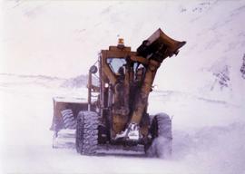
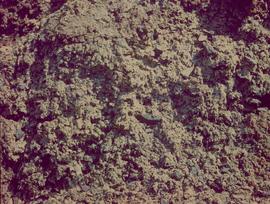
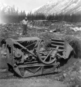
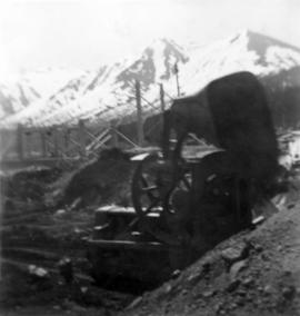
Photograph depicts snowy mountaintop, wooden shelter and truck in foreground. Corresponding note on accompanying photo description page: "Pictures taken July 2nd, 1952. 1. Picture taken from campsite showing snow on talus."
Photograph depicts man standing on dirt road. Snowbank to right of man is almost shoulder-height and disappears as road continues. Corresponding note on accompanying photo description page: "12. Indicates snow along the mountain road."
Photograph depicts mountain side, semi-covered in snow, trees in foreground. Corresponding note on accompanying photo description page: "9. Shows snow conditions in second gully north of talus deposit. Same condition here but high crown can be seen [see item 2000.1.1.2.228]."
Photograph depicts mountain side, semi-covered in snow. Snowbank in foreground. Corresponding note on accompanying photo description page: "8. Shows snow conditions in gully just north of talus deposit on south slope. Note considerable snow still above road. Estimated depth of snow here to be from 10 to 20 feet [see also item 2000.1.1.2.229]."
Photograph depicts flat area mostly covered in snow. Corresponding note on accompanying photo description page: "11. Indicates snow conditions in the cirque. Taken from near first switchback."
Photograph depicts mountain side mostly covered in snow. Corresponding note on accompanying photo description page: "10. Snow on mountain slope above road between where mountain road starts and the first switchback. This snow will melt and the water must still pass over or along road."
Handwritten annotation below photo on page taped to photograph: "PHOTO #4 Face of cut 4' wide 3' deep. Showing serpentine fragments in loose asbestos fibre. Assumed to overly serpentine high in fibre veinlets. Frost action."
Photograph depicts 8 men working on top of unknown wooden structure, dog in foreground, mountain base in background. Corresponding note on accompanying photo description page: "1. Erecting 12"x12"s for mill walls. Looking west. Note boulders in foreground ready to be blasted to clear area."
Photograph depicts track loader moving dirt in semi-cleared area, man and mountains in background. Corresponding note on accompanying photo description page: "3. Excavating for ore haul truck dump. Looking west".
Photograph depicts track loader moving dirt, mountains in background. Corresponding note on accompanying photo description page: "4. Excavating for ore haul truck dump with mill in background. Looking southeast."
Handwritten annotation below photo on page taped to photograph: "PHOTO #3 Showing approx. area covered by Asbestos - serpentine float". The approximate area has been outlined in blue ink on verso of photograph. Photo taken from lower level in valley, trees in foreground, outcrop visible in distance.
Handwritten annotation below photo on page taped to photograph: "PHOTO #1: Outcrop of Serpentine showing veinlets of asbestos fibre. Wider veinlets 1/2" - 1"."
Photograph depicts a construction worker carrying a plank of lumber across a higher level area of the construction site, semi-constructed walls below him. Barricades against loose rock are semi-visible in foreground (see item 2000.1.1.2.352).
Handwritten caption beside this photo reads: "Lunchroom Damaged by Boulder". Large boulder stands to right of small building, walls of right corner partially destroyed. Lumber, upturned saw horse, and various other material lie on ground. Dirt road in foreground, mountainside in background.
File contains images depicting various landslides near Cassiar BC. Set of 20 photographs (with 9 corresponding negative strips) date stamped June 1987 depict landslide near creek and dirt road with a Cassiar company truck. Set of 5 black and white photographs found in envelope marked "D. Stewart" are likely from 1988-1989 and depict a rockslide on the south western side of the pit mine, near the tramline. Album entitled “6200 DUMP SLIDE / SPRING, 1979” contains 34 photographs depicting aerial shots of a massive rockslide on the eastern slope of McDame Mountain, originating from the mine waste dump. Several images from album show greenish water pooling in the toe of the slide.
Photograph depicts ore haul truck at dump in mine, driver visible, mountain range in background. Handwritten annotation on recto of photograph: "Kenworth - Model 802 dumping stripping waste at 6565 Elevation", on verso: "1961".
Photograph depicts ore haul truck at dump in mine, mountain range in background. Photo also features driver and a second unidentified man standing in front of truck. Handwritten annotation on recto of photograph: "Int. Harvester Payhauler Model 95 dumping stripping waste at 6565 Elevation", on verso: "1961".
Photograph depicts plant buildings below, tailings pile in foreground. Valley and mountains in background. Handwritten annotation on recto of photograph: "CASSIAR".
Photograph depicts plant buildings in front of tailings pile in midground. Forest, power line, and tramline in foreground; south mountains in background.
Photograph depicts mine valley and road in foreground. Cassiar plant and tailings pile visible in left midground, townsite in right midground. Mountainside of McDame Mountain in foreground, southern mountain range in background.
Photograph depicts the West Peak of the Cassiar mine on McDame Mountain. Pit area visible between West Peak and road in foreground. Mine valley and north mountain range in background. Photo speculated to have been taken from a point on or near the South or North Peak.
Photograph depicts crusher plant in centre foreground. Shifter shack and vehicles can be seen in front of pit area. West Peak semi-visible in right midground. Mine valley an northwestern mountain range in background.
Photograph depicts close up view of gravel pit, ruler displayed for scale. Photograph speculated to have been taken at the plant or near the Cassiar airstrip. Stamped annotation on recto of photograph: "JUN. 1987".
File includes six aggregations of photographs which have been assembled in this file in order to maintain the integrity of each group by keeping the photos arranged together, though each group features operations pertaining to multiple files in this subseries. Includes groups featuring photos from 1961, 1965 1971, a helicopter trip, a community album, and a workplace album. Photographs depict images pertaining to the following operations at Cassiar, B.C.: mining, milling, maintenance, labratory tests, and tramline and town operations. Images featuring operations of the company town include the grocery store, bank, churches, school, library, lounge, pool, theater, community center, outdoor recreation, hospital, dentist, cafeteria, bus route, residences, air strip, firehall, laundromat, park, police, and newspaper.
Photograph collection of various foothills around Cassiar.
File contains portraits and sample photographs of exposed asbestos fibre: in veins of rock outcrops, and loose in talus on McDame Mountain (location of Cassiar mine). Some photographs were printed in Cassiar's Annual Reports, with labels and descriptions.
Photograph depicts the North peak of McDame mountain in the earlier stages of strip mining, South peak unmined in background. Quonset and other shops visible in left foreground, unknown building built into mountainside in right foreground.
Photograph depicts red truck dumping waste at what is believed to be the tailings pile at the Cassiar plant. Small building and unidentified individual in bottom left foreground, valley and mountains in background. Photo caption next to printed copy of image in 1953 Annual Report: "Stockpile of 80,000 tons of Ore at Mill."
Photograph depicts large dry rock storage building in foreground on right, mill on left behind tailings pile, and dryer building in centre behind conveyor belt connecting mill to dry rock storage. A cloud can be seen rising from plantsite. Trees and Troutline Creek cross foreground, mine valley and mountains visible in background. Stamped annotation on recto of photograph: "ANSCO PRINTON Munshaw Colour Service Ltd. MAR 10 1955".
Photograph depicts large dry rock storage building in foreground on left, mill in background, dryer building in right midground. Miscellaneous supplies in far right foreground, mountains visible in background. Handwritten annotation on verso of photograph: "Sept 1954". This photograph was originally stored inside duotang labeled "CASSIAR ASBESTOS CORPORATION LIMITED PHOTOGRAPHS 1954"; photo caption beneath this image: "40,000 Ton Dry Storage Building / Mill / Dryer Building".
Photograph depicts large dry rock storage building on left, mill in background, dryer building on far right. Road and power poles cross foreground, mountains stand in background. Photo caption next to printed copy of image in 1953 Annual Report: "Completed dry rock storage and dryer buildings."
Photograph depicts two pick hammers laid in asbestos fibre. Annotations on note glued to recto of photograph: "ASBESTOS"; "Detail view of asbestos talus. Early test pit near top of showing. Western slope." Areas of image have been labeled "A" and "B". Photo caption under printed copy of image in 1952 Annual Report: "A - Asbestos fibre partially opened by frost action. B - Serpentine rock originally containing the asbestos fibre."
Photograph depicts construction worker walking up mountain slope, possibly using rope safety gear. Wood framework for Crusher building in foreground; mine road, plant site, and mountain range in background.
Handwritten photo captions below this item and item 2000.1.1.2.324: "ELEVATION OF SITE: 6000' " "Two views of completed Crusher Bldg." Crane numbered "151" stands above and to right of crusher building. Snowdrift in foreground, mountain range in background.
Photograph depicts yellow conveyor belt in foreground over gravel pit, dump truck behind in midground. Mountains visible in background. Photo speculated to have been taken at the plant or near the Cassiar airstrip. Stamped annotation on recto of photograph: "JUN. 1987".
Photograph depicts framework of one side of the crusher building next to rocks from excavated mountain wall. Lumber in foreground. Handwritten caption beside this photo reads: "Note confined area to work in, and need for rock fences."
Photograph depicts Zora Ivanovska in safety gear, vaccuming asbestos dust from "hall screen" in mill (slanted vibrating tables with varying mesh sizes, used to separate different lengths of fibre). Mill General Foreman Tony Pinto is visible on far right, with unidentified man.
Photograph depicts part of the vacuum dust control and removal system in the Cassiar mill building. Unidentified man can be seen at rotary air-lock, in which heavy blown dust would collect before dropping to plenum conveyor resting just above floor. From here, the dust would eventually be expelled at the tailings pile outside of the mill. Second unidentified man can be seen climbing steps in background. This section of the mill was located above the lab.
Photograph depicts wheel bulldozer in snowy unknown area of mine.
Photograph depicts three women wearing white aprons while conducting tests on asbestos fibre in lab area, miscellaneous equipment throughout room.
Photograph depicts mine area. Switchback road and higher benches in background. Blasthole drills, track shovels, and ore haulage trucks can be seen on level in foreground and higher bench in background. Mountains visible in distance. Benches in background speculated to be located on the mine's West Peak.
Photograph depicts machinery in snowy area of mine. Euclid ore haulage truck in foreground, cassiar pickup truck visible in lower area in midground. Blasthole drill in front of track shovel in left background, Wabco ore haulage truck visible behind other machinery in right background.
Photograph depicts shovel in excavation area of mine, loading ore haulage truck believed to be a Wabco "haul pak".
Photograph depicts palletizer machinery, where bags of asbestos fibre were shrink-wrapped and made ready for shipping pallets. Palletizer was located near shipping (believed to be in mill building). Unidentified man visible in machinery on far left.
Photograph depicts woman wearing safety gear in second floor of mill building, holding unidentified instruments. Helen Joseph took air quality tests in the working areas and town (see item 2000.1.1.3.19.147).
Photograph depicts Joseph wearing safety gear while standing at testing equipment on raised sampling station. Sign below Joseph reads "DO NOT DISTURB / SAMPLING IN PROGRESS / PROPERTY OF ENVIRONMENTAL CONTROL DEPT. / CASSIAR ASBESTOS LTD." Helen Joseph took air quality tests in the working areas and town (see item 2000.1.1.3.19.135). Power lines, unidentified building, and mountain base visible in background. Photo was taken during winter.
Photograph depicts group of men and women on rocky shore, pile of fish in foreground. Photo speculated to have been taken in the Telegraph Creek area, possibly at the Tahltan or Stikine River, B.C.
Photograph depicts mobile home modified for Cassiar winters (steeply sloped roof added). Yellow suburban parked in driveway in left foreground. Forest trees and mountainside visible in background. Sign reading "686" posted on tree in left foreground. Believed to be the home of Gerry Cooper.
Photograph depicts two unidentified individuals in canoe on Boya Lake, B.C. (formerly known as Chain Lakes). Foliage silhouetted in foreground; forest and hills on opposite shore in background.
Photograph depicts exposed asbestos fibre in talus.