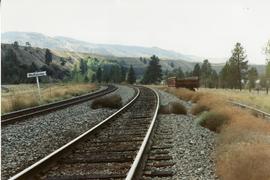
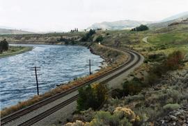
Map depicts the cities of Summerland, Penticton, and Naramata. Annotated by Davies to emphasize the rail lines in the area.
Postcard depicts "Summit City" in Rogers Pass, built in 1886 and existed only for the consctruction of the CPR.
Photograph depicts block ships sunk to protect booming grounds at Powell River. The ships were former wartime naval vessels.
Photograph depicts a sunken whaler with a harpoon gun. A destroyer or, possibly, a corvette was being broken up in the middle background.
Photograph depicts the close up of harpoon guns of a sunken whaler in the Upper Harbour of Victoria.
Photograph depicts the Superior Propane Ltd. tank yard behind Wilkinson Steel Ltd.
Photograph depicts the CPR swing bridge crossing the Harrison River at Harrison Mills. It is a plate girder bridge carrying a double track. The bridge tender occupied a shanty at the east end of the bridge at mile 68.3 from North Bend. The timetable states that trains may proceed at restricted speed after stopping, if the tender fails to appear after 4 whistle signals and the hone signals show stop.
Photograph depicts the swing span of the road and rail bridge at Mission City, looking upstream from the south bank.
Photograph depicts switcher #8106 that served the 3 mile branch to a pulp mill. The switcher pulled with heavy string of loaded cars from the mill. The trip was a caboose run. Locomotive built in 1958 as part of a batch of 31. 17 of them remained in 1997.
Photograph depicts switcher #8106 and caboose #434612 that just arrived with a loaded train from a pulp mill. To the left lay the main track to Nelson.
Photograph depicts a switching locomotive and stand-in locomotive.
Photograph depicts an old tank car owned by a logging railway on Vancouver Island, parked at the end of a spur behind a locomotive shed of the Alberni Pacific Railway.
Photograph depicts a new tank car for sodium chlorate CN/CP interchange.
Photograph depicts a tank that was found outside of the headquarters of the British Columbia Armoured Regiment in Vancouver.
Photograph depicts a tank 'Scale Test Car' at the Kamloops CPR yard.
Photograph depicts telephone fittings on Vancouver Island.
Photograph depicts ten ballast cars of the B.C. Electric Railway on newly laid industrial spur on the northeast side of the Langley depot.
Map depicts location of treasure hidden between Clearwater and Clemina, BC.
Postcard depicts "Canadian Pacific's all Stainless Stel Scenic Dome Streamliner-"The Canadian"-in the Canadian Rockies."
Postcard depicts "VIA Rail Canada Nos. 6456 and 6454 hauling Train No. 1, "The Canadian" between Spences Bridge and Drynoch, British Columbia, on Canadian Pacific's Thompson Subdivision, having been delayed by the need to detour, from its usual route, on Canadian National's Ashcroft Subdivision, seen here across the Thompson River. May 14, 1993."
Postcard depicts "Canadian Pacific's eastbound, "The Canadian," crosing the Kicking Horse River between Golden and Field B.C. in October 1976. Some of the... trains power through some of North America's most spectacular scenery. The morning has brought the season's first snowfall."
Tourist map of Prince George depicts city area, including railway trackage.
Postcard depicts "The Four Tracks."
Postcard depicts the Four Tunnels on the CPR line through the Rocky Mountains.
Postcard depicts "Twin Bridges in the Fraser Canyon. The CNR and CPR change sides at this point."
Postcard depicts 'The Gap," the entrance to the Rockies.
Postcard depicts the Golden-Field Highway as seen from high up on the mountain side from a tunnel on the CPR run in the Kicking Horse Canyon.
Postcard depicts the Canadian Pacific Railway line where the Great Divide between BC and Alberta.
Postcard depicts the Illecillewaet Valley, near Glacier, BCThe view shows the end of the descent over Rogers Pass, if travelling westerly. The scar in the foreground was believed to be the track between the 1st (Glacier Hotel) and 2nd (Loop Brook) loops.
Postcard depicts the Kicking Horse Canyon near Yoho National Park.
Postcard depicts "The Loop, as this great pear-shaped arc of trestle was known along with the spectacular station and hotel facilities at Glacier were replaced by the Connaught Tunnel in 1916."
Postcard depicts "The Loop," CPR Selkirks.
Postcard depicts "The Loop," CPR, Selkirk Mountain.
Postcard depicts "The Loop," Glacier, BC
Map depicts the province of British Columbia. Includes rail lines and historical notes about the province.
Tourist map of Prince George depicts city area, with annotations by Davies to emphasize locations of rail lines.
Photograph depicts the "Princess of Vancouver" loading at 7 p.m. in Vancouver.
Map depicts the route of BC Rail and its connecting rail lines.
Postcard depicts a spiral tunnel near Field B.C. Mount Stephen visible.
Postcard depicts 'The Spiral Tunnels."
Postcard depicts spiral tunnels near Yoho National Park, BC
Photograph depicts the split of the Great Northern Railway (GNR) (shown) and the Canadian National Railway (CN) tracks, immediately south of the Fraser crossing at New Westminster.
Postcard depicts the town of Field and Mt. Stephen. Near Yoho National Park in the Canadian Rockies.
Postcard depicts the Van Horne Range, looking west from Field, BC
Postcard depicts the west portal of the Connaught Tunnel, near Glacier, BCDavies noted the ventilation engine house above the entrance.
Postcard depicts a "Spectacular sight to be seen while travelling through this Canyon. Many trains rumble past with heavy loads making a grand sight when they twist and turn around corners along the clear blue water of the Thompson River."
Photograph depicts CN track 1 mile east of Walhachin. Looking east. Thompson River running downstream, towards the camera. CPR also goes through Walhachin.
Photograph depicts CN track 1 mile east of Walhachin. Looking east. Thompson River running downstream, towards the camera.