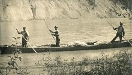
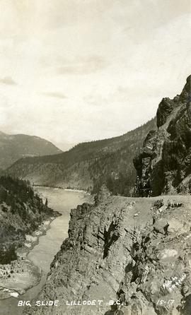
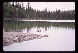
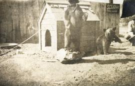
Photograph depicts bears in captivity. The large bear is chained by a neck collar.
Image depicts a small section of the Bear Glacier.
Image depicts a close-up of a cave-like opening in the Bear Glacier.
Image depicts the Bear Glacier in Bear Glacier Provincial Park, as well as what is possibly Strohn Lake.
Image depicts the Bear Glacier in Bear Glacier Provincial Park.
Image depicts a close-up of the Bear Glacier in Bear Glacier Provincial Park.
Image depicts Bear Glacier in the foreground and a mountain in the background, somewhere in Bear Glacier Provincial Park.
Image depicts the Bear Glacier with a cave-like opening.
Image depicts Bear Glacier in the foreground and numerous mountain peaks in the background in Bear Glacier Provincial Park.
Image depicts Sue and Kent Sedgwick with two dogs, standing with the Bear Glacier in the background.
Image depicts Sue Sedgwick with a dog, standing with the Bear Glacier in the background.
Image depicts the Bear Glacier stretching through a mountain range.
Image depicts a dog on a road, and a view of the mountains in Bear Glacier Provincial Park.
Image depicts a view of Bear Pass, likely from Glacier Highway and somewhere in or near Bear Glacier Provincial Park, located north-east of Stewart, B.C.
Image depicts what is possibly Bear River in the Bear Glacier Provincial Park.
Image depicts the Bear River.
Image depicts what is possibly Bear River in the Bear Glacier Provincial Park.
Image depicts what is possibly Bear River, flowing out from an opening in the Bear Glacier.
Image depicts what is possibly Bear River flowing past what is likely a section of the Bear Glacier.
Image depicts a section of road running through the Bear River Gorge.
Map depicts sea floor of the Beaufort Sea, fault lines, and diapirs.
Photograph depicts the bow of a boat in the foreground, lake water and low treed hills in the background.
Image depicts the canoe group preparing to canoe on Beaver Pond, which is the start of Kibbee Lake.
Image depicts a field of hay somewhere in Beaver Valley.
Image depicts what appears to be a small ranch. The slide is labelled "Becher's Prairie," possibly meaning Becher's Prairie Provincial Park in B.C.
Image depicts an esker at Bednesti Lake, B.C.
Image depicts a beehive burner, as well as rail road tracks, at an unknown location.
Image depicts a Beehive Burner along the Nechako on River Road. Map coordinates 53°55'34.1"N 122°44'58.0"W
Foreground shows two rocky shores covered in dirt and wood debris, connected by a barely visible bridge. Annotation on recto reads: "Before the Blast Apr. 24th 13"
Image depicts Bellos Road, most likely in Red Rock, B.C.
Image depicts the Berg Glacier at Berg Lake in the Mt. Robson Provincial Park.
Image depicts the Berg Glacier and Berg Lake near Mt. Robson.
Image depicts the Berg Glacier and Mt. Robson.
Rev. William Edwin Collison stands in centre of boat, with wife Bertha and daughters Muriel and Katherine seated behind. Unknown man and woman are also seated in boat, and an unknown man stands on shore holding rope.
Handwritten annotation on verso reads: "Will Collison with wife & children leaving Metlakatla to catch steamship en route to England (1910)".
Photograph depicts a view possibly from a stage coach, fences and rolling hills with dry vegetation in the background.
Photograph depicts three men standing in a canoe with long poles. Canoe is floating in quiet river water, bluffs in the background.
Image depicts two individuals on a canoe on Big Bar Lake north of Clinton, B.C..
Image depicts the a flock of ducks on Big Bar Lake north of Clinton, B.C..
Photograph of a large explosion on what appears to be a shoreline. Printed annotation on recto reads: "'Big Blast' Prince Rupert. B.C."
Photograph depicts the "Big Slide" at Lillooet. Also visible are a horse-drawn cart and the Fraser River.
Photograph depicts Bill and canoe on sandy shore, river and opposite shore in background. Handwritten annotation on recto of photograph: "Billy Barnett at Giscome Portage."