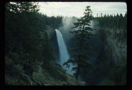
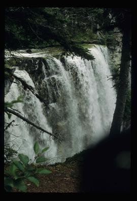
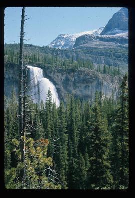
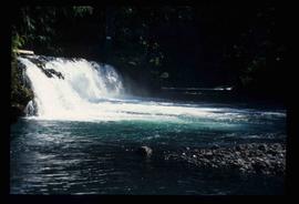
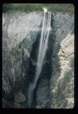
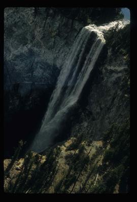
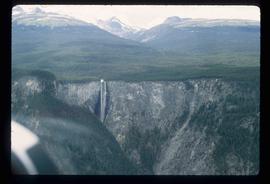
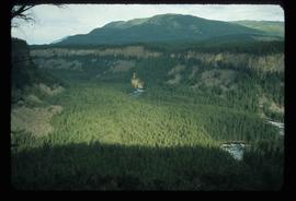
Image depicts the drainage area for the Helmcken Falls in Wells Gray Provincial Park.
Image depicts the Helmcken Falls in Wells Gray Provincial Park.
Image depicts Wells, B.C.
File contains slides depicting Wells, B.C.
Image depicts Wells, B.C.
Item is an original 1994 map titled "Welcome to Prince George" that includes the Prince George Heritage River Trails. The map was published by the City of Prince George.
File contains slides depicting weather balloons.
Image depicts the Watson Mansion at Mile 108 of Highway 97. It was built by Captain Geoffrey Watson in 1904, and was burned down by a chimney fire in 1983.
Image depicts the Watson Mansion.
Image depicts a waterfall with a mountain peak in the background; it is most likely Mt. Robson.
Image depicts a waterfall in what is possibly the Robson River.
Image depicts a waterfall somewhere in South Tweedsmuir Provincial Park.
Image depicts a waterfall on a mountain side in Mt. Robson Provincial Park.
Image depicts a small waterfall at an uncertain location.
Image depicts an aerial view of a waterfall in South Tweedsmuir Provincial Park.
The item is a photograph reprint originally taken between 1967 and 1975. The photograph depicts Prince George's war memorial cenotaph in front of City Hall. The address is 1100 Patricia Boulevard
Image depicts War Lake.
File consists of notes and reproductions relating to a walking tour of the Millar Addition in Prince George.
Image depicts the W.A.C. Bennett Dam on the Peace River in Hudson's Hope, B.C.
Image depicts several unidentified individuals lying on a hill outside what is most likely the W.A.C. Bennett Dam in Hudson's Hope, B.C.
Image depicts a section of the Peace River blocked off by the W.A.C. Bennett Dam. The dam itself is not visible in the image.
File consists of notes, reproductions, and clippings relating to the W. Lamb and Sons Lumber Sawmill in Island Cache and its development. File predominantly includes printed photographs and photographs from the Exploration Place Museum database depicting the sawmill. Includes "Engines" printed email from Trelle Morrow to Kent Sedgwick (24 Nov. 2009).
The item is a photograph of W. D. West foto source on 3rd Avenue in Prince George.
File consists of notes, clippings, and reproductions relating to the Volksport trail in Prince George. The trail starts at the Prince George Railway and Forestry Museum and follows the Heritage River Trail through parks along the Fraser and Nechako Rivers with some residential walking. Includes: "Prince George Railway & Forestry Museum 11 km trail for Volkssporting members" typed document (2004) and "Presentation for Railway and Forestry Museum Directors Meeting" typed document by Audrey L'Heureux (Jan. 2004).
Image depicts a view south, possibly of an abandoned grade for the BCR; possibly somewhere near Woodpecker, B.C.
Image depicts a view of Tabor Mountain in Prince George, B.C.
Image depicts a view of Quesnelle Forks and the nearby river.
Image depicts the Grand Trunk Railway bridge across the Fraser River. Map coordinates 53°54'29.0"N 122°42'06.5"W
Image depicts a view of Prince George from Cranbrook Hill looking southeast. Map coordinates 53°54'51.5"N 122°49'05.2"W
Image depicts a view of Prince George from Cranbrook Hill looking east. Map coordinates 53°54'51.5"N 122°49'05.2"W
Image depicts a view of Prince George from Cranbrook Hill looking southeast. Map coordinates 53°54'51.5"N 122°49'05.2"W
Image depicts a view of Prince George from Cranbrook Hill looking east with pulpmill and downtown in background.
Image depicts a view of Prince George from Cranbrook Hill looking east. Map coordinates 53°54'51.5"N 122°49'05.2"W
Image depicts a view of Prince George from Cranbrook Hill looking east.
Image depicts a view of Prince George from Cranbrook Hill looking southeast. Map coordinates 53°54'51.5"N 122°49'05.2"W
Image depicts a view of Prince George from City Hall looking north. Map coordinates 53°54'46.3"N 122°44'41.9"W
Image depicts a view of Pine Pass on the border between Alberta and British Columbia in the Rocky Mountains.
Image depicts a view of the small town of Likely, B.C.
Image depicts a view of Giscome with a train passing through.
Image depicts downtown Prince George taken from across the Nechako River looking south. Map coordinates 53°56'00.0"N 122°44'29.7"W
Image depicts a view of Prince George from City Hall looking northeast along George Street. Includes a back view of the Prince George cenotaph. Map coordinates 53°54'46.3"N 122°44'41.9"W
The item is a photograph depicting a dip between two hills of Woodpecker Landing Road. Annotation on reverse side of photograph states, "cut at powerline Woodpecker Ldg. Rd."