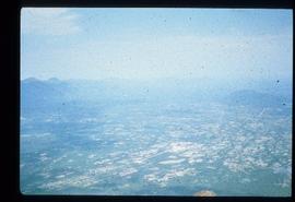
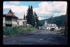
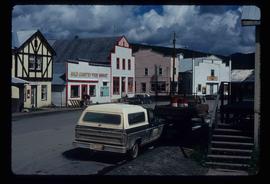
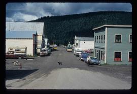
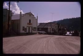
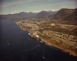
Photograph depicts an aerial view of the Prince Rupert shoreline.
Photograph is one of seven images believed to have been taken on a Canadian University Service Overseas (CUSO) mission in Mozambique; see also items 2009.6.1.483 - 2009.6.1.489.
Handwritten photo album caption beside this photo reads: "S/L. A.C. Heaven. C.D. #3 Unit, N.W.S.R. Fort Nelson." Photograph depicts man in uniform standing on steps in front of doorway to unidentified building. Wings medallion on left breast.
Royal Canadian Air ForcePhotograph depicts the abandoned Sumas substation at Vedder Mountain.
Photograph depicts an abandoned settlement.
Photograph depicts an abandoned ranch house, southeast of Rock Creek, north of an abandoned GNR grade, and about a mile north of an international boundary.
Photograph depicts an abandoned log cabin in the Kettle Valley between Rock Creek and Westbridge, on the east side of the road approximately 5 miles from Rock Creek.
Photograph depicts an abandoned house in a semi-host town viallage that dated back to 1895-1900. It was coverd with hop flowers which was typical for most of the deserted homes in the area. Village had 20 buildings standings of which 12 were occupied.
Image depicts the interior of a house that appears to be abandoned and in disrepair in Island Cache.
Image depicts an old and abandoned duplex somewhere in Wells, B.C.
Front view of an abandoned log building. The door is open or missing, the front window glass is broken, the area in front of the building is littered with antlers, boxes and wood. The tree next to the building has grown too close the building and roof. Handwritten annotation on verso in pen reads: “Laketon, Dease Lake, BC. Court house & jail June ‘62”
Photograph depicts an abandoned church at Extension, B.C., west of Nanaimo.
Image depicts the interior of an old, abandoned church at an uncertain location; possibly somewhere between Lillooet and Kamloops.
Image depicts an old and abandoned, collapsing church at an uncertain location.
Image depicts several abandoned and collapsing cabins in Quesnelle Forks, B.C.
Image depicts part of a path leading to some abandoned cabins in Quesnelle Forks, B.C.
Image depicts an old, abandoned cabin with ivy growing up the side. The location is uncertain.
Image depicts an old and abandoned cabin with ivy growing up the side. The location is uncertain.
Photograph depicts an abandoned cabin about 100 yards from the Fraser River on Bridge River road, about 2 miles out of Lillooet.
Image depicts an abandoned cabin in Quesnelle Forks, B.C.
Photograph depicts a water tower beside a rail line.
Photograph depicts a water tower.
Head on photograph of a trapper standing in front of his cabin in Prince Rupert, BC. The front of the cabin is covered in various pelts. Printed annotation on recto reads: "A Trappers Cabin near Prince Rupert."
Image depicts a street in Wells, B.C.
Image depicts a street in Wells, B.C. The Sunset Theatre and Gold Country Food Market are both present in the image.
Image depicts a street in Wells, B.C. The Wells Hotel is present in the image.
Image depicts a street in Wells, B.C.
Image depicts a street in Wells, B.C. The Sunset Theatre is located on the left of the image, and the Jack O' Clubs Hotel is the building with the green roof on the right. The hotel burned down on February 14th in 1994.
Image depicts a street in Island Cache.
Image depicts what appears to be a shed at an uncertain location.
Image depicts what appears to be a type of log bridge crossing a river somewhere on Haida Gwaii.
Photograph depicts one of the remaining old type of houses left on Beach Ave., Vancouver.
Photograph depicts an unidentified priest and man standing in the doorway as a small house under construction.
Image depicts what appears to be a motel somewhere near Bralorne, B.C.
Photograph depicts a man standing in front of a log house with trees and mountains in the background.
Photograph depicts a man standing in front of an unidentified building with trees and a mountain range in the background.
Photograph depicts a large building under construction with windows being installed.
Photograph depicts a wooden dock in the foreground with a large building and forest in the background.
Image depicts the interior of a kitchen at an uncertain location.