File consists of notes, a reproduction, and a clipping relating to British Columbia's 150th anniversary, "BC150", in 2008.
Item is an original 1970 map of British Columbia with annotations of Kent's travels throughout the province highlighted in yellow. The map was originally published by the Department of Lands, Forests and Water Resources in British Columbia.
Item is an original map depicting British Columbia published by the National Atlas Information Geographical Services Division.
File consists of notes and reproductions relating to the boundary survey done by A.O. Wheeler, who was employed by British Columbia Government as a surveyor in 1922 to survey the boundary between British Columbia and Alberta.
File consists of notes and typed documents relating to the British Columbia Ecomuseum Symposium.
File consists of notes, clippings, and reproductions relating to the British Columbia Express Company. Barnard's Express, later known as the British Columbia Express Company or BX, was a pioneer transportation company that served the Cariboo and Fraser-Fort George regions in British Columbia, Canada from 1861 until 1921.
File consists of notes, clippings, and reproductions relating to British Columbia historical bibliographies and reference material. Includes: "Rural British Columbia: A Bibliography of Social and Economic Research" typescript document compiled by Dean S. Goard (1967); "Photo chronicler of B.C. a century ago" clipped article from Canadian Photography magazine (Feb. 1977); and "A Guide to British Columbia Stop of Interest Plaques" pamphlet by the Parks Branch of British Columbia (1969).
File consists of notes and printed emails relating to the British Columbia Historical Federation.
File consists of notes and reproductions relating to the British Columbia Historical Federation 2006 Annual Conference in Kimberley. Includes: "Kimberley Historic Calendar" prepared by the Kimberley Heritage Museum (2005).
File consists of notes, clippings, and reproductions relating to the British Columbia Historical Federation (BCHF) conference of 2003. Includes: the 2003 BCHF conference schedule, titled "Work and Society: Perspectives on Northern BC History" (May 2003); "RE: BC Historical Federation Conference" typed letter from the Regional District of Fraser-Fort George to Kent Sedgwick (24 Feb. 2003); and "Organizing Committee Members" typed letter from the City of Prince George to Kent Sedgwick (17 Feb. 2003).
File consists of notes and reproductions relating to maps and mapping in British Columbia. File primarily consists of resources from the University of Northern British Columbia, the College of New Caledonia, the Prince George Public Library, and printed secondary sources for where to find maps, mapping techniques, how to produce maps, and surveying processes. Includes: "Prince George and District map collection finding aid" typescript document from the Fraser-Fort George Regional Museum and Archives (Oct. 1989).
File consists of notes and reproductions relating to British Columbia's provincial government land reserves. Includes material regarding railway land reserves on the Upper Fraser in 1912; homesteading land reserves; and pre-emptor land reserves for settlement. File predominantly consists of photocopied clipped articles regarding provincial government land reserves in northern and central British Columbia, particularly surrounding Fort George.
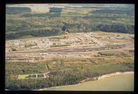
Image depicts an aerial view of the BC Rail, in Prince George, B.C. It is now known as CN Rail.
Item is an original 1968 map depicting British Columbia and its reliefs, including hills, valleys, and mountains across the province. The map was published by the British Columbia Department of Lands, Forests and Water Resources.
File consists of notes and reproductions relating to soldier land settlement in northern British Columbia following the First World War. Includes material regarding the British Columbia Land Settlement Act; the allotment of land for Prince George; and the opening of reserved lands for veterans. Includes a printed article entitled "Soldiers, Settlement and Development in British Columbia, 1915-1930" by Paul Koroscil (2000).
The photograph depicts a brown house in a forest outside of Finmoore, B.C. There is plastic pink flamingo in the yard. The photograph is taken in the autumn. Annotation on reverse side of photograph states, "Finmoore fall 2009."
The item is a photograph depicting the unveiling of the Arrival of Steel monument at 772 1st Avenue, Prince George. Bruce Anderson and Mayor John Backhouse are in front of the monument with Backhouse giving a speech.
The item is a photograph depicting the unveiling of the Arrival of Steel monument at 772 1st Avenue, Prince George. Bruce Anderson and Mayor John Backhouse are in front of the monument. A crowd is standing around the monument watching the unveiling. Tilden Truck Rentals can be seen in the background.
The item is a photograph depicting the unveiling of the Arrival of Steel monument at 772 1st Avenue, Prince George. Bruce Anderson and Mayor John Backhouse are in front of the monument. A crowd is standing around the monument watching the unveiling. Tilden Truck Rentals can be seen in the background.
Photograph depicts Buchanan Benson Real Estate and Insurance at 1276 4th Avenue.
File consists of notes relating to Buckhorn Elementary School. Also includes photographs depicting the old Buckhorn School building and the Prince George Snowmobile club building from the exterior (between 2001 and 2005).
The item is a photograph depicting the front and side of Buckhorn school in 1956. The photograph is a photograph taken of the original print.
The item is a photograph depicting the front and side of Buckhorn school in 1956. The photograph is a photograph taken of the original print. Annotation on reverse side of the photograph states, "1956."
File consists of notes, clippings, and reproductions relating to Buckwater Road. Also includes photographs depicting various areas and buildings along Buckwater Road (1990-2001).
The item is a photograph depicting the old site of Bud Lake school. Annotation on reverse side of photograph states, "Bud L. site."
The item is a photograph depicting the old site of Bud Lake school. Annotation on reverse side of photograph states, "Bud L. school site."
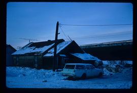
Image depicts a vehicle parked beside a small, wooden house in Upper Fraser, B.C. Map coordinates 54°07'05.7"N 121°56'38.9"W
The item is a photograph depicting a residential duplex house off the Cariboo Highway. It is one of three buildings that were relocated for the airport in 1957.
The item is a photograph depicting a residential duplex house off the Cariboo Highway. It is one of three buildings that were relocated for the airport in 1957.
The item is a photograph depicting a residential duplex house off the Cariboo Highway. It is one of three buildings that were relocated for the airport in 1957
The item is a photograph depicting a residential duplex house off the Cariboo Highway.
The item is a photograph depicting a residential duplex house off the Cariboo Highway.
The item is a photograph depicting a residential duplex house off the Cariboo Highway.
The item is a 35 mm photograph depicting a stucco duplex on the Cariboo Highway.
The item is a photograph depicting a residential duplex house off the Cariboo Highway. It is one of three buildings that were relocated for the airport in 1957.
The item is a photograph depicting a white residential house off the Cariboo Highway.
The item is a 35 mm photograph depicting a stucco duplex on the Cariboo Highway.
The item is a photograph depicting a residential duplex house off the Cariboo Highway. It is one of three buildings that were relocated for the airport in 1957.
The item is a photograph depicting a residential duplex house off the Cariboo Highway.
The item is a 35 mm photograph depicting a stucco duplex on the Cariboo Highway.
The item is a photograph depicting a residential duplex house off the Cariboo Highway.
The item is a 35 mm slide photograph depicting a residential duplex house off the Cariboo Highway. It is one of three buildings that were relocated for the airport in 1957.
The item is a 35 mm photograph depicting a stucco duplex on the Cariboo Highway.
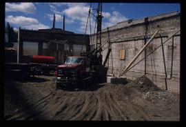
Image depicts an unknown building under construction at the corner of 6th Avenue and Dominion Street in Prince George, B.C.
Image depicts an unknown building under construction at the corner of 6th Avenue and Dominion Street in Prince George, B.C.
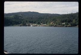
Image depicts numerous buildings and a dock on the shore of Haida Gwaii, B.C..
The photograph depicts three buildings, white, beige, and blue at the Prince George airport. Annotations on the photograph describe the buildings as, "RCMP, airport terminal building, [and] small arms building."
The photograph depicts two buildings, one beige, the other white, at the Prince George airport.
The photograph depicts three buildings, white, beige, and blue at the Prince George airport.
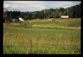
Image depicts several old buildings in a field, one of which has a caved-in roof, in Newlands, B.C. Map coordinates 54°06'28.2"N 122°12'01.0"W
