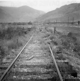
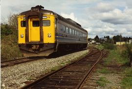
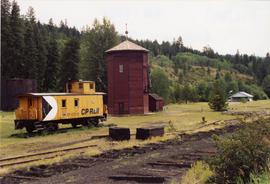
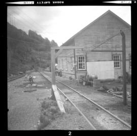
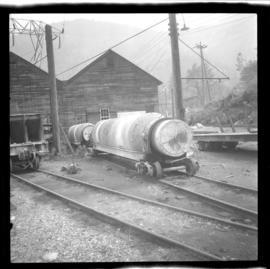
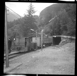
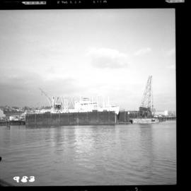
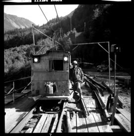
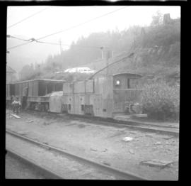
Photograph depicts a self-propelled rail barge.
Photograph depicts the Burrard Dry Dock Co. Ltd. on the North Shore in Vancouver. There is a freighter in dock #2.
Photograph depicts boat named "Burnaco."
Photograph depicts a BN snow plow in Fruitvale.
File consists of Burlington Northern Railway timetables. Includes Seattle Region timetable 10 (29 Apr. 1973) and Special Instructions no. 3 (11 June 1972). Also includes a Northern Corridor timetable No. 1 (1 Jan. 1993).
Photograph depicts disused, but perhaps not legally abandoned, track 2 miles south of Keremeos on the old Keremeos branch. The track was broken in several places and fences were also erected across its length.
Photograph depicts a disued or abandoned track 2 miles south of Keremeos. Tracks was broken at one bridge and at least one cover was as well. Fences were erected across it.
File consists of a Burlington Northern public timetables from 1970 and a ticket stub from a last trip ride.
Photograph depicts buildings of the former Vancouver-Lansdale ferry. They appeared to now be used by Kingcome Navigation Co. as well as other businesses.
Photograph depicts small buildings sited on the north side of the tracks and just west of the Mission City CPR depot. They are all in use and well cared for.
Photograph depicts a possible storage and coal shed, and toilets located on the west side of track about a quarter mile north of the McCulloch depot building. McCulloch depot is located at mile 76.6 on the Carmi Subdivision.
File consists of documentary photographs taken by David Davies of stores and service buildings in British Columbia.
File consists of documentary photographs taken by David Davies of public buildings in British Columbia.
File consists of documentary photographs taken by David Davies of log dwellings in British Columbia.
File consists of documentary photographs taken by David Davies of various houses in British Columbia.
File consists of documentary photographs taken by David Davies of hotels in British Columbia.
File consists of documentary photographs taken by David Davies of commercial and industrial buildings in British Columbia.
File consists of documentary photographs taken by David Davies of churches in British Columbia.
File consists of documentary photographs taken by David Davies of agricultural buildings in British Columbia.
File consists of documentary photographs taken by David Davies of buildings in British Columbia.
File consists of documents relating to the construction of the Pacific Great Eastern Railway (PGE), which predominantly consist of photocopy reproductions, excerpts from books, and clippings from periodicals. Includes a chronology of the history of PGE, a list of sub-contractors who completed the Squamish sub-division, "PGE/BCR: Dease Lake Extension First 25 Years, 1968 to 1993", and "P.G.E.R. 1914 to 1923: Progressive Dates of Commencement of Passenger Service".
File consists of documents relating to the construction of the Kettle Valley Railway (KVR), which predominantly consist of photocopy reproductions, excerpts from books, and clippings from periodicals. Includes a piece compiled by Davies entitled "Bread Ovens of Construction Works on the KVR c. 1913-1914".
File consists of documents relating to the construction of the Grand Trunk Pacific Railway (GTPR), which predominantly consist of photocopy reproductions, excerpts from books, and clippings from periodicals. Includes an article entitled "The Construction of the Grand Trunk Pacific Railway in British Columbia" by J.A. Lower and a transcript of a Prince George history talk given by Ted Williams. Also includes the following pieces compiled by Davies: "Building the G.T.P.R. in B.C., 1908-1914"; "Major Bridges on the GTPR"; "Construction of Grand Trunk Pacific Railway between Tete Jaune Cache and Prince George"; "Narrow Gauge Contractors Locomotives used in the Building of the Grand Trunk Pacific Railway in British Columbia"; and "Early Days of Fraser Sub of G.T.P.R.".
File consists of research material relating to the construction of other railway lines in British Columbia, which predominantly consist of photocopy reproductions, excerpts from books, and clippings from periodicals. Includes mention of the Columbia & Western Railway; the CPR connector between Kootenay Landing and Procter; construction of logging railways; the Kootenay Central Railway (CPR); sternwheelers in railway construction; the CPR south Slocan branch line; the Port Alberni branch line of the E&N Railway (CPR); the Oroville to Princeton GNR branch; the BCER Fraser Valley Interurban; and the Nelson and Fort Sheppard Railway. Also includes an article by Sanford entitled "Building CP Rail's Fording River Railway".
Photograph depicts the builder's plaque of the C.N.R. S.S. Canora.
File consists of a monograph by Geoffrey W. Taylor entitled "Builders of British Columbia: An Industrial History".
File consists of research material regarding Budd cars (rail diesel cars) and earlier self-propelled coaches, which predominantly consist of photocopy reproductions, excerpts from books, and clippings from periodicals. Includes information on car schematics; the operating history of CNR Railiners; CPR Dayliners; GNR RDC-3 Budd car; CNR 15820; the CPR 'Motor Car' of 1906; the first use of diesel traction in British Columbia; GTW Doodlebugs; KVR Budd cars; and Kamloops rail jitneys. Also includes issue no. 491 of Canadian Rail, which features articles on Budd cars in Canada.
Photograph depicts a southbound Budd car on Esquimalt & Nanaimo Railway (CPR) track.
Photograph depicts the Buckingham Apartments at 925 Cardero St.and Barclay St. in Vancouver, B.C.
Photograph depicts the Buckingham Apartments at 925 Cardero St. in Vancouver, B.C. after a snowfall. The view is looking south and depicts Barclay St. crossing in the foreground.
Photograph depicts a water tower maintained by volunteers. It moved to the present site from a concrete base near the KVR trackside.
Photograph depicts Brodie Junction on the CPR Spences Bridge to Princeton line, located at mile 65.2 from Spences Bridge. The former northbound connector of the Coquihalla line (Hope to Brodie) is in the right foreground but it's not a dead-end spur of 200 yards in length. The mainline makes an 180 degree loop at this point. The tracks in the left rear of the photo lead to Merritt. The elevation is 3025 ft.
Photograph depicts British Navy cottages (styled after cottages in the U.K.) in Esquimalt. Built when Dockyard was operated by the Imperial Navy.
File consists of a publication by Lorraine Harris entitled "British Columbia's Own Railroad".
File consists of an original 1909 provincial publication entitled "British Columbia, the Mineral Province of Canada, being a Short History of Mining in the Province, a Synopsis of the Mining Laws in force, Statistics of Mineral Production to Date, and a Brief Summary of the Progress of Mining during 1908". Includes inset plates and pull-out graphs.
File consists of two pamphlet guides to stop of interest plaques in British Columbia.
Map depicts railways in British Columbia, with insets for the Lower Mainland and the Kootenays.
Government map depicts railway lands, lands "disposed of", grazing leases, and timber berths. Shows the British Columbia 'railway belt' running from Greater Vancouver to Field, B.C.
File consists of provincial and regional maps of British Columbia relating to railways, which consist of photocopy reproductions from books and hand drawn works by Davies. Includes a series of articles by Davies published in The Sandhouse entitled: "An Interesting Tale: An Old Map is Discovered"; "Railways Around the Bottom End of Kootenay Lake"; "Railways in the Slocan Region"; "Nelson, Trail, and Thereabouts"; "Kettle Valley Railway Routing: The Theory"; "Competition, Then Compromise: The meshing of the V.V.E.R. and the K.V.R."; "Centenary of Crow's Nest Pass Railway"; and "E&N Developments on Vancouver Island".
File consists of material regarding the British Columbia Museum of Mining and the Britannia Copper Mine. Predominantly consists of tourist pamphlets, commemorative publications, photocopy reproductions, excerpts from books, and clippings from periodicals.
Series consists of material regarding the BC Electric Railway (1897-1961) and its successor, the BC Hydro Railway (1961-1989). Includes information about BCER interurbans, the Granville Island street railway, and the Nelson Electric Tramway.
Photograph depicts a dead end 100 yard tunnel beyond the ore bins in Britannia Beach. Davies notes that it was easier to tunnel than to make a track shelf.
Phoro depicts railways workshops in Britannia Beach.
Photograph depicts a railway workshop and car yard, west of the main portal of the main line in Britannia Beach. Locomotive #5 is visible.
File consists of material regarding the Britannia Copper Mine Railway. Predominantly consists of notes, correspondence, photocopy reproductions, excerpts from books, and clippings from periodicals.
Photograph depicts a mule trolley locomotive #1 that purchased in August 1975 by a demolition contractor from Calgary. It was used to remove rails from the main haulage line.
Photograph depicts two moran cars that were used for hauling ready-mixed cement.
Photograph depicts locomotive #6, built by General Electric. It used to carry 12 people half a mile into the mountain of the Britannia Copper Mine.
Photograph depicts what was believed to be locomotive #3 that was built by Jeffrey and was found on the main yard line.