Photograph of ocean liner SS Arna docked in a harbour. Foreground shows two individuals on a dock in the lower right corner and a large pile of lumber in the lower left corner. Annotation on recto reads: "S.S. Arna arrived in Prince Rupert B.C March 30th 1914"
Item is an original copy of a report to the Minister of Agriculture and Food by Moura Quayle entitled "Stakes in the Ground: Provincial Interest in the Agricultural Land Commission Act".
File consists of an oral history given by Stephanie Lode, which was gathered as part of Dr. Mike Evan's Island Cache Recovery Project. Includes consent forms, transcripts, and the recorded oral history on the original media.
File consists of notes and reproductions relating to the Stewart River townsite. Includes photographs depicting newspaper articles about the Stuart River.
File consists of notes, clippings, and reproductions relating to Stone Creek and Red Rock.
File consists of notes and reproductions relating to the Strathnaver, BC land records. Strathnaver, BC is located 42 kilometres north of Quesnel and was settled by the Duke of Sutherland.
View of the road descending to the waterfront. Buildings and forested area are visible on either side of street. Annotation on recto reads: "Prince Rupert BC. '07."
Photograph is a printed postcard depicting a wagon track between buildings situated on either side. There are mountains in the back ground. Possibly Stewart, BC.
File consists of subdivision control by-law no. 55 for the Regional District of Fraser Fort-George.
The item is a reproduction of a survey map drafted June 1912. The reproduction was likely created in 1990. The area covered is Central Fort George, South of 5th Street, East of Alden Avenue, North of 12th Street and West of Fraser Street. Annotations state, "Plan 1085 Carney Addition."
The item is a reproduction of a survey map drafted in approximately 1911 and revised in May 1914. The reproduction was likely created in 1990. The annotation states, "Plan 1391" and is circled in red ink. The area covered is along the Nechako and Fraser Rivers and Northeast of First Avenue.
The item is a reproduction of a section of survey map drafted on 18 March 1915 and revised on 23 May 1916. The reproduction was likely created in 1990. The Plan Number is 1268 and highlights the area along the Nechako and Fraser Rivers. The map details subdivisions East of Carney Street, North of Twentieth Avenue and South of Ninth Avenue. Annotations in pencil state different map scale variations and "cemetery setback."
File consists of neighbourhood planning maps for Langley, Abbotsford, Prince George, and Aldergrove. Includes housing plans in Calgary and a newspaper clipping.
Item is an original Canada Department of Agriculture Publication 1179 entitled "Suitability for Irrigation of Water from Lakes and Streams in the Southern Interior of British Columbia".
Disc contents unknown (failed migration).
File consists of a draft copy of a supplement to the Official Community Plan for the City of Prince George through the 1990's.
Photograph depicts two surveyors (Jack Lee, Gordon Wyness, or Philip Monckton) taking bearings from Pineview Station tower east of Prince George. Their surveying transit and telescope are visible in the image.
File consists of notes and reproductions relating to the Sutherland Colony in Brooks, Alberta.
File consists of notes and reproductions relating to the Sutherland Land Company created by the 4th Duke of Sutherland.
File consists of records relating to the Agricultural Land Commission symposium "Urban Development and the ALRD: 'Up Not Out'" on March 9, 1993. Gary Runka attended as a speaker with the address "Agriculture in the Urban Shadow". Includes correspondence, symposium material, agenda, a copy of Ray Spaxman's speech "Urban Form in a Sustainable Region", attendee folder, notes, and background material. Also includes Agricultural Land Commission 'Preserving our Foodlands' buttons.
File consists of a physical development plan report for the Takla Lake Band, prepared by Stanley Associates Engineering Ltd.
Photograph depicts two unidentified men standing to right of flag mounted in rock pile.
Image is one of 65 photos documenting a survey of the Canada-Alaska Boundary, Taku River area, May 23 to Oct. 15, 1906.
This particular photo is one of 13 found in original enclosure with the following handwritten annotation: "SOME OTHERS." See also items 2006.20.3.22 - 2006.20.3.34.
Photograph depicts two unidentified men standing to right of flag mounted in rock pile.
Image is one of 65 photos documenting a survey of the Canada-Alaska Boundary, Taku River area, May 23 to Oct. 15, 1906. This particular photo is one of 10 found in original enclosure with the following handwritten annotation: "From [Wahut?]-Azmuth and Koshu.” See also items 2006.20.3.47 - 2006.20.3.56.
Photograph depicts two men on either side of camera on tripod, flag visible behind them. Mountain range and glacier in background.
Image is one of 65 photos documenting a survey of the Canada-Alaska Boundary, Taku River area, May 23 to Oct. 15, 1906. This particular photo is one of 9 found in original enclosure with the following handwritten annotation: "Pictures of different members of ‘our’ party.” See also items 2006.20.3.57 - 2006.20.3.65.
Audio cassette titled "Tape 1 - Dec. 10, 1993 - 9:30-1:45 - KBR" is believed to be an audio recording of a workshop for the East Kootenay CORE project.
Audio cassette titled "Tape 2 - Dec. 10, 1993 - 1:45-5:00" is believed to be an audio recording of a workshop for the East Kootenay CORE project.
Audio cassette titled "Tape 3 - Dec. 10, 1993 - 5:00-" is believed to be an audio recording of a workshop for the East Kootenay CORE project.
Audio cassette annotated "Powers Dec. 10" is believed to be an audio recording of a workshop for the East Kootenay CORE project.
Audio cassette annotated "Tape 5 - Dec. 10, 1993 - 8:10-9:44 pm - Dr. Thomas Powers / Dec. 11, 1993 - 8:30-9:50 am" is believed to be an audio recording of a workshop for the East Kootenay CORE project.
Audio cassette titled "Tape 5: 2:45-4:05" is believed to contain a recording of a workshop related to the Vernon commonage project.
Audio cassette annotated "Tape 6 - Dec. 11, 1993 - 9:50-11:40 am" is believed to be an audio recording of a workshop for the East Kootenay CORE project.
Audio cassette titled "Tape 6: 4:05-5:10" is believed to contain a recording of a workshop related to the Vernon commonage project.
Audio cassette annotated "Tape 7 - Dec. 11, 1993 - 11:40 am-2:10 pm" is believed to be an audio recording of a workshop for the East Kootenay CORE project.
Audio cassette titled "Tape 7: 5:10-5:50" is believed to contain a recording of a workshop related to the Vernon commonage project.
Audio cassette annotated "Tape 8 - Dec. 11, 1993 - 2:10-4:15 pm" is believed to be an audio recording of a workshop for the East Kootenay CORE project.
Audio cassette annotated "Tape 9 - Dec. 11, 1993 - 4:15-5:00 pm" is believed to be an audio recording of a workshop for the East Kootenay CORE project.
This CD-ROM contains digital records collected by Gary Runka during his consultancy work for client job 650, Canoe Creek Indian Band's "Overview of Issues and Concerns Related to Transmission Line Corridor Component" project. Includes three PDF format maps prepared by AXYS Ltd. for Taseko Mines Ltd. Prosperity Project depicting "Taseko Transmission Corridor Orthophotography".
The group stands in front of an ornate stone wall and two Canadian flags.
Handwritten annotation on photograph enclosure reads: “8/6/99. Dear Lady, When I saw this photograph I knew there was a certain person who would truly appreciate and ‘feel’ its significance. Not many steps left to take now . . . . your unwavering support is never more appreciated. best personal regards, Peter”; handwritten annotation on verso reads: “Nisga’a”.
Item is an original copy of "Ten Years of Agricultural Land Preservation" the 1983 anniversary publication by the Provincial Agricultural Land Commission.
Gathering of tents in Vickersville with the harbour and mountains in the distance. Annotation on recto reads: "Vickersville Prince Rupert o/n[?] 1908."
Item is a print of a photograph of tents and newly cleared land in Prince Rupert taken between 1906 and 1908.
File consists of handwritten notes by Kent Sedgwick relating to pack saddling to Tete Jaune Cache in 1962. Also includes a photograph depicting Cecil Giscombe in Penny (May 2004).
Item is an original copy of a 1979 promotional booklet produced by the BC Agricultural Land Commission entitled "The Agricultural Land Reserve: Protecting B.C.'s Farmland". The booklet was prepared for the Provincial Agricultural Land Commission by J.M. Sawicki. Photographs by G.G. Runka.
Disc contains a single file, "GGR 2A.ppt", which is a PowerPoint presentation by Gary Runka entitled "The Agriculture Land Reserve: What it is and how it got here" created April 18, 2002.
Item is an original copy of a 1982 technical report presented to the British Columbia Utilities Commission by G.E. Cheesman and R.L. Davis of the Ministry of Environment Air Studies Branch entitled "The Agroclimate of the Peace River Valley and a Comparison with other Locations in British Columbia".
Publication is entitled "The Alaska Panhandle Boundary Dispute" by Hugh Finsten of the Research Branch, Library of Parliament.
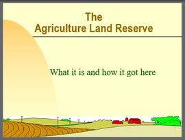
File consists of a speech given by Gary Runka entitled "The BC Agricultural Land Preservation Experience" to the Canadian Agricultural Extension Council Conference in Kelowna.
Commentary on this speech by Barry Smith of the Ministry of Agriculture and Lands:
"This speech represents a major paper that reiterates historical themes concerning the legislative initiative, B.C's very limited area available for agricultural production and the designation of the ALR plans.
GGR emphasizes that the main criteria when considering applications under the ALC Act is the soil/climate capability for agriculture. He mentions that the actual designation of the ALR and its subsequent refinement was fairly straight-forward but: "Much more difficult is the task that we are now facing, to make the right land-use decisions within the agricultural zone and encourage good land-use planning adjacent to it in order to accomplish the stated objectives."
GGR remarks that the ALC Act is based on the assumption that there are alternatives to farmland for urban uses and he personally agrees that alternatives do exist in almost all cases but he cautions: "But, the ability and willingness to go in these other directions necessitates a radical change in thinking on the part of governments, private industry, real estate interests, and the general public. It also demands an acceptance of the fact that agricultural land preservation is in British Columbia to stay and it assumes a commitment to preserve the agricultural industry as being in our own long term best interests. Some vibrations tell me we still have not quite made the grade in this area." These words were spoken by the Chair of the ALC 36 years ago and could be as appropriately be spoken by any of the subsequent ALC's Chairs to this day.
Competing land uses are listed and guidelines on expected policy content in Official Settlement Plans developed under the Municipal Act aimed at the protection of agricultural land and agriculture are noted.
Three examples are provided of studies to explore alternate areas of growth along with work on dealing with impact issues (edge/interface planning). GGR emphasizes the challenge of dealing with other governmental agencies and ends by outlining 3 general approaches to look at land needs, land uses and resource planning:
- Make land use decision based on the inherent natural characteristics rather than protecting land values or simply accommodating growth;
- The Fall 1977 amendments to the Act allowing greater Cabinet involvement will test the program but also emphasizes the importance of shared decision making; and
- The ALC Act has defined a land use priority and a direction around which all others can plan and there is a need for a national land use policy that GGR supports."
Item is an original copy of an Agricultural Land Commission promotional booklet from 1975 entitled "The B.C. Land Commission - Keeping the Options Open".