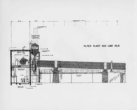
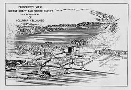
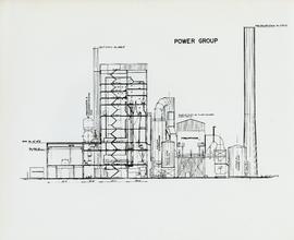
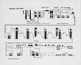
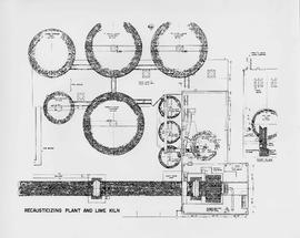
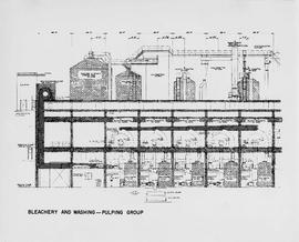
Item is a diagram of the bleachery and washing portion of the pulp mill.
Item is a map of British Columbia and is a key map showing: maps published on scale 1 inch to 2 miles and summary zones of the provincial forest inventory. Map includes index of post offices correct to October 22, 1956.
Item is a diagram of the digesters of the pulp mill.
Item is a diagram of the filter plant and lime kiln of the mill.
Item is a map showing the watersheds of Diana Lake, Rainbow Lake and Prudhomme Lake.
Item is a map that distinguishes the regions covered by Tree Farm Licence No. 1 granted to Columbia Cellulose and Three Farm Licence No. 40 granted to Skeena Kraft. Major locations indicated in this map include: Prince Rupert, Terrace, Hazelton, Smithers, Kitimat, Skeena River, and Nass River. Railway routes are also shown.
Item is a labeled diagram of the power group at a mill.
Item is a diagram showing the process through chip preparation and continuous digesting, brown stock washing, brown stock screening and cleaning, bleach plant, and bleach stock screening and cleaning.
Item is a diagram of recausticizing plant and lime kiln.
Item is a diagram of the layout of Skeena Kraft recovery and recausticizing.
Item is a map of British Columbia's Status of Sustained-Yield Forestry Programme as at 31 December 1962. The map has been annotated to show forest area surveyed by Celgar Ltd. as base for new kraft mill.
Attached description: The graph indicates how Skeena Kraft pulping characteristics compare with the burst-tear properties of other bleached kraft market pulps. In this relationship, Skeena Kraft develops the high bursting strength typical of northern Canadian krafts while retaining a distinct advantage in tearing strength.