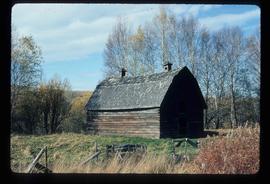
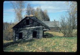
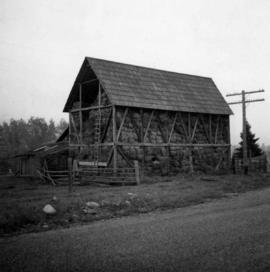
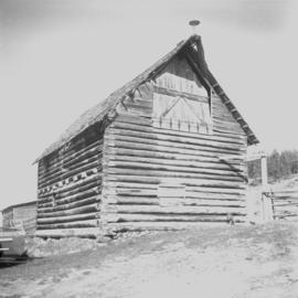
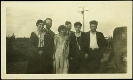
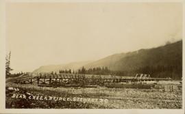
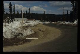
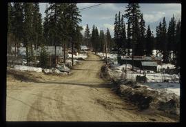
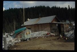
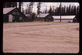
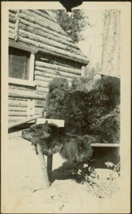
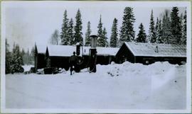
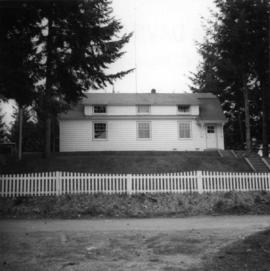
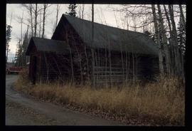
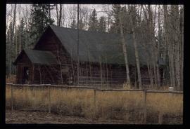
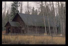
Image depicts a souvenir and gift shop for both Barkerville and Wells, B.C.
Image depicts an old barn somewhere in the Fort George Canyon Provincial Park, B.C.
Image depicts an old barn and a collapsing cabin somewhere in the Fort George Canyon Provincial Park, B.C.
Photograph depicts a barn at Darfield, near Barriere, about 35 miles north of Kamloops. The English timbered cottage developed from this architectural form.
Photograph depicts a barn of the Glenwalker Ranch. Built in 1890-1910.
Photograph depicts a barn at Lund, a village 12 miles north of Powell River. This building overlooks the harbour.
Photograph depicts a barn at Port Guichon, 1 mile west of Ladner, Delta.
Photograph depicts a barn attached to Watch Lake Lodge, a dude ranch.
Photograph depicts a barn located in Aspen Grove.
Photograph depicts a barn advertised for rent on Liverpool Rd. in South Westminster. Barn later half demolished on April 17, 1966.
Photograph depicts a barn in the Upper Fraser Valley, west of the Vedder crossing and southwest of Atchelitz.
Photograph depicts a barn located on the south side of Kokamee Creek, part of Kootenay Lake.
Handwritten photo album caption below this photo reads: "Barracks at Watson Lake". Photograph depicts three long log buildings connected in a U shape. The barracks are in a forest, surrounded with trees. The area around the building is strewn with wood debris and log piles. Dirt road in foreground.
Sans titreImage depicts a Bavarian style house at College Heights in Prince George, B.C.
Left to right: Margaret (nee Baxter) and husband Gus Lund, Bea Baxter and beau, Violet and Bob Baxter. The group stands on road wearing formal attire. Rear of car can be seen in foreground on right; power poles, log building, and unidentified structure stand in front of forest in background.
Photograph depicts the B.C. Electric Railway depot at Huntingdon and Sumas, about 20 ft from the U.S.-Canadian border. The view is looking southeast.
Photograph depicts the B.C. Electric Railway workshops at the south end of the Burrard bridge in Vancouver. The view is looking west and depicts caboose A10 in the background.
Photograph depicts the B.C. Forest Service Ranger's administration and equipment building at Pender Harbour in Sechelt, B.C.
Image depicts the BC Liquor Store in Prince George, B.C.
Photograph of a long wooden bridge spanning a river. Forest and hills are visible in the background. Printed annotation on recto reads: "#46 Bear Creek Bridge, Stewart, BC."
Image depicts some houses in Bear Lake, B.C.
Image depicts some trailers in Bear Lake, B.C.
Image depicts some houses in Bear Lake, B.C.
Image depicts some houses most likely in Bear Lake, B.C.
Image depicts some buildings along a dirt road, possibly near Bear Lake, B.C.
Image depicts a shack, possibly near Bear Lake, B.C.
Image depicts the curling club and skating rink buildings in Bear Lake, B.C.
Image depicts some houses in Bear Lake, B.C.
Photograph depicts the head and skin of a bear on display in front of log building. Trees in background.
Image depicts a log cabin in Beaverly.
Image depicts what appears to be a small ranch. The slide is labelled "Becher's Prairie," possibly meaning Becher's Prairie Provincial Park in B.C.
Photograph depicts wood building and signage, with traffic regulating beams raised on either side.
Handwritten annotation on verso reads: “Dawson Creek B.C. Bechtel Price Callahan Dispatch Office [1943]”
Image depicts a bee-hive burner beside a rail-road track at an unidentified mill somewhere in Prince George, B.C.
Image depicts a beehive burner, as well as rail road tracks, at an unknown location.
Image depicts a Beehive Burner along the Nechako on River Road. Map coordinates 53°55'34.1"N 122°44'58.0"W
Image depicts a Beehive Burner along the Nechako on River Road. Map coordinates 53°55'34.1"N 122°44'58.0"W.
Image depicts a Beehive Burner along the Nechako on River Road. Map coordinates 53°55'34.1"N 122°44'58.0"W
Photograph depicts large group of men gathered outside large building with the sign "WHITEHORSE GRILL".
Handwritten photo album caption below this photo reads: "Dawson Creek BC / 1943 Beer Ration Day".
Photograph depicts a church and unidentified building with a large fenced yard in the foreground. Annotation on verso of photograph states: "Bella Bella Church"
Item is a photograph of the beltway used to carry aggregate to the Dam site.
Glassey stands among plants to right of house, trees in background.
Group of eleven men and women stands and sits in front of log building. Woman on far left holds infant, Glassey stands on far right. Similar group also featured in items 2009.5.2.274 - 2009.5.2.294.
Handwritten caption beside this photo reads: "Bert and Kitchen Staff". Photograph depicts Bert (Youngstrom?) standing close to a woman and young girl on snow in front of unidentified buildings. Forest trees can be seen in background. It is believed that this photo was taken at the camp in Summit Lake, B.C. (see item 2005.3.57).
Photograph depicts Bert Youngstrom leaning on one of two gas pumps in front of three long buildings. Trees can be seen in background, as well as snow all around. Steel drums an other miscellaneous material surround the buildings. Handwritten captions above and beside this photo read: "Bert Youngstrom" "Shop & Warehouse".
Rev. William Edwin Collison stands to left of wife Bertha who sits on front steps of large shingled home, flower pots in background (oldest son of of Archdeacon W.H. Collison).
Handwritten annotation on verso reads: "Dad & Mother Prince Rupert".
The pair sits on ground beside large totem pole, Bertha on left (wife of W.E. Collison). Log fence can be seen in front of forest in right background.
Handwritten annotation on verso reads: “Mother & Josie Edenshaw at Massett".
Bertha Collison stands on lawn in front of house (wife of Rev. W.E. Collison).
Handwritten annotation on verso reads: "Mother / Prince Rupert".