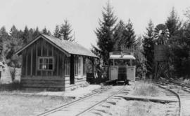
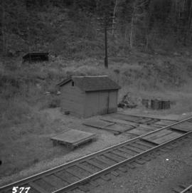
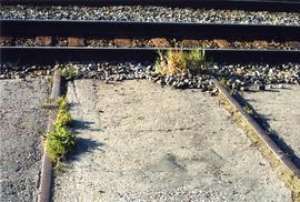
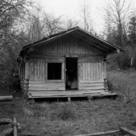
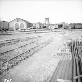
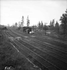
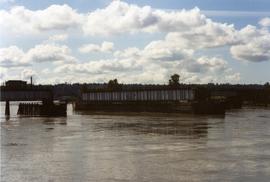
Photograph depicts railway track previously owned by BCER. It led onto the east end of Lulu Island and then to Annacis Island. Looking from the Naew West River Walk to the Queensborough bridge that was protected by signals and had a high chain link fence to deter pedestrians. It was likely that the rail was only used at night. Originally built by Canadian Northern Railway to reach Steveston, circa 1917.
Photograph depicts a railcar and possible shed or depot. Location and details unknown.
File consists of documentary photographs taken by David Davies of railway maintenance of way buildings in British Columbia.
Photograph depicts an RCAF Langer that was erected in 1942 as part of a flying boat base to counter possible Japanese sea and activities. It was used subsequently as whaling station premises.
Photograph depicts a replacement rail bridge. Forms sat on a temporary pile of dirt, which in turns sat on a road bed of a new highway that had just been cut.
Photograph depicts a Roman Catholic church, "Our Lady of Lourdes," on the First Nations reservation, Sechelt Village. It was built in 1907 and is now closed, but the heavy bell is still in position in the belfry.
Photograph depicts a bell tower of a Roman Catholic church in the Saanich Peninsula.
Photograph depicts Royal Oak Apartments on Kingsway in Burnaby.
Photograph depicts a Ruston steam roller owned by Gary Wellburn in Duncan, BC
Photograph depicts a completely rebuilt saloon that was done so based on historical sketches and photos.
Photograph depicts "Salt Spring Island Trading Company Ltd." store.
Photograph depicts a one roomed school that was seemingly still in use.
Photograph depicts a school room or church on the road between Louis Creek and Adams Lake.
Photograph depicts the schoolhouse of Chinatown in Nanaimo, B.C. It is the only surviving building; the others were destroyed by a fire.
Photograph depicts a CPR section bunk house in Midway. On the left was a living room with two windows, stove, and sink. Bedroom with one window and two beds located on the right.
Photograph depicts the side view of an abandoned section house in Wasa, on the CPR Windermere Subdivision.
Photograph depicts an abandoned section in Wasa, on the CPR Windermere Subdivision. Built in 1914-20. Very rare at this date. The only known of the same type was in Brookmere (private and lived in).
Photograph depicts a section shanty at the CPR McCulloch depot located at mile 76.6 on the Carmi Subdivision. The rail here is Canada Algoma, 85 lbs. and dated to 1940. The view is looking southeast, with Hydraulic Lake in the background.
Photograph depicts a typical section shed scene anywhere in B.C. It was taken on the C.P.R. track near Flat Creek or Illecillewaet, between Rogers Pass and Revelstoke. The April 25, 1965 CPR Employee timetable lists the mileage at Illecillewaet as 98.2.
Photograph depicts typical 'set on' rails for speeders that were often made of wood.
Photograph depicts a settler's log cabin, about 1 mile from the main road of Sechelt Peninsula and on the side road leading to Gordon Bay, at a point where a small stream cease to be tidal. Vertical cracks in logs stuffed with rags and horizontal cracks filled with cement.
Photograph depicts sheds and repair center of the C.P.R. at Victoria, near Lime Bay. The rail-liner just came in from the daily run to Courtenay.
Photograph depicts a shop on the north side of Main St. in Cumberland on Vancouver, Island.
Photograph depicts Simon Fraser University in Burnaby, B.C., 1 week after the official opening.
Photograph depicts Simon Fraser University in Burnaby, B.C., one week after the official opening.
Photograph depicts Simon Fraser University in Burnaby, B.C. The view is looking northeast towards the northwest corner of the Academic Quadrangle.
Photograph depicts Simon Fraser University in Burnaby, B.C. The view is looking northwest from the science complex towards the gymnasium.
Photograph depicts Simon Fraser University in Burnaby, B.C. The view is looking southwest from the mall towards the gym and sports arena.
Photograph depicts Simon Fraser University in Burnaby, B.C. The view is looking east towards the nearly completed water tower from the west inner face of the Academic Quadrangle.
Photograph depicts Sirdar station belonging to the C.P.R. It is at the south end of Kootenay Lake and 11 miles north of Creston. There is a little used turntable behind the depot. The view is looking south.
Photograph depicts the site of a former C.P.R. connection between the mainline into Vancouver and False Creek yards at West Pender St. In Vancouver. The rails are not used but still appear in the street and on the parking lot on the far side. Another parallel set of tracks 30 yards to the east are in daily use.
Photograph depicts "Six Mile House Stable" on the west side of Okanagan Lake.
Photograph depicts the Silver Ledge Hotel, Ainsworth Hot Springs, on the west side of Kootenay Lake, north of Nelson.
Photograph depicts the sluice gates off the Nicola River, on a ranch at Nicola village, 7 miles northeast of Merritt.
Photograph depicts a small barn that had just been built within the last 12 months.
Photograph depicts the interior of a snow shed at about mile 29.0 using CPR mileages commencing at Brookmere, which is 4 miles east of Brookmere. It is on the ex CPR Coquihalla Line from Hope to Brodie Junction.
Photograph depicts St. Anne's log church on French Creek, near Parksville on Vancouver Island. The church was built in 1894 and was still in use at the time.
Photograph depicts St. Ann's Academy, a girls boarding school. In the distance, a graceful spire marks the highest point of the building.
Photograph depicts St. Ann's Academy, a girls boarding school that was close to the centre of Victoria. In the corner of the property, nuns had established the first school in B.C. in 1853.
Photograph depicts St. Ann's Academy, a girls boarding school that was close to the centre of Victoria. Captured the front of the main building.
Photograph depicts the St. Helen's Anglican Church on Old Yale Rd. (overlooking the Patullo Bridge) in South Westminster, Surrey.
Photograph depicts St. Hilda's Anglican Church in Sechelt on the Sechelt Peninsula. Tall tree on left just coming into flower is a dogwood.
Photograph depicts St. John the Divine church, built in 1914 at Hubert which is now a ghost town. Moved to this location in the open country in 1928.
Photograph depicts St. Margaret's Anglican Church on Bradner Rd., 3 miles northeast of Aldergrove in the Fraser Valley.
Photograph depicts St. Paul's Anglican Church in Powell River. The church was built in 1955.
Photograph depicts a 120 ft. stack of the former B.C. Copper Company in Anaconda, on the outskirts of Greenwood. It was built sometime between 1903 and 1909 and replaced a steel stack built on 1900, immediately below it.
Photograph depicts Stave Falls School, a type of rural school that was falling into disuse. This one was still in use and cared for.
Photograph depicts a stone house on 17th St. and Esquimalt St. in West Vancouver, B.C.
Photograph depicts the only store in the small, derelict village of about 12-15 houses of which only one is occupied.
Photograph depicts a store 50 yards south of the B.C. Electric Railway on the west side of the Vedder crossing road in Sardis, Chilliwack, B.C.