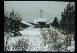
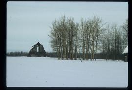
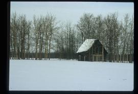
Image depicts Pineview on Buckhorn Lake Road, Prince George, B.C.
Prince George, BC
356 Archival description results for Prince George, BC
Image depicts Pineview on Buckhorn Lake Road, Prince George, B.C.
Image depicts Pineview on Buckhorn Lake Road, Prince George, B.C.
Photographs within this file document natural and artificial features across the landscape of Northern British Columbia. This landscape also includes the physical, built, urban and industrial landscapes; topography; site plans; boundaries, districts, reserves, parks, sanctuaries, towns, villages and cities, etc.
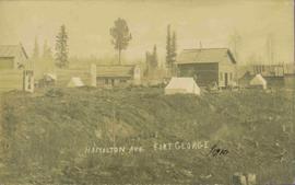
View of 5 buildings and 4 tents on land that has been cleared to stumps. Printed annotation on verso reads: “HAMILTON AVE. FORT GEORGE”, added handwritten annotation in ink reads: “1910”.
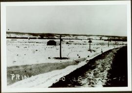
Railroad track, utility poles, field, small building and background hills are visible in image.
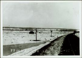
Unidentified man can be seen walking on railroad tracks on far right. Utility poles, field, small building and background hills are visible in image.
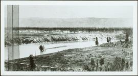
Photograph depicts landscape with cleared land in foreground, river in middle, building and trees in background.
Handwritten annotation on verso: "Central Fort George 1911".
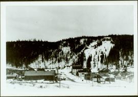
Winter scene with buildings, street, and utility poles. Hill in background.
Handwritten annotation on verso: “South Ft. George 1912”.
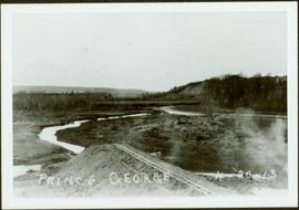
Early spring landscape with roadbed and track in foreground, river in midground, and hill in background.
Handwritten annotation on recto: “PRINCE GEORGE 4-20-13”.
File consists of photocopied material regarding the Aleza Lake Experimental Station from BC Archives.
File consists of photocopied material regarding the Aleza Lake Experimental Station from BC Archives.
File consists of photocopied material regarding the Aleza Lake Experimental Station from BC Archives.
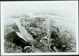
Aerial view of Prince George featuring roadways and the confluence of the Fraser and Nechako rivers.
Annotation on verso: “Prince George from air 1936”.
Subseries consists of materials collected by Kent Sedgwick for research on the geography and natural resources in Prince George and its region. Includes material on the natural resource industry, including the opening of the McArthur Sawmill, the W. Lamb and Sons Lumber Sawmill, and mining; photocopied aerial photographs of Prince George; the climate, temperatures, and flooding; and the geographical features of Prince George.
File consists of photocopied material regarding the Aleza Lake Experimental Station from BC Archives.
This Prize List, which was published by the Prince George Agricultural and Industrial Association incorporated with Prince George Horticultural Society, outlines the August 1943 Fall Fair rules and regulations, the prizes to be awarded; as well as a list of prize donors.
File consists of photocopied material regarding the Aleza Lake Experimental Station from the Canadian Forest Service Archives in Victoria. Also includes handwritten notes.
Series consists of publications created by those associated with the Aleza Lake Research Forest as well as the Aleza Lake Research Forest Society itself. Includes various clippings and articles from serial publications such as newspapers and newsletters that focus on the ALRF. Also includes publications that served as reference material on topics relevant to the ALRF.
File contains an original EP 433 report entitled "A Preliminary Working Plan for the Aleza Lake Experimental Forest" by L. DeGrace of the BC Forest Service.
File contains an original copy of a BC Forest Service publication entitled "The Development of the Spruce-Balsam Type in the Aleza Lake Experimental Forest" by A.R. Fraser and J.L. Alexander.
File consists of photocopied material regarding the Aleza Lake Experimental Station from BC Archives.
File consists of photocopied material regarding the Aleza Lake Experimental Station from BC Archives.
File consists of photocopied material regarding the Aleza Lake Experimental Station from BC Archives.
File contains an original report entitled "An Appraisal of Logging Practices in the Naver Forest" by D. Burbidge of the BC Forest Service.
File contains an original BC Forest Service report for E.P. 443 by S. Benteli entitled "Marking of Douglas Fir: A Preliminary Investigation of the Problems, Restricted to Interior Dry Types and the Cariboo".
File consists of photocopied material regarding the Aleza Lake Experimental Station from BC Archives.
File contains an original "Do's and Don't's When Marking Stands For Cutting" booklet illustrated by J. Pickford.
Series consists of photographs created or accumulated by the Aleza Lake Research Forest Society.
File contains a photocopied version of "Tree Farm Licence No. 29 - Eagle Lake Sawmills Ltd. Cutting Permit Application No. 7". Although this item is not related to the Aleza Lake Research Forest, it is relevant to forest history in the Prince George area and therefore retained by the Society.
Photographs are panoramas taken from the Churchill BC Forest Service Lookout, located at latitude 54°04' and longitude 122°16'. The photographs were bound together and include a transparent grid that was intended to be used for locating forest fires.
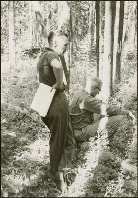
Item is a photograph of Ray Williston and John Liersch in a small wood area southwest of Prince George.
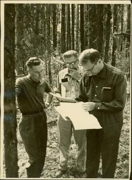
Item is a photograph of Mr. Williston, Chief Forester John Stokes and Tom Wright of Canadian Forest Products examining an area near Prince George in order to determine the timber area required for a Pulp Harvesting License for a proposed pulp mill that would depend completely on waste wood.
File consists of photocopied material regarding the Aleza Lake Experimental Station from BC Archives.
Slide depicts a black bear eating garbage by wooden outbuildings, possibly at the Aleza Lake Experiment Station.
Slide depicts a detonation in an area of cleared ground in a forested area, likely the Aleza Lake Experiment Station. Work may have been undertaken for roadbuilding activities at the Experiment Station.
Slide depicts a cleared area at the Aleza Lake Experiment Station with plant regeneration.
Slide depicts a heavily forested area with fallen logs, likely at the Aleza Lake Experiment Station.
Slide depicts the original wooden BC Forest Service sign for the Aleza Lake Forest Experiment Station.
Slide depicts a burning building at the Aleza Lake Experiment Station on the date it was shut down by the BC Forest Service.
Slide depicts a view of what is possibly the Upper Fraser River.
Slide depicts the Ranger Station at the Aleza Lake Experiment Station.
File consists of photocopied material regarding the Aleza Lake Experimental Station from BC Archives.
Slide depicts a man operating heavy equipment in a forest, likely at the Aleza Lake Experiment Station.
Slide depicts a sawmill in operation, likely located in the Upper Fraser area, with a pile of burning wood products and a beehive burner.
Slide depicts a bulldozer clearing ground, likely at the Aleza Lake Experiment Station.
Slide depicts a cleared area in a forest, likely at the Aleza Lake Experiment Station.
Slide depicts cleared ground and felled trees in a forested area, likely at the Aleza Lake Experiment Station.
Large-format map depicts the Monkman Public Sustained Yield Unit (PSYU) and Tree Farm Licence 30 east of Prince George.
