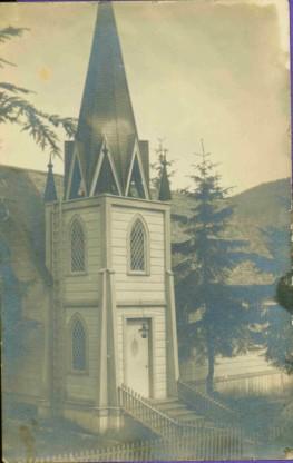
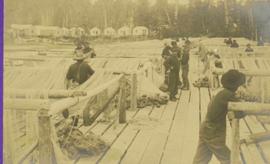
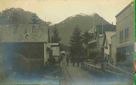
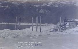
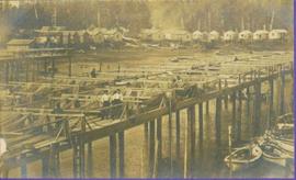
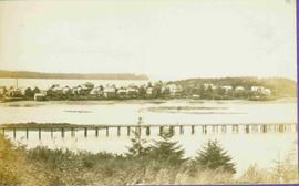
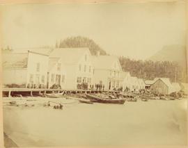
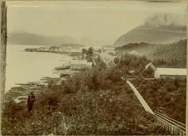
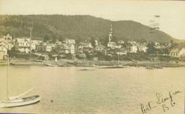
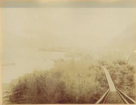
Port Essington, BC

Elements area

Taxonomy

Code

Scope note(s)

    Source note(s)

      Display note(s)

        Hierarchical terms

        Port Essington, BC

          Equivalent terms

          Port Essington, BC

            Associated terms

            Port Essington, BC

              21 Archival description results for Port Essington, BC

              2011.3.1.02 · Item · [ca. 1905]
              Part of North Coast & Central BC Postcard Collection

              View of building, dock, harbour and small islands with snow peaked mountains in background. Printed caption on verso reads: “Port Essington B.C. Photo by P. E. Fisher”. Handwritten annotation in ink on verso reads: “up the Skeena”, in pencil on verso: “Port Essington, North Coast Commercial Coy”.

              2006.45 · Fonds · [ca. 1897]

              Contains photographs generally depicting landscapes, water scenes, and views of towns on British Columbia's north coast. Includes images featuring sternwheelers and other boats, canneries, fisheries, and individuals. Locations depicted include Port Essington and Port Simpson (Lax Kw’alaams) in BC, Fort Wrangell in Alaska, and other unknown towns. Includes one photograph of a man named Max Lohbrunner, and many other images depicting unidentified individuals.

              2011.3.1.06 · Item · [ca. 1905]
              Part of North Coast & Central BC Postcard Collection

              View of peninsula with houses and trees. Dock in mid ground, trees and grasses in foreground. Recto stamped “Port Simpson DE 17" and "Port Essington DE 18". Handwritten annotation on recto of photograph: "W. J. O'Neill Esq. Telegraph Point Via Pt. Essington B.C. Don't you think this pretty [Weggs & Mr. Byron?] was over last night - said he saw you and [Halie?]. Yours - BaBa".

              Photographs
              2009.7.1 · Series · [ca. 1873 - ca. 1939]
              Part of Archdeacon W. H. Collison fonds

              Series consists of images pertaining the Collison family, North Coastal First Nations communities, means of transportation along North Coastal British Columbia, and various church structures and religious events.

              Plan of Port Essington
              2002.5.2 · Item · 28 September 1926
              Part of NBCA Document and Ephemera Collection

              Plan of Port Essington consists of an architectural plan for the townsite of Port Essington compiled from plans in Land Registry and described as Composite Plan 537 (originally deposited October 17th 1893). Depicts Skeena River, Hocsal River, individual lots and streets, the B.C. Fishing and Packing Co. Ltd., a graveyard, and the Anglo British Columbia Packing Co.

              Port Essington, BC
              2002.5.3 · Item · March 1986
              Part of NBCA Document and Ephemera Collection

              Consists of a black & white copy of an artwork depicting a street of Port Essington. Two identifiable buildings along the street are the Hotel Essington and a church.

              2006.45.11 · Item · [ca. 1897]
              Part of Historical North Coast Photograph Album

              Shops stand along riverside boardwalk. Storefront sign for R. Cunningham & Sons visible. Many people stand and sit on boardwalk, and canoes and small boats float in water in foreground.

              Handwritten photo captions beside image read: "R. Cunningham & Sons - Probably Port Essington", "NW coast canoe".

              2009.21 · Collection · 1932-1946

              Subject areas identified in this collection include: church and hospital buildings (including nurses quarters); group photos featuring doctors, nurses, and hospital workers; grave markers; landscapes; processing of oolichan fish; and various church-related events such as weddings and church openings.

              Thomas Crosby Mission Ships
              2009.7.1.066 · Item · [ca. 1873 - ca. 1920]
              Part of Archdeacon W. H. Collison fonds

              Photograph depicts buildings along shore; bridge and boardwalk cross forest in right foreground. Hills visible in distance.

              Handwritten annotation below image reads: "Port Essington from bridge"; on verso: "Heading or full page Illustration Chapter XXIII No2".