Natural Resources

Elements area

Taxonomy

Code

Scope note(s)

  • Land, water, minerals, forests, fisheries, soil, oil, and gas
  • Energy (eg. hydroelectric, thermal, solar)
  • Game management
  • Individuals, industries, and businesses related to natural resources
  • Regulatory and professional organizations
  • SEE ALSO: Business and Commerce; Environment; Industries; Land, Settlement and Immigration

Source note(s)

  • MemoryBC Subject Groups

Display note(s)

    Hierarchical terms

    Natural Resources

      Equivalent terms

      Natural Resources

        Associated terms

        Natural Resources

          6040 Archival description results for Natural Resources

          6040 results directly related Exclude narrower terms
          2023.2.1.04 · File · 1994-2005
          Part of Dr. Paul Sanborn fonds

          File consists of proceedings and abstracts for conferences and workshops attended by Paul Sanborn.

          Includes the following items:

          Alloway, B.V., D.G. Froese, and J.A. Westgate (eds.) 2005. Proceedings of the International Field Conference and Workshop on Tephrochronology & Volcanism: Dawson City, Yukon Territory, Canada, July 31st – August 8th, 2005.

          BC Forestry Continuing Studies Network. 1994. Workshop proceedings: Grasses and legumes in forestry - A forum for discussing the economic and ecological costs and benefits of using grass and legume species in all phases of northern forest management. Prince George, BC: April 6-7, 1994.

          Canadian Quaternary Association. 2001. Canadian Quaternary Association Meetings, 2001: Program and Abstracts. Occasional Paper in Earth Sciences No. 1. Heritage Branch, Government of the Yukon. http://emrlibrary.gov.yk.ca/Tourism/canadian-quaternary-association-meetings-program-and-abstracts-2001.pdf

          Enhanced Forest Management Pilot Project. 2000. Proceedings of the March 30-31 Information Session. Robson Valley Forest District. [9 extended abstracts & full articles]

          Society for Ecological Restoration. 1995. Taking a broader view: 1995 international conference. September 14-16, 1995. University of Washington, Seattle WA, USA. [program & abstracts]

          2023.2.1.01 · File · 1981-2001
          Part of Dr. Paul Sanborn fonds

          Research on the ecological functions of coarse woody debris (CWD) in forests, and techniques for inventorying CWD, were major topics for forest ecologists and soil scientists during Paul Sanborn's years with BC Forest Service research program (1991-2002).

          File of documents consists mostly of unpublished internal and consultant reports, workshop summaries & handouts, and government publications (BC, Canada, USA). Methods-related documents may have been drafts which were superseded later by published manuals. In some cases, the document has a memo or email attached which provides some additional context.

          Includes the following items:

          BIOFOR Resource Consultants. (n.d.) Methodology for developing coarse woody debris photo guides. [consultant report to Ministry of Forests, Research Branch]

          Brown, J.K., T.E. See. 1981. Downed dead woody fuel and biomass in the northern Rocky Mountains. General Technical Report INT-117. USDA Forest Service.

          Clark, D.F., P.J. Burton, J.A. Antos. 1995. A comparative study employing different methods for inventory of coarse woody debris. Symbios Research and Restoration, Smithers, BC. September 30, 1995.

          Ellis, R. 1996. Summary of the coarse woody debris workshop, Cowichan Lake Research Station, April 11-12, 1996. [Incl. handouts by A. Mackinnon, S.W. Taylor & J.V. Parminter]

          Ember Research Services Ltd. 1997. CWD/Fuel calculator user’s guide. October 1997.

          Hermanek, H. 2001. The distribution and description of CWD in the SBSmk1 and IDFdm2 zones of British Columbia. Work term report, Biology Co-op Program, University of Victoria.

          Lajzerowicz, C. 2000. Coarse woody debris: what are we leaving in British Columbia. Examining TRENDS. ET2000-02. Northern Interior Vegetation Management Association.

          Lajzerowicz, C. 2000. Coarse woody debris: what are the changes following harvesting in Alberta. Examining TRENDS. ET2000-03. Northern Interior Vegetation Management Association.

          Lloyd, R. 2001. A comparison of coarse woody debris in harvested and unharvested sites in the SBSmc2: First-year report, March 2001. Prepared for: Houston Forest Products.

          Mackinnon, A. 1996. What kind of CWD measurements are MOF research ecologists using? [handout at CWD Workshop, April 11-12, 1996]

          Mackinnon, A., J. Parminter. 1996. Natural landscape patterns and processes. Notes from a meeting at Cowichan Lake Research Station, April 10, 1996.

          Marshall, P.L. 1999. Using line intersect sampling to determine the volume of odd-shaped pieces of coarse woody debris: an explanation of the Vegetation Resources Inventory formula. Contract report to: Ministry of Forest, Vancouver Region. February 1999.

          Marshall, P.L., G. Davis, V.M. LeMay. 2000. Using line intersect sampling for coarse woody debris. Forest Research Technical Report, TR-003. Vancouver Forest Region.

          Ministry of Forests, Resources Inventory Branch 1999. Pilot study for dead tree information on growth and yield permanent sample plots.

          Parminter, J. 1994. Correction factors and the measurement of coarse woody debris. Research Branch, Ministry of Forests. March 11, 1994.

          Parminter, J. 2001. Natural disturbance research and project summaries. Cowichan Lake Research Station meeting, April 10, 1996.

          Parminter, J. 2001. Procedures for measuring CWD volume in spot accumulations, landing piles and strip accumulations.

          Parminter, J. 2001. CWD extensive pilot program – sampling of CWD in cutblocks.

          Robson Valley Enhanced Forest Management Pilot Project. 2001. Field data collection protocol manual: coarse woody debris survey 2001. [attached covering email from B. Rogers]

          Rogers, B. 2001. Robson Valley Enhanced Forest Management Pilot Project, Coarse Woody Debris Assessment Phase I: Working Plan 2001. Prepared for: Ministry of Environment, Lands and Parks. March 3, 2001.

          Snag Protocol Team. 2000. Northern region snag management protocol: January 2000. USDA Forest Service, Northern Region.

          Taylor, S.W., J.V. Parminter. 1996. Effects of broadcast burning on coarse woody debris in British Columbia. [handout at CWD Workshop, April 11-12, 1996]

          Graham, R.T. et al. 1994. Managing coarse woody debris in forests of the Rocky Mountains. Research Paper INT-RP-477. Intermountain Research Station, USDA Forest Service. Available online at: https://www.fs.usda.gov/research/treesearch/24829 (accessed March 2023)

          Harmon, M.E., J. Sexton. 1996. Guidelines for measurements of woody debris in forest ecosystems. Publ. No. 20. U.S. LTER Network Office. Available online at: https://andrewsforest.oregonstate.edu/pubs/webdocs/reports/detritus/publications/Guidelines%20for%20Measurements%20of%20Woody%20Detritus%20in%20Forest%20Ecosystems.pdf (accessed March 2023)

          Rogers, B. 2002. Robson Valley Enhanced Forest Management Pilot Project, Coarse Woody Debris Assessment Phase III: Final Report. Prepared for: Ministry of Environment, Lands and Parks. Available online at: https://www.env.gov.bc.ca/omineca/documents/cwd_2002_reportf.pdf (accessed March 2023)

          Stevenson, Susan K. (March 1999). Biodiversity assessments at silvicultural systems sites, summer 1998. Prepared for: Prince George Forest Region, BC Ministry of Forests, Prince George BC. 16 p. + 16 p. graphs

          Taylor, S.W. 1997. A field estimation procedure for downed coarse woody debris. Technology Transfer Notes. No. 2, August, 1997. Available online at: https://publications.gc.ca/site/eng/409169/publication.html (accessed March 2023)
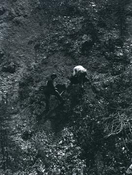
          2023.2.2.11.2 · File · 1995-1997
          Part of Dr. Paul Sanborn fonds

          This 3.5" floppy contains the following EP 1148 .TXT data sets from 1995-1997:

          • sbsapc.txt "Long-term soil productivity study, Sub-Boreal Spruce" Intact soil cores
          • sbsbd.txt "Long-term soil productivity study, Sub-Boreal Spruce" Bulk density mineral soil 0-20cm
          • sbsffc.txt "Long-term Soil Productivity Study, Sub-boreal Spruce" SBS forest floor bulk density and mass3
          • sbsfc.txt "Long-term Soil Productivity Study, Sub-boreal spruce" SBS forest floor chemistry
          • sbsmc.txt "Long-term Soil Productivity Study, Sub-boreal Spruce sites" SBS mineral soil chemistry
          • sbskgff.txt "Long-term soil productivity study, Sub-boreal spruce zone" SBS forest floor nutrient mass in kg/ha
          • sbskgmm.txt "Long-term soil productivity study, Sub-boreal spruce" SBS mineral nutrient mass in kg/ha
          • sbsom.txt "Long-term Soil Productivity Study, SBS" "SBS bole-only treatment, slash levels"
          • sbscr.txt "Long-term soil productivity study, Sub-boreal spruce zone" Timber cruise of initial stands
          • sbshtcr.txt "Long-term soil productivity study, SBS" Age vs height curves - pretreatment data (mature stand)
          • sbssi.txt "Long-term soil productivity study, Sub-Boreal Spruce zone" Carmean estimates of site indices for initial stand
          • sbstr.txt "Long-term soil productivity study, Sub-Boreal Spruce" Tree measurements
          2023.2.2.11.1 · Item · 1996
          Part of Dr. Paul Sanborn fonds

          The BC Ministry of Forest's EP 1148 Long-term Soil Productivity (LTSP) study addresses two key factors— soil porosity and site organic matter—that potentially limit tree growth and site productivity in the timber-harvesting land base and that can be affected by forestry operations.

          This establishment report for EP 1148, "The effects of soil compaction and organic matter retention on long-term soil productivity in British Columbia (Experimental Project 1148)", is accompanied by a floppy disk containing 12 data sets (see 2023.2.2.11.2).

          2023.2.2.11 · Subseries · 1995-1997
          Part of Dr. Paul Sanborn fonds

          The BC Ministry of Forest's EP 1148 Long-term Soil Productivity (LTSP) study addresses two key factors— soil porosity and site organic matter—that potentially limit tree growth and site productivity in the timber-harvesting land base and that can be affected by forestry operations.

          Grasslands documents
          2023.2.1.06 · File · 2001-2008
          Part of Dr. Paul Sanborn fonds

          File consists of reports and documents relating to British Columbia grasslands.

          Includes the following items:

          B.A. Blackwell & Associates Ltd. 2007. Cariboo-Chilcotin ecosystem restoration plan: grassland benchmark.

          Cariboo-Chilcotin Grasslands Strategy Working Group. 2001. Cariboo-Chilcotin grasslands strategy: forest encroachment onto grasslands and establishment of a grassland benchmark area. Prepared for Cariboo-Mid Coast Interagency Management Committee.

          Grasslands Conservation Council of British Columbia. 2003. Changes in the grassland-forest interface: A BC grasslands conservation risk assessment communication tool.

          Ross, T.J. 2008. Becher Prairie range unit ecosystem restoration strategic plan. Prepared for British Columbia Ministry of Forests and Range Central Cariboo Forest District.

          Soil conservation documents
          2023.2.1.02 · File · 1990-2009
          Part of Dr. Paul Sanborn fonds

          File of documents consist of a mixture of internal government reports, including reports prepared by consultants, superseded manuals, and training manuals. Most deal with soil conservation in forestry settings, but there is a report on soil conservation in relation to agricultural soils which Paul Sanborn did under contract to Agriculture Canada in 1991.

          Includes the following items:

          Cuthbert, John. 1991. Why the concern about soil degradation in British Columbia? An address by John Cuthbert, Chief Forester, Ministry of Forests to be delivered by Lois Dellert, Acting Assistant Chief Forester to the 1991 Logging Seminar, October 1991. Prince George, B.C.

          J. Hunt & Associates Inc. 1998. Soil compaction and disturbance: status of forestry research and operational trials in British Columbia. Prepared for Lorne Bedford, British Columbia Ministry of Forests, Forest Practices Branch, March 1998.

          Ministry of Forests (n.d. – probably ca. 1990). Soil conservation guidelines for timber harvesting: interior British Columbia.

          Ministry of Forests. 1994. Interim soil conservation guidelines for mechanical site preparation: interior British Columbia.

          Ministry of Forests (n.d. – probably ca. 1993-95). [excerpt: internal report on soil physical properties in relation to soil disturbance at research site near 70 Mile House, B.C.]

          Ministry of Forests. 1996. Audit level soil conservation survey course.

          Ministry of Forests. 2002. Forest soil conservation and rehabilitation in British Columbia: opportunities, challenges, and techniques … with examples from recent research. Forest Science Program. March 2002. Available online at https://www.for.gov.bc.ca/hfd/pubs/docs/bro/bro70.pdf (accessed 2023)

          Ministry of Forests. 2005. Protocol for soil resource stewardship monitoring: cutblock level. Version 1.0.

          Ministry of Forests. 2005. Protocol for soil resource stewardship monitoring: cutblock level. Version 1.0. [Superseded version]

          Ministry of Forests. 2009. Protocol for soil resource stewardship monitoring: cutblock level. Version 5.0. [Current version as of March 2023; available from: https://www2.gov.bc.ca/assets/gov/farming-natural-resources-and-industry/forestry/frep/frep-docs/indicators-soils-protocol.pdf]

          Rollerson, T.P. (n.d.) Windthrow study, Queen Charlotte Woodlands Division. Prepared for: Queen Charlotte Woodlands Division. Land Use Planning Advisory Team, Woodland Services, Macmillan Bloedel Limited, Nanaimo, BC.

          Sanborn, P. 1991. An evaluation of soil conservation under three tillage systems for the Peace River region of British Columbia: soil physical properties. ARDSA Project 23011. Submitted to: Agriculture Canada, Vancouver, B.C. [Unpublished report; cited by: van Vliet, L. J. P., Kline, R. and Hall, J. W. 1993. Effects of three tillage treatments on seasonal runoff and soil loss in the Peace River region. Can. J. Soil Sci. 73: 469-480. https://cdnsciencepub.com/doi/abs/10.4141/cjss93-048 ]

          Schwab, J.W. 1993. Interim terrain and slope stability mapping standards, Prince Rupert Forest Region. B.C. Forest Service, Prince Rupert Forest Region.

          Thompson, S. 1991. Provincial soil disturbance summary: 1989-1990 results. Prepared for: B.C. Ministry of Forests, Forest Site Degradation and Rehabilitation Committee. Frontline Forest Research, Nelson, B.C.

          Thompson, S. 1999. Evaluation of surface erosion on forest roads: a summary of 1st year sampling results. Submitted to Peter Jordan, Ministry of Forests, Nelson Forest Region. January 1999.

          Thompson, S.R., P.M. Osberg. 1992. Soil disturbance after logging in British Columbia, 1991 results. Prepared for: Ministry of Forests, Research Branch, May 1992.

          Watt, B. (n.d.) Soil disturbance after logging on 11 sites in the Cariboo Forest Region, 1993. Prepared for: Timber Section, Cariboo Forest Region.

          Field trip guidebooks
          2023.2.1.03 · File · 1987-2016
          Part of Dr. Paul Sanborn fonds

          File consists of guidebooks for trips – both in Canada and international – that Paul Sanborn attended. Also includes guidebooks that were given to him by colleagues. Most of these guidebooks relate to soil science, but some deal with Quaternary and bedrock geology.

          Includes the following items:

          4th International Workshop on Disturbance Dynamics in the Boreal Forest. 2002. A Naturally Disturbing Tour of the Central Interior of British Columbia. August 12, 2002.

          18th Biennial Meeting of the American Quaternary Association. 2004. Guidebook for Field Trips. Compiled by Rolfe D. Mandel. June 25, 28-30, 2004.

          19th World Congress of Soil Science. 2010. Excursion 2: Brisbane Bayside, 1 August 2010.

          19th World Congress of Soil Science. 2010. New Zealand “Volcanoes to Ocean”, Pre-Conference North Island Guidebook, 26th – 30th July 2010.

          ASA-CSSA-SSSA International Annual Meeting. 2011. SSSA Soils-Geomorphology Field Tour: Blackland Prairies, Edwards Plateau, and Texas Central Basin. October 20-21, 2011.

          Canadian Geophysical Union. 2002. Rocky Mountain highlights and dirt: C.G.U. Field Trip. May 18, 2002. Prepared by: C. Henderson.

          Canadian Geophysical Union. 2006. The Burgess Shale and Rocky Mountain Highlights: C.G.U. Field Trip. May 14, 2006. Compiled by C.J. Collom.

          Canadian Society of Soil Science. 2014. Soils and Landscapes of the Front Ranges, Foothills, and Great Plains: Field Guide. Compiled by Dan and Lea Pennock. May 2014.

          Friends of the Pleistocene – Rocky Mountain Cell. 1995. Late Pleistocene – Holocene Evolution of the Northeastern Yellowstone Landscape: Field conference guidebook. August 25-27, 1995. Compiled by Grant A. Meyer.

          Froese, D., P. Matheus, and J. Rasic. 2003. Beringian environments and heritage of the Upper Yukon River: A field workshop from Dawson City, Yukon through Yukon Charley Rivers National Preserve, Alaska. May 30-June 3, 2003. [associated with International Mammoth Conference, Dawson]

          Froese, D., R. Woywitka, L. Andriashek, D. Smith, and N. Atkinson. 2013. Field trip guide to the Quaternary geology and geoarchaeology of the Oil Sands region, NE Alberta: August 22-25, 2013. Canadian Quaternary Association.

          Geological Association of Canada / Mineralogical Association of Canada. 2016. Veins to Valleys: the Klondike District. Field trip leaders: Jim Mortensen, Jeffrey Bond, Peter Tallman, Grant Zazula. May 28-31, 2016.

          Luttmerding, H.A. 1992. Vertisolic soils field tour, British Columbia portion. August 19-23, 1992. BC Ministry of Environment, Lands and Parks.

          Morison, S.R., C.A.S. Smith. 1987. XIIth INQUA Congress Field Excursions A20a and A20b: Research in Yukon. National Research Council of Canada, Ottawa.

          Northwest Forest Soils Council Field Trip. 2001. Boreal Forest Soils in a Changing Climate. July 9-11, 2001. Fairbanks, Alaska.
          Tarnocai, C., C.A.S. Smith, and C.A. Fox. 1993. International Tour of Permafrost Affected Soils: the Yukon and Northwest Territories of Canada. Research Branch, Agriculture Canada, Ottawa. https://sis.agr.gc.ca/cansis/publications/surveys/yt/ytps/ytps_report.pdf

          Sanborn, P. 1995. Watershed Restoration in the Olympic National Forest, Hood Canal Ranger District, Washington. September 17-18, 1995. International Conference of Society for Ecological Restoration.

          2023.2.2.9 · Subseries · 2000-2002
          Part of Dr. Paul Sanborn fonds

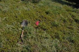
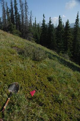
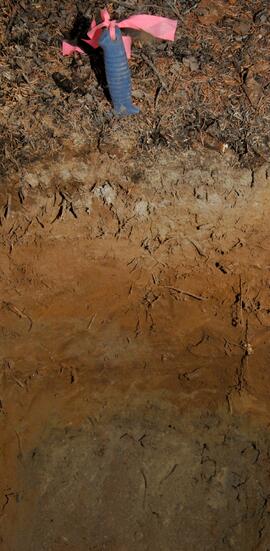
          With support from the Muskwa-Kechika Trust Fund as a Seed Grant, Dr. Paul Sanborn carried out a pilot study of soils in relation to prescribed burning in the Northern Rocky Mountains, in collaboration with Perry Grilz, then a Range Officer in the Ministry of Forests. Sanborn and Grilz conducted 3 days of field work in July 2001. Sanborn wanted to test the utility of plant-derived opal (phytoliths) as a soil indicator of vegetation history, in the hope of distinguishing natural grasslands from those created by anthropogenic burning.

          2023.2.2.8 · Subseries · 2003-2014
          Part of Dr. Paul Sanborn fonds

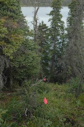
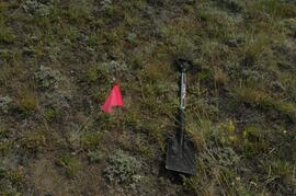
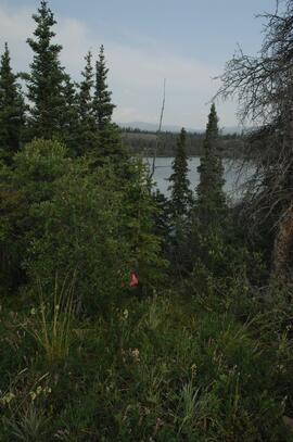
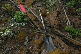
          The Kluane Lake area of SW Yukon was a continuing focus of Dr. Paul Sanborn's research for more than a decade, and generated several productive collaborations. Key themes included biological soil crusts in boreal grasslands, and interactions between aeolian sediment deposition, slope processes, and fire in boreal grassland and forest soils.

          Research results appeared in these publications:
          Marsh, J., Nouvet, S., Sanborn, P., and Coxson, D. 2006. Composition and function of biological soil crust communities along topographic gradients in grasslands of central interior British Columbia (Chilcotin) and southwestern Yukon (Kluane). Canadian Journal of Botany 84: 717-736. https://doi.org/10.1139/b06-026

          Pautler, B.G., Reichart, G.-J., Sanborn, P.T., Simpson, M.J., and Weijers, J.W.H. 2014. Comparison of soil derived tetraether membrane lipid distributions and plant-wax δD compositions for reconstruction of Canadian Arctic temperatures. Palaeogeography, Palaeoclimatology, Palaeoecology 404: 78-88. https://doi.org/10.1016/j.palaeo.2014.03.038

          Sanborn, P. and A.J.T. Jull. 2010. Loess, bioturbation, fire, and pedogenesis in a boreal forest – grassland mosaic, Yukon Territory, Canada. 19th World Congress of Soil Science, Soil Solutions for a Changing World 1 – 6 August 2010, Brisbane, Australia. http://www.iuss.org/19th%20WCSS/Symposium/pdf/0120.pdf

          The 2003 field work with Darwyn Coxson was a pilot study to assess the types and distribution of biological soil crusts in boreal grasslands in the Kluane Lake area. Eight sites were visited at which the team sampled the crust and the uppermost A horizon immediately underneath it. Note that site numbers Y03-03, -04, -05, -06, -07, -09, -10 and -12 were indicated as sites 3, 4, 5, 6, 7, 9, 10 and 12 in Table 1 of Marsh et al. (2006). Additional crust sampling was conducted at two additional sites (“Peninsula”, “Silver City”) in 2004; details of sampling methods and site locations are in Marsh et al. (2006).

          Results from 2009 field work were presented in Sanborn and Jull (2010), along with soil charcoal radiocarbon dates from 2003-2008 sampling which were used to reconstruct fire history in the Kluane Lake area. The 2003 (a single site at Silver City), 2004, and 2008 field work consisted of a reconnaissance of grassland and forest sites across a range of aspects and slope positions in order to recover buried soil charcoal.

          Research reference material
          2023.2.1 · Series · 1976-2016
          Part of Dr. Paul Sanborn fonds

          Series consists of reference material collected by Dr. Paul Sanborn, including field trip guidebooks, resource inventory documents, collected sources for various areas of research, and proceedings and abstracts for conferences and workshops.

          2023.2.2.6 · Subseries · 1983-2010
          Part of Dr. Paul Sanborn fonds

          During the 1980s, Agriculture Canada pedologists Scott Smith (retired from Summerland Research Station, formerly based in Whitehorse) and Charles Tarnocai (retired from Central Experimental Farm, Ottawa) had a large field program which addressed the trends in soil development in the central Yukon. Across this region, particularly between Whitehorse and Dawson City, the land surfaces and surficial deposits vary greatly in age due to the differing extents of glaciations over the past ~2 million years.

          This work built on a pioneering study from the previous decade:
          Foscolos, A.E., N.W. Rutter, and O.L. Hughes. 1977. The use of pedological studies in interpreting the Quaternary history of central Yukon Territory. Bulletin 271. Geological Survey of Canada, Ottawa. 48 p. https://doi.org/10.4095/103066

          Tarnocai and Smith presented their results in two publications:
          C. A. S. Smith, C. Tarnocai, and O. L. Hughes. 1986. Pedological investigations of Pleistocene glacial drift surfaces in the central Yukon. Géographie physique et Quaternaire, 40 (1): 29–37. https://doi.org/10.7202/032620ar
          Tarnocai, C. and C. A. S. Smith. 1989. Micromorphology and development of some central Yukon paleosols, Canada. Geoderma 45 (2): 145-162. https://doi.org/10.1016/0016-7061(89)90047-5

          Tarnocai and Smith shared the unpublished data and soil samples from this work with Dr. Paul Sanborn, and this resulted in a student project published as:
          Daviel, E., P. Sanborn, C. Tarnocai, and C.A.A. Smith. 2011.Clay mineralogy and chemical properties of argillic horizons in central Yukon paleosols. Canadian Journal of Soil Science 91: 83-93. https://doi.org/10.4141/cjss10067

          2023.2.2.5 · Subseries · 1991-2023, predominant 2004
          Part of Dr. Paul Sanborn fonds

          The Lost Chicken Mine, a placer gold mine in eastern Alaska, approximately 120 km west of Dawson City, Yukon, is an important fossil locality for the late Pliocene (approximately 2.5 – 3.0 million years ago). A comprehensive account of the stratigraphy and paleontology of this site was given by:
          Matthews, J.V., Jr., J.A. Westgate, L. Ovenden, L.D. Carter, and T. Fouch. 2003. Stratigraphy, fossils, and age of sediments at the upper pit of the Lost Chicken gold mine: new information on the late Pliocene environment of east central Alaska. Quaternary Research 60: 9-18. https://doi.org/10.1016/S0033-5894(03)00087-5

          Dr. Paul Sanborn visited the site on July 20, 2004, as part of a group led by Duane Froese (Professor, University of Alberta). The group concentrated on a single exposure (~ 2 m thick) straddling the Lost Chicken tephra, a volcanic ash bed (2.9 ± 0.4 myr) which is a major stratigraphic marker at the site. Sanborn described, photographed, and sampled this exposure, and obtained a basic set of characterization data. Intact samples were collected but thin sections were never produced.

          2023.2.2.4 · Subseries · 2004-2005
          Part of Dr. Paul Sanborn fonds

          The eastern flank of the Mackenzie Mountains has a complex history of multiple glaciations by both the Laurentide and Cordilleran ice sheets, recorded in thick sequences of glacial sediments that were documented at 3 locations (Katherine Creek, Little Bear River, Inlin Brook) by:
          Duk-Rodkin, A., R.W. Barendregt, C. Tarnocai, and F.M. Phillips. 1996. Late Tertiary to late Quaternary record in the Mackenzie Mountains, Northwest Territories, Canada: stratigraphy, paleosols, paleomagnetism, and chlorine-36. Canadian Journal of Earth Sciences 33 (6): 875-895. https://doi.org/10.1139/e96-066

          Of the 3 sites, the exposure on Inlin Brook, a tributary of the Keele River, was the least well-documented, so in summer 2004 Dr. Paul Sanborn joined a field party of the Geological Survey of Canada (GSC) based at Tulita, NWT, and was given helicopter support to visit Inlin Brook (August 5-8). A brief visit was also made to the Little Bear River site.

          On August 9-10, Sanborn joined Alejandra Duk-Rodkin (GSC) and Rene Barendregt (U Lethbridge) in helicopter-assisted field work at sites in the Franklin Mountains and elsewhere east of the Mackenzie River.

          2023.2.2.3 · Subseries · 2004-2006
          Part of Dr. Paul Sanborn fonds

          As part of a multidisciplinary team led by Grant Zazula (then a Ph.D. student at Simon Fraser University; later a palaeontologist with the Government of Yukon) and Duane Froese (Professor, University of Alberta), Dr. Paul Sanborn examined a set of buried paleosols (fossil soils) preserved in frozen sediments exposed by placer mining in the spring of 2004.

          The findings were published in:
          Zazula, G.D., D.G. Froese, S.A. Elias, S. Kuzmina, C. La Farge, A.V. Reyes, P.T. Sanborn, C.E. Schweger, C.A.S. Smith, and R.W. Mathewes. 2006. Vegetation buried under Dawson tephra (25,300 14C yr BP) and locally diverse late Pleistocene paleoenvironments of Goldbottom Creek, Yukon, Canada. Palaeogeography, Palaeoclimatology, Palaeoecology 242: 253–286. https://doi.org/10.1016/j.palaeo.2006.06.005

          2023.2.2.3.2 · Item · 2004, 2023
          Part of Dr. Paul Sanborn fonds

          Data set consists of lab data for sites Y04-01 to Y04-04. Original data set created in 2004; an update was provided in March 2023 but horizon designations were not updated to be consistent with the paper.

          2023.2.2.2 · Subseries · 1995-2005
          Part of Dr. Paul Sanborn fonds

          In the mid-1990s, Dr. Paul Sanborn worked with Dr. Lito Arocena of UNBC to assemble and interpret basic physical, chemical, and mineralogical data for typical soils at important long-term forestry research sites in central and northeastern BC. The key results were published as:

          J.M. Arocena and P. Sanborn. 1999. Mineralogy and genesis of selected soils and their implications for forest management in central and northeastern British Columbia. Canadian Journal of Soil Science 79: 571-592. https://doi.org/10.4141/S98-07

          Nine pedons were involved, with 7 located at the sites of 4 Ministry of Forests Experimental Projects (E.P.), and 2 at the Aleza Lake Research Forest.

          Forest soil sulphur research
          2023.2.2.1 · Subseries · 1988-2011
          Part of Dr. Paul Sanborn fonds

          Forest soil sulphur research was a continuing interest for Dr. Paul Sanborn for more than 30 years, beginning at UBC in the mid-1980s when he took a graduate course in Forest Soils from Dr. Tim Ballard. Among the things that he learned was that soils in much of BC were deficient in sulphur (S). Simultaneously, he became aware of the large amount of research on prescribed fire in BC forests, with broadcast burning being the main method of site preparation across much of the province at that time.

          Sanborn undertook various projects in this area of research:

          1. UBC Postdoctoral Project on effects of prescribed fire on sulphur in forest soils (1988-90)
          2. Cluculz retrospective study (E.P. 886.10) with the BC Ministry of Forests and UNBC
          3. Sulphur stable isotope tracer study (E.P. 886.15) with the BC Ministry of Forests and UNBC
          2023.2.2.1.2.2 · Item · [between 2002 and 2005]
          Part of Dr. Paul Sanborn fonds

          This document file "Cluculz Creek Fertilization Research Site.pdf" contains a field description and basic characterization data for a representative pedon at the E.P. 886.10 site.

          2023.2.2.9.4 · File · 2001
          Part of Dr. Paul Sanborn fonds

          File contains the following data sets:

          • Phytolith contents.xls [phytolith content in 5-20 µm silt, tallied by morphological categories; also summarized as % of total soil fine (< 2 mm) fraction]
          • M-K (2001) soil LOI data.pdf [LOI (loss-on-ignition) data for sampled soil horizons – proxy measurement for organic matter content]