Land, Settlement and Immigration

Elements area

Taxonomy

Code

Scope note(s)

  • Claiming, settling, and moving to a new land
  • Land titles, distribution, grants, etc.
  • Community and regional settlement patterns
  • Land settlement companies
  • Land surveys and surveyors
  • Real estate companies and activities
  • Organizations involved in sponsoring and supporting immigrants

Source note(s)

  • MemoryBC Subject Groups

Display note(s)

    Hierarchical terms

    Land, Settlement and Immigration

      Equivalent terms

      Land, Settlement and Immigration

        Associated terms

        Land, Settlement and Immigration

          1213 Archival description results for Land, Settlement and Immigration

          1213 results directly related Exclude narrower terms
          2020.4.6.540.1 · Item · June 2001
          Part of G. Gary Runka fonds

          Optical disc holds a full CD version of the "www.BCRock.com" website. From the home page on the disc:

          "In the Central Coast Regional District of British Columbia, near the town of Bella Coola, No Cents Holdings and Arthon Construction initiated a Federal and Provincial Environmental Assessment for the purposes of permitting a rock quarry, an expansion to an existing sand & gravel quarry and a marine loading facility.
          Exclusive to the CD Version ..... A Quicktime movie Greening the Gravel

          Also, some bonus information related to the project and activities.
          We are pleased to report in a press release dated May 9, 2001, that the companies have entered into an agreement with Polaris Minerals Corporation that gives Polaris the right to become a joint venture partner in the Bella Coola Aggregates Project.

          Nuxalk Nation General Election - Results from Wednesday, Mar. 7, 2001
          Congratulations to Chief Anfinn Charles Siwallace and the new councillors .... M O R E
          Three public Open Houses
          have been held in the Bella Coola valley.

          This site went live on October 12, 2000 and will remain a work in progress.
          Here you may find reports, news, project descriptions, professionals reviews, process descriptions, economic impacts, environmental reviews, archaeological reviews, geotechnical and hydrologist input, and a great many photo tours of the area."

          Workshop 2, Tape 5
          2020.4.6.425.6 · Item · 1996
          Part of G. Gary Runka fonds

          Audio cassette titled "Workshop 2, Tape 5" is believed to contain a recording of a workshop related to the Vernon commonage project.

          Workshop 2, Tape 3: 3:30 pm
          2020.4.6.425.5 · Item · 1996
          Part of G. Gary Runka fonds

          Audio cassette titled "Workshop 2, Tape 3: 3:30 pm" is believed to contain a recording of a workshop related to the Vernon commonage project.

          Workshop 2, Tape 2: 2:00 pm
          2020.4.6.425.4 · Item · 1996
          Part of G. Gary Runka fonds

          Audio cassette titled "Workshop 2, Tape 2: 2:00 pm" is believed to contain a recording of a workshop related to the Vernon commonage project.

          Works by Kent Sedgwick
          2012.13.4 · Series · 1966-2010
          Part of J. Kent Sedgwick fonds

          Series consists of material collected and created by Kent Sedgwick in relation to his writings, publications, editorial work, and lectures. The files contain material regarding Kent Sedgwick’s writing and lectures on the Lheidli T’enneh cemetery; his book "Monumental Transformation: The Story of Prince George's National Historic Monument"; his book chapter "Crossing the Divide: Northern Approaches to New Caledonia"; his book "Giscome Chronicle: The rise and demise of a sawmill community in central British Columbia, 1912-1976"; edits done to June Chamberland’s book "From Broadaxe to Clay Chinking: Stories about the Pioneers in and around the Prince George area"; writing for the Prince George Heritage Advisory Committee; and Sedgwick’s MA thesis on the Peyto Glacier. The files primarily consist of notes, correspondence, and completed works.

          Woodpecker and Hixon
          2012.13.2.18.10 · File · 1994-2007
          Part of J. Kent Sedgwick fonds

          File consists of notes, clippings, and reproductions relating to Woodpecker and Hixon. Includes: "Heritage Week" poster with photographs depicting Huble Homestead, Valemount Museum, St Mark's Anglican Church, and the Church of St Pius X (Feb. 1994). File also includes photographs depicting various buildings in Woodpecker and Hixon, including the Woodpecker Church (2001).

          Willow River
          2012.13.2.17.18 · File · 2002-2007
          Part of J. Kent Sedgwick fonds

          File consists of notes, clippings, and reproductions relating to the community of Willow River.

          William John "Wiggs" O'Neill
          2000.23.1.078 · File · 1960-1963
          Part of Audrey Smedley L'Heureux fonds

          File consists of material relating to William John "Wiggs" O'Neill, a riverboat pioneer. Wiggs began working on a Skeena River sternwheeler in 1898 and continued working on the river until the end of the steamboat era in 1911. He then moved to Smithers, where he operated the first power plant and owned an auto agency for 43 years. Materials include two books, newspaper clippings, and reproductions of journal articles. Highlights include:

          • Wiggs O'Neill, "Steamboat Days on the Skeena River British Columbia", 1963 (book)
          • Wiggs O'Neill, "Whitewater Man of the Skeena", 1960 (book)
          2020.4.2.1.46 · File · Feb. 1981
          Part of G. Gary Runka fonds

          File consists of a speech given by Gary Runka entitled "Who Gets to Use the Land and Water? - the Urban and Agricultural Land Needs of the Okanagan Valley" for the Faculty of Agricultural Sciences, UBC and Okanagan College.

          Commentary on this speech by Barry Smith of the Ministry of Agriculture and Lands:
          "Although the ALR and ALC Act are not mentioned directly, the paper is focused on agriculture and rural planning.

          When speaking of the competition for land and the pressure agricultural land is under, an interesting statement is included referring to the fact that "the fluctuation" in Washington State's apple crop is greater than the entire annual Okanagan production.

          The paper reviews pressures on agriculture and urban land uses. Under "Satisfying the Needs (Options and Interrelationships)" seven points are made including "Understanding the land is the most important prerequisite to its wise and proper use," and that Integrated Natural Resource Management and Land Use Planning must be closely tied.

          The paper ends with a point of optimism - "I see that potential to increase our understanding of the natural processes and to explore the questions of who gets to use the land and water from a view point somewhere in the orchard or countryside rather than from Main Street. That's a beginning."

          2020.4.2.2.13 · Item · 1981
          Part of G. Gary Runka fonds

          Item is an original copy of the "Western Land Directors Conference Proceedings" in Victoria, BC between June 7-11, 1981. Gary Runka was a guest speaker with the speech "Agricultural Land and Land Use Decision Making in the 1980's".

          2020.4.2.1.50 · File · Nov. 1980
          Part of G. Gary Runka fonds

          File consists of a speech given by Gary Runka entitled "Western Canadian Agriculture - A Look to the Future" for an unknown audience.

          Commentary on this speech by Barry Smith of the Ministry of Agriculture and Lands:
          "As the title suggests, this speech is largely a look at agriculture in Western Canada and therefore breaks from many of the familiar themes in GGR's speeches and includes several interesting statistics.

          For example in 1921 the average Canadian farmer could feed 11 people. By 1981 the average farm could feed 56 people. [In 2012 The average farm in Canada produced enough food to feed 120 people every day.] The average Canadian expenditure of income on food after taxes:
          1947 - 25%
          1969 - 22%
          1980 - 18%

          The speech considers the following topics:
          A. The changing Picture of Western Canadian Agriculture

          • Energy Costs
          • Cropping Options
          • Northern Expansion
          • Diversification, Intensification, Specialization
          • Foreign Ownership

          B. Agricultural Land Use Planning
          C. Integrated Land Use Issues"

          Walk to Island Cache School
          2003.11.1.47 · File · 1999-2000
          Part of Island Cache Recovery Project Collection

          File consists of an oral history given by Robert Parris, Elizabeth Cariselle, Rose Bortolon, Betty Williams, and Sherry Lewis recalling the walk to Island Cache school. This oral history was gathered in conjunction with Dr. Mike Evan's Island Cache Recovery Project. Does not include a transcript or consent forms.

          Violet Findlay
          2003.11.1.11 · File · 1999-2000
          Part of Island Cache Recovery Project Collection

          File consists of an oral history given by Violet Findlay, which was gathered as part of Dr. Mike Evan's Island Cache Recovery Project. Includes consent forms, transcripts, and the recorded oral history on the original media.

          2020.05.25 · Item · [Sept. or Oct. 1936]
          Part of Gordon Wyness Album

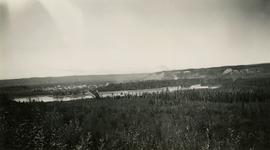
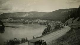
          Photograph depicts a view of the city of Prince George looking west from the east hill. The confluence of the Fraser River and Nechako River is visible to the right. The Grand Trunk Pacific Railway bridge is visible at centre. The current location of where this photograph may have been taken is likely somewhere near where Highway 16 rises on the hill past the correctional centre (jail).

          2020.05.08 · Item · October 1936
          Part of Gordon Wyness Album

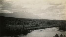
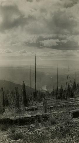
          Photograph depicts a view of the Fraser River from what Wyness calls "Fraser Mountain". There are a number of places named "Mount Fraser" in British Columbia, but the exact location of where this photograph was taken is unclear.

          View of Burns Lake
          2020.05.53 · Item · 1936
          Part of Gordon Wyness Album

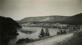
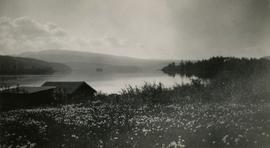
          Photograph depicts a view of Burns Lake, as seen from the survey crew's temporary lodgings at the cabin of Ben[?] Smith. Wyness notes in the photograph transcription that float planes landed in the bay below the buildings visible in this image.

          2012.13.2.15.29 · File · [before 1980]
          Part of J. Kent Sedgwick fonds

          File consists of notes and reproductions relating to the Vanderhoof and area townsites. Also includes a map depicting the South Hazelton townsite before 1980.