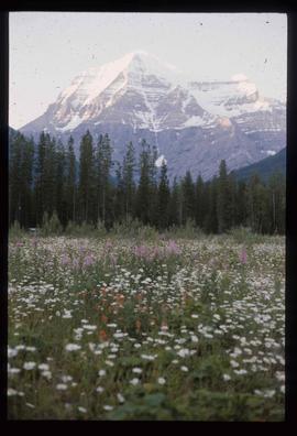
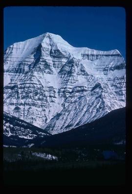
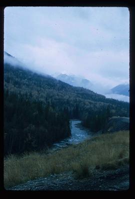
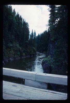
Image depicts a view of a forested, mountainous area and a river, somewhere along the White Pass railway. The slide is labelled "begin climb," suggesting the image was taken at the beginning of the White Pass Train's ascent into the mountains.
Image depicts a view over a forested, mountainous area and a river somewhere in the area of Skagway, Alaska.
Image depicts the White Pass Train crossing over a railway bridge at an uncertain location.
Image depicts the restored White Pass Snow Plow No.1 in Skagway, Alaska.
Image depicts a sign, labelled "The White Pass Snow Fleet," which details the history of the fleet; it is located in Skagway, Alaska.
Image depicts the original steam engine for the White Pass Train, located in Skagway, Alaska.
Image depicts the river which runs through Miles Canyon, located near Whitehorse Y.T.
Image depicts a pyramid shaped house, possibly located in Atlin, B.C.
Image depicts the Globe Theatre in Atlin, B.C.
Image depicts a mural of Atlin with information about the Globe Theatre and Edwin L. Pillman on it. It reads: "Talented businessman arrived in Atlin in 1899, and for nearly fifty years operated a variety of businesses ~ grocery and drug stores, undertaker, market gardens and the theatre. Assissted by his loyal wife Elizabeth." It also states that the Globe Theatre was built in 1917 and was used until the early 40's.
Image depicts the Garrett Store in Atlin, B.C. A plaque on it reads: "John Garrett, a prominent English cricket player, came to Atlin in 1910 to mine gold. In 1917 he opened this grocery and dry goods store where he also sold his wife's fresh baked bread and sweets."
Image depicts numerous old buildings on a main street in Atlin, B.C.
Image depicts an old boat on the shore of Atlin Lake.
Image depicts a boat named "the Tarahne," which is located in Atlin, B.C. Atlin Lake and Mountain are visible in the background.
Image depicts a dock on the shore of Atlin Lake, as well as a building that may have once been a hospital. The slide is simply labelled "hospital."
Image depicts Atlin Lake.
Image depicts a boat named "the Tarahne," which is located in Atlin, B.C. Atlin Lake and Mountain are visible in the background.
Image depicts what appears to be a footbridge at an uncertain location.
Image depicts what appears to be a small community on the shore of a lake. The location is uncertain.
Image depicts an old building undergoing a restoration process, possibly in Atlin, B.C.
Image depicts the old railroad building in Skagway, Alaska.
Image depicts a pair of mannequins in the second story windows of a building, possibly located in Skagway, Alaska.
Image depicts one of the main streets, Broadway, in Skagway, Alaska.
Image depicts a building which once served as the residence for two nurses in Atlin, B.C. A sign in front of the house reads: "Grateful Atlinites built this house in 1902 for their first missionary nurses, Helen Bone and Elizabeth Mitchell, who came here in 1899 and lived in a crude shack while valiantly and humanely caring for sick and dying pioneers."
Image depicts an old building which used to be the Discovery Jail. The plaque on it reads: "It cost $800 to build this two cell jail in 1902. The solid walls are 2"x6" laid flat one on top of the other. It was skidded to Atlin in the 1920s and used as a residence for many years."
Image depicts the post office in Atlin, B.C.
Image depicts the UNBC partnership campus in Atlin, B.C. The slide also labels it as being a former courthouse.
Image depicts a railway bridge, possibly in the small town of Fraser, located on the Klondike Highway in B.C.
Image depicts a large building which is labelled "Alberta Pool Elevators Ltd. Dawson Creek," located in Dawson Creek, B.C.
Image depicts an unidentified man in a greenhouse, possibly somewhere in Fort St. John, B.C.
Image depicts the Peace River and visible layers of sediment deposits in the surrounding cliffs.
Image depicts three unidentified individuals examining rocks near a set of railway tracks at an uncertain location in the Peace River Region.
Image depicts the Peace River.
Image depicts an unidentified man in a yellow hat who appears to be speaking to large group of people. It is possibly an educational event.
Image depicts a river, possibly the Peace River.
Image depicts numerous individuals who appear to be searching among the rocks on a ledge at an uncertain location in the Peace River Region.
Image depicts what is possibly the Peace River.
Image depicts what is possibly the Bowron River from a bridge. The slide is simply labelled "Bowron Canyon."
Image depicts an old house with a torn up roof. The location is uncertain.
Image depicts a road covered in snow running through the woods at an uncertain location.
Image depicts an old building that used to be a store and post office in Dome Creek, B.C.
Image depicts a boarded-up house in Lamming Mills, B.C.
Image depicts a stone marker in Lamming Mills, B.C.
Image depicts a church somewhere in McBride, B.C. The sign in front possibly reads "St. Patrick's Church."
Image depicts Mt. Fitzwilliam.
Image depicts the boundary line between British Columbia and Alberta at the Yellowhead Pass.
Image depicts Portal Lake, located near the Yellowhead Pass on the British Columbia-Alberta border, west of Jasper, A.B.
Image depicts Mt. Robson.
Image depicts a view of what is possibly the Yellowhead Pass on the British Columbia-Alberta border, west of Jasper A.B.