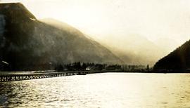
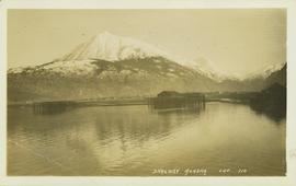
Photograph depicts a view of Hyder Alaska. Handwritten annotation below photograph reads, "Hyder Alaska 25/6/28".
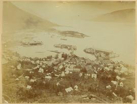
View of town on shore, from above. Boats docked along piers and buildings. Hills visible on either side of water in background.
Handwritten photo captions with arrows pointing to sections of image read: "General Merchandise", "Fort Wrangell Hotel".
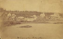
Photograph depicts community buildings on shoreline, water in foreground.
Handwritten annotation on image reads: "Wrangle, Alaska."; on verso: "Fort Wrangle, Alaska Territory. visited by W.H.Collison, C.M.S. 1877. Prior to the establishment of any mission, [...? illegible] 1875 - 1876. Presbyterian. Insert this illustration of Wrangle on Page 77 as marked."
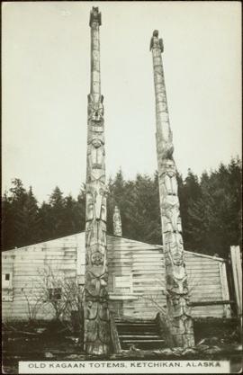
Two carved poles stand in front of a wide wooden building. Forest in background.
Printed below image: "OLD KAGAAN TOTEMS, KETCHIKAN, ALASKA".
Map depicts Chilkoot Inlet, Port Chilkoot, Taiya Inlet, Skagway, Tagish Lake, Golden Gate, and Graham Lake.
Alpine Club of Canada's 1967 Yukon Alpine Centennial Expedition, Kluane National Park, Yukon
Partially visible handwritten annotation on verso reads: "Mrs. O.M. Helgerson, Prince Rupert, BC"
Alpine Club of Canada's 1967 Yukon Alpine Centennial Expedition, Kluane National Park, Yukon
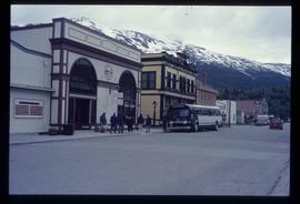
Image depicts the bus depot in Skagway, Alaska (USA).
A plan produced by Central Planning and Management Consulting LTD.
Original plan for basement floor.
A second floor plan of a building produced by Central Planning and Management Consulting LTD.
A second floor plan of a building produced by Central Planning and Management Consulting LTD.
Item is a Canadian Pacific Railway "CP Rail" pamphlet for ferry services in British Columbia for the following locations: Vancouver, Nanaimo, Seattle, Victoria, and Port Angeles. Also advertises an "Alaska cruise" on the Princess Patricia from Vancouver to Skagway, with stops at Prince Rupert, Ketchikan, Wrangell, Juneau, and Bartlett Cove.
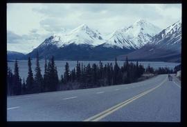
Image depicts the road to Skagway, Alaska. Possibly located on the Klondike Highway in British Columbia with Tutshi Lake on the left.
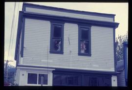
Image depicts a pair of mannequins in the second story windows of a building, possibly located in Skagway, Alaska.
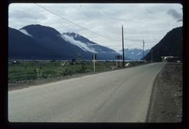
Image depicts the road leading to Hyder, which is on the other side of the Alaska-British Columbia border and is just a little south-west of Stewart, B.C.
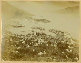
Town in a harbour - Alaska (?)
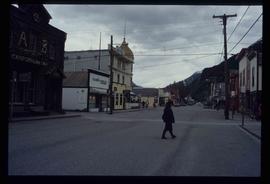
Image depicts one of the main streets, Broadway, in Skagway, Alaska.
File contains slides depicting Premier Mine in Hyder, Alaska.
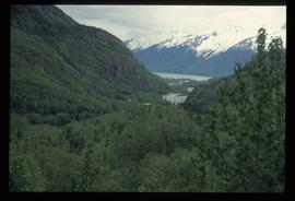
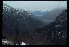
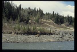
Image depicts a view over a forested, mountainous area and a river somewhere in the area of Skagway, Alaska.
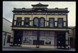
Image depicts the old railroad building in Skagway, Alaska.
Image depicts a view over a forested, mountainous area and a river towards the vicinity of Skagway, Alaska.
File contains slides depicting places around and between Skagway, on the Alaska border, Atlin and Miles Canyon.
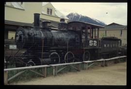
Image depicts the original steam engine for the White Pass Train, located in Skagway, Alaska.
This travel scrapbook was created by Jill Singleton to document a trip to Alaska, Yukon, Haida Gwaii, and northern BC. Jill Singleton and Eric Stathers embarked on a 1985 car camping trip using the BC Ferries and Alaska Ferry systems. Includes postcards, ephemera, handwritten notes, pamphlets, issues of local newspapers, and maps. Also includes 37 photographs.
Includes the following:
- "Queen Charlotte Islands Observer" newspaper issue for August 8, 1985
- "A Walking Tour and Business Directory for Queen Charlotte City", June 1985
- "A Walking Tour and Business Directory for Tlell + Port Clements", June 1985
- "A Walking Tour and Business Directory for Skidegate Landing, Skidegate and Sandspit", June 1985
- "A Walking Tour and Business Directory for Masset", June 1985
- "Explorations Q.C.I." pamphlet advertising guiding, outfitting, and touring
- "Sandspit Inn, Queen Charlotte Islands" pamphlet
- "Visit the Queen Charlottes" pamphlet
- Queen Charlotte Islands map, circa 1985
- BC Ferries pamphlet "New in 1985... Inside Passage Day Cruise"
- BC Ferries pamphlet "Tickets and Boarding Information, Inside Passage"
- "Alaska Marine Highway" pamphlet
- "Discover Southeast Alaska, Ketchikan" pamphlet
- "Alaska State Parks" pamphlet/map
- "Tongass National Forest, Alaska" pamphlet/map
- "Alaska Marine Highway Summer Schedule - May 1, 1985 through September 30, 1985" pamphlet
- History leaflet for St. Michael's Cathedral, Sitka, AK
- Alaska Seafood Marketing Institute leaflets, 1984
- Anchorage 1984 Visitors Guide, Anchorage Convention & Visitors Bureau
- "Skagway... some Steps on the Gold Rush Trail... walking Tour of the Historic District - Klondike Gold Rush National Historical Park"
- "Skaguay Alaskan" newspaper issue, Vol. VIII, No. 1880 (1985)
- "Klondike Gold Rush" pamphlet for tourists
- "Broadway, Skagway, Alaska" pamphlet
- "S.S. Tutshi, Carcross" pamphlet
- "Moon Watching" pamphlet by BC Ministry of Lands, Parks and Housing (1980)
- "Some Insects of Provincial Parks" pamphlet by BC Ministry of Lands, Parks and Housing (1980)
- "Stewart, British Columbia - Hyder, Alaska... Your Gateway to Alaska and the Yukon!" pamphlet
- "Stewart-Cassiar Highway 37" map
- "Prince Rupert City Map & Guide" pamphlet
- "Explore Canada's Yellowhead, Western Canada's New Interprovincial Highway" pamphlet (1983)
- "101 Things To Do in Yukon" booklet published by Tourism Yukon (1985)
- "Your Guide to B.C. Ferries' Inside Passage" booklet by British Columbia Ferry Corporation (1985)
- "Port Alberni, British Columbia, Canada" booklet (1981)
Trip itinerary:
- Vancouver, BC
- Nanaimo, BC
- Port Hardy, BC
- Prince Rupert, BC
- Yakoun River, BC
- Haida Gwaii, BC (formerly Queen Charlotte Islands)
- Rennell Sound, BC
- Graham Island, BC
- Queen Charlotte City, BC
- Sandspit, BC
- Prince Rupert, BC
- Ketchikan, AK
- Sitka, AK
- Tenakee Springs, AK
- Juneau, AK
- Skagway, BC
- Carcross, YK
- Atlin, BC
- Telegraph Creek, BC
- Kitwanga, BC
- Prince Rupert, BC
- Prince George, BC
- Lillooet, BC
- Vancouver, BC
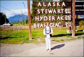
Woman stands in front of sign that reads "ALASKA / STEWART 237 km / HYDER AK. 240 km / BEAR GLAC. 201 km". Second sign in background indicates restaurant, convenience store, and service centre. Car, road, and highway can be seen in midground; mountains in background. (This woman is also featured in item 2008.3.1.22.13).
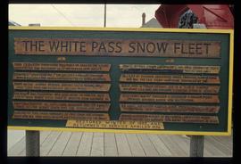
Image depicts a sign, labelled "The White Pass Snow Fleet," which details the history of the fleet; it is located in Skagway, Alaska.
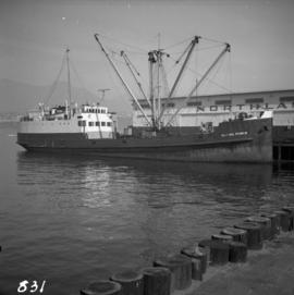
Photograph depicts a ship named "Alaska Prince" at the Northland Pier in Vancouver Harbour.
Alpine Club of Canada's 1967 Yukon Alpine Centennial Expedition, Kluane National Park, Yukon
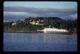
Image depicts the ferry to Alaska in the port of Prince Rupert, B.C.
File consists of:
- 1948 Canadian National Brochure, Alaska in ’48. Dimensions: [21 x 28 cm]
- 1948 Pamphlet brochure 5 Day Cruise to Ketchikan Alaska. Dimensions: [10 x 22 cm]
- 1948 CNR Grand Trunk Railway letter regarding cruise offerings. Dimensions: [20 x 28 cm]
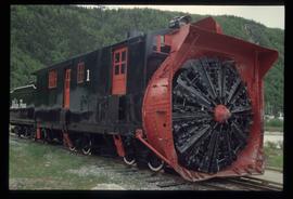
Image depicts the restored White Pass Snow Plow No.1 in Skagway, Alaska.
Image depicts a small section of the Alaska Highway somewhere near Whitehorse, Y.T. The slide also appears to be labelled "army washing" for unknown reasons.
Publication is entitled "The Alaska Panhandle Boundary Dispute" by Hugh Finsten of the Research Branch, Library of Parliament.
File consists of documents relating to the Alaska Highway Commemorative Symposium.
Shop front in Skagway Alaska, Alpine Club of Canada's 1967 Yukon Alpine Centennial Expedition, Kluane National Park, Yukon
Alpine Club of Canada's 1967 Yukon Alpine Centennial Expedition, Kluane National Park, Yukon
? Colorful map of mostly Yukon, BC, AB, and parts of Alaska, Northwest Territories and southern part of the United States.
? Legend, Mileage Tables and notes are printed on a white sheet that is then glued onto the map
? Legend includes: 1) Main Routes shown, 2) Roads Fully or Partially Constructed in B.C. and Yukon, 3) Roads Elsewhere, 4) Airports.
B.C.-Yukon-Alaska Highway Commission – Map showing Highway Routes to Accompany Preliminary Report on Proposed Highway to Alaska
? January 1940
? Legend includes: 1) Existing Main Highways, 2) Roads in Northern Area, 3) Routes Under Construction.
ALASKAN HIGHWAY PHOTOGRAPH ALBUM. British Columbia: N.D. [ca 1945]. 10 1/4" x 13 1/4" in thick green embossed boards, with title (Photographs) in gilt and tied at spine with green cord. Photo album contains 172 original photographs and 27 real photo postcards. Photographs measure 5 3/4" x 3 1/2," with a majority captioned in manuscript. Through these photos one has visual journey of travel on the newly constructed Alaskan Highway through British Columbia and into the Yukon. The travelers set off from Fort Saint John, passing through Fort Nelson, and seeming to go as far as Watson Lake, just across the border into the Yukon Territory. Along the way, they drove through the Trout River Valley, Steamboat Mountain, Muncho Lake, and many other impressive features of the landscape. The final section of images comprise home photos of the family that made the trip and some photos taken earlier.
This file consists of 3 copy prints and negatives (some duplicates of 2004.11.1.8) depicting trapping around Fort St. John and the Alaska Highway.
Alaska/Canada border
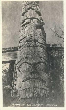
Photograph depicts an Indigenous totem pole. Annotation on recto of photograph states: "Totems of Old Kasaan Alaska"
This series consists of the August 1963 edition of Alaska newsletter "News Digest of the Far North" (Vol. 2 No. 8) ; 14 August 1963 newspaper "Jessen's Weekly" ; and the summer 1962 Whitehorse Nugget.
? With suggested highway routes to Alaska.
? Legend includes: 1) Main Highways Constructed, and In Use, 2) Suggested highway to Alaska, 3) Connections.
Map depicts various gas projects across North America including: the "El Paso Project" along American and Mexican boarder; the "Arctic Gas Project" which runs from the Beaufort Sea through Alberta towards San Francisco and Chicago; the "Alcan Project" which runs through Alaska, British Columbia, Alberta and onwards to San Francisco and Chicago; the "Maple Leaf Project" which runs from the Beaufort Sea into Alberta; and the "Polar Gas Project" which runs from the Parry Islands and circles the Hudson Bay towards Quebec.
File consists of documents relating to the Alaska Highway conference in 1992.
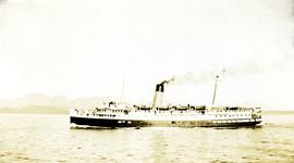
Photograph depicts a passenger steamship on open water, mountains in the background. Handwritten annotation below photograph reads, "S.S. Alameda".
