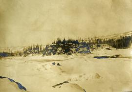
Photograph depicts two people and a dog team on a snowy river bank with a narrow passage of open water and a snowy bluff in the background.
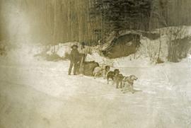
Photograph depicts a four-dog team harnessed to a loaded sleigh. Two people stand near the loaded sleigh on a snowy forest path.
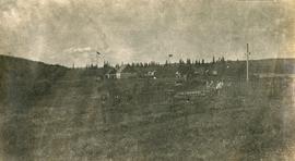
Photograph depicts Lheidli T'enneh Nation burial grounds in foreground, Hudson Bay Company buildings in background.
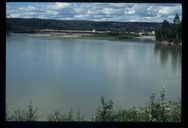
Slide depicts a view of what is possibly the Upper Fraser River.
File consists of a booklet prepared for the May 9, 2002 UNBC/UBC Aleza Lake Research Forest Field Tour.
File contains a photocopied version of "Tree Farm Licence No. 29 - Eagle Lake Sawmills Ltd. Cutting Permit Application No. 7". Although this item is not related to the Aleza Lake Research Forest, it is relevant to forest history in the Prince George area and therefore retained by the Society.
Slide depicts cleared ground and felled trees in a forested area, likely at the Aleza Lake Experiment Station.
File consists of trail maps and recreation guides from various places in British Columbia, especially Northern British Columbia. Maps include:
- British Columbia Road Map and Parks Guide
- Northwood Pulp and Timber Limited Forest Operations Recreation Map
- Provincial Parks of Northern British Columbia
- Visitor's Guide: Mackenzie Woodlands
- Visitors Guide: Mackenzie Woodlands
- Mackenzie Forest District Recreation Map
- Dawson Creek Forest District Recreation Map
- Morice Forest District Recreation Map
- Fort St. James Forest District Recreation Map
- Lakes Forest District Recreation Map
- Cariboo Forest Region Recreation Map
- Lakes District Visitors Map
- Prince George Forest District Recreation Map
- Vanderhoof Forest District Recreation Map
- Fort St. John Forest District Recreation Map
- Cariboo Forest Region Recreation Map (East)
- Robson Valley Forest District Recreation Map
- Fort Nelson Forest District Recreation Map
- Forest Service Recreation Sites: Valemount - Blue River
- Forest Service Recreation Sites: McBride - Goat River
- Forest Service Recreation Sites: Prince George West
- Forest Service Recreation Sites: Moberly - Sukunka
- Forest Service Recreation Sites: Nation - Takla
- Forest Service Recreation Sites: Murrat - Kiskatinaw
- Recreation Road Map for the Prince George Forest Area (1987-1988)
- Recreation Road Map for the Prince George Forest Area (1997)
- The Bobtail Forest Service Road Tour
- Forest Recreation Map: Northwood Pulp and Timber Limited
- Forest Operations Recreation Map: Northwood pulp and timber limited
- Forest Service: Recreation Sites Williston/Mackenzie
- Forest Service Recreation Sites Prince George West
- The Official Prince George Tourist Street Map
- Ecological Reserves in British Columbia (July 1990)
- Prince George Forest District map (April 1990) with annotations regarding trials.
A VHS tape containing "The Mark of Progress" film created by the British Columbia Forest Service and first played for a live audience in 1959 in Prince George, BC.
File contains an original copy of a BC Forest Service publication entitled "The Development of the Spruce-Balsam Type in the Aleza Lake Experimental Forest" by A.R. Fraser and J.L. Alexander.
File consists of one VHS tape showing the building of the Northwood Pulp Mill in Prince George. Video has no sound.
File contains a photocopy of the BC Forest Service publication entitled "The Aleza Lake Research Forest: 'A Rich Past and a Bright Future' Provincial Colleges Tour" from June 1991.
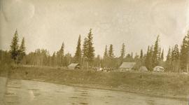
Photograph depicts a small cluster of buildings near the river bank.
File consists of 1 audiocassette of public presentation hosted by Bob Harkins discussing the history of sawmilling in Prince George Region. Introduces several people involved in sawmilling industry and also discusses history of the Northern Interior Lumbermen's Association. Also shows a historical film about sawmilling and provides commentary.
Harkins, BobFile consists of 1 audiocassette of interviews by Bob Harkins with John Backhouse, city librarian discussion of referendum on construction of new library. Also contains interview with Don Thatcher, conservation officer.
File consists of 1 audiocassette of people interviewed by Bob Harkins. Side A consists of interviews with Bill Jones of the Fort George Railway Society, Walter Gill formerly of the BC Provincial Police, and Bob Sebastian, of the Carrier First Nation. Side B consists of interviews with Ella Fry, a trapper from Valemount and Prince George boxer Harold Mann.
Photograph depicts seven or more men relaxing near a canvas tent. Some of the men appear to be whittling wood. Long underwear dry on a tent rope and wood smoke drifts past the men and tent to the forest behind.
Photograph depicts a view of a lake from a row boat. The back of one male boat passenger and oars are in the foreground.
Original photographic print included in "Northern Interior Forest Experiment Station: Report of Preliminary Investigations" by Percy Barr.
Original photographic print included in "Northern Interior Forest Experiment Station: Report of Preliminary Investigations" by Percy Barr.
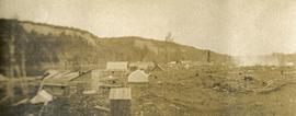
Photograph depicts scattered buildings, an outhouse, and tents on a rough clearing. A river and its cutbacks are in the background.
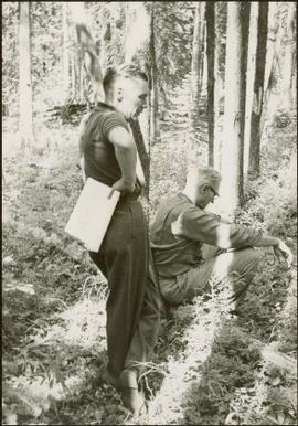
Item is a photograph of Ray Williston and John Liersch in a small wood area southwest of Prince George.
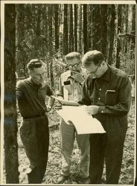
Item is a photograph of Mr. Williston, Chief Forester John Stokes and Tom Wright of Canadian Forest Products examining an area near Prince George in order to determine the timber area required for a Pulp Harvesting License for a proposed pulp mill that would depend completely on waste wood.
Map reproduction of the Sinclair Spruce Lumber Co. Ltd. T.S.H.L. A01848 C.P. 310 cutting area, likely in the Aleza Lake Research Forest.
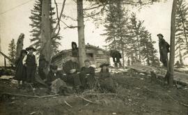
Photograph depicts six adults and three or more children sitting on the ground with a log cabin in the background. Snow scatters the ground in small patches.
Slide depicts a sawmill in operation, likely located in the Upper Fraser area, with a pile of burning wood products and a beehive burner.
Image depicts a sawmill, possibly Lakeland Sawmill, in Prince George B.C.
File is a Resource Folio of maps and accompanying information created by Northwood Pulp & Timber regarding Timber Sale Harvesting Licence A01847, Willow River Block, Willow River P.S.Y.U. Includes maps that depict ungulates, waterfowl, recreation areas, special influence areas, and timber types. Most of the sheets have a duplicate, some with very slight variations. The following maps are supposed to be included in the but were missing upon arrival at the Archives: fish & topography, cutting permits & roads, and soils.
File consists of an original and a copy of a BC Forest Service pamphlet entitled "Reforestation in the Central Interior: A glimpse of the past and a view to the future". This pamphlet includes discussion of the Aleza Lake Experiment Station and John Revel's work.
File consists of recreational guides from various places in British Columbia, especially Northern British Columbia. Guides include:
- The North Ridge Ecr-Trail Guide: Aleza Lake Research Forest
- Cluculz Lake Silviculture Demonstration Area: Trail Guide
- Willow River Interpretive Trail
- Crooked River Forest Self-Guided Circle Tour
- Forests for the World Interpretive Trail Guide
- Cottonwood Island Nature Park: Habitat Enhancement.
Slide depicts a burning building at the Aleza Lake Experiment Station on the date it was shut down by the BC Forest Service.
Slide depicts the Ranger Station at the Aleza Lake Experiment Station.
File consists of:
- Original version of Ralph Schmidt's 1993 BC Forest Service publication entitled "The Aleza Lake Experiment Station (1920's and 1930's)"
Image depicts a pulpmill, likely Northwood, in Prince George, B.C.
Series consists of publications created by those associated with the Aleza Lake Research Forest as well as the Aleza Lake Research Forest Society itself. Includes various clippings and articles from serial publications such as newspapers and newsletters that focus on the ALRF. Also includes publications that served as reference material on topics relevant to the ALRF.
File contains an original "Proceeding of the Experimental Forests Workshop, April 28-29, 1992" co-published by the Government of Canada and the BC Ministry of Forests. Item is noted to be FRDA Report 202 and BCFRAC Report 2.
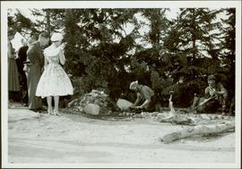
Item is a photograph of Princess Margaret on July 17, 1958 at an event staged in the Prince George railway yards. Alex Moffat dressed as a prospector demonstrates panning for previously salted gold nuggets, which were later given to the Princess.
Image depicts the Prince George Sawmill from the Northwood Bridge.
Image depicts Prince George Sawmill taken from across the Nechako River looking southwest. Map coordinates 53°56'00.0"N 122°44'29.7"W
Image depicts Prince George Sawmill taken from across the Nechako River looking southwest. Map coordinates 53°56'00.0"N 122°44'29.7"W
File contains an original "Prince George Land and Resource Management Plan" published by the Government of British Columbia.
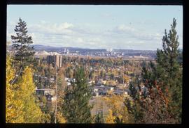
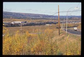
Image depicts Prince George, possibly with the Northwood Pulpmill in the background.
Image depicts Prince George, possibly with the Northwood Pulpmill in the background.
Image depicts Prince George, possibly with the Northwood Pulpmill in the background.
Series consists of photographs created or accumulated by the Aleza Lake Research Forest Society.
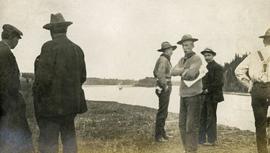
Photograph depicts several men standing on the river bank. Possibly A.H. Holland in center of photo.
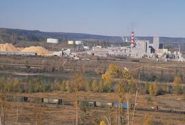
Image depicts the Northwood pulpmill in Prince George B.C.
Image depicts the Northwood pulpmill in Prince George B.C.
Image depicts the Northwood Pulpmill in Prince George, B.C. taken from above the Nechako River looking east. Map coordinates 53°56'00.0"N 122°44'29.7"W
