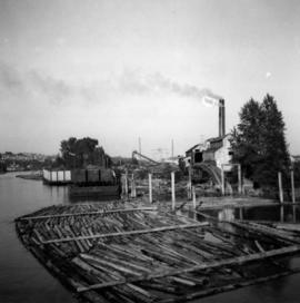
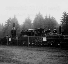
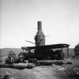
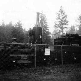
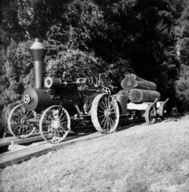
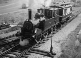
The David Davies Railway Collection encompasses all facets of railway history specifically in the province of British Columbia and the Yukon territory. The collection consists of research material accumulated over the course of more than fifty years, and includes monographs, periodicals, articles, clippings, railway timetables, photographs, maps and plans, and excerpts. Material covers public, tourist, and private (industrial) railways, including: CPR, KVR, E&N; CNR, CNoR, GTPR; and PGER, BCR. The collection excludes material regarding streetcar systems and rapid transit, but includes long distance electric interurbans.
Photograph depicts the Tsable coal pit on Vancouver Island as the first coal of the afternoon shift being hauled up.
Photograph depicts a mill on the north stream of the north arm of the Fraser River, looking east from the Fraser St. bridge.
Photograph depicts an early type of spool donkey circa 1890-1900, on display at Promised Land Park on the Olympia Peninsula in Washington state.
Photograph depicts a steam donkey located in the Crown Zellerbach Museum at Ladysmith on Vancouver Island.
Photograph depicts an early type of steam donkey mounted on a flatcar and attached to a Shay Tank. It is displayed on the roadside at Promised Land Park, probably near Forks, on the Olympic Peninsula in Washington state.
Photograph depicts a saw on the outskirts of Courtenay on the road to Cumberland.
Photograph depicts a donkey engine at the Cowichan Valley Forest Museum
Photograph depicts a view of the main saw and bull chain of the Horne Bros. Ltd. Shingle mill on #305 West Esplanade Rd. in North Vancouver.
Photograph depicts a steam crane in the yard of the Lions Gate Lumber Co. at the foot of Lloyd St. in North Vancouver. The crane was made by the Brown Hoisting Machinery Co. in Cleveland, Ohio and is undated. It has a 20 ton capacity, is well maintained, and freshly painted.
Photograph depicts a steam crane in a lumber yard on the north side of Porpoise Bay in Sechelt on the Sechelt Peninsula. The steam crane has been converted to diesel and was made by the Brown Hoisting Co. from Cleveland, Ohio. It lifts 21 tons at a 12ft radius and 5 tons at 35ft radius, and is in daily use. The 200 yards of rail track form a "Y" with the bottom piece onto the wharf.
Photograph depicts a small coal drift mine which worked perhaps 6 months prior to the picture being taken. Timber lands # 8, Cranberry, about 17 miles south of Nanaimo.
Photograph depicts a derelict gold mine at Hedley, BC.
Photograph depicts the pit head refuse at Extension Coal Mine, 5 miles southwest of Nanaimo. It worked between 1901 and 1931.
Photograph depicts a mine 200 yards south of Moyie village, which is 20 miles south of Cranbrook. It produced silver, zinc, and lead from 1900-1910 and had a smelter a quarter mile away. The shaft was 900 ft. deep, with levels going under Moyie Lake. The head gear dates from 1925-1935 and has electric winding.
Photograph depicts a derelict shovel beside the coaling wharves at Union Bay.
Photograph depicts a Ruston steam roller owned by Gary Wellburn in Duncan, BCIt was previously owned by the Oak Bay municipality.
Photograph depicts a steam crane at the Allied Shipbuilders Ltd. on 145 West First Ave in Vancouver, BC
Photograph depicts an old pelton wheel at a former quarry at Granite Falls on the northeast head of the Indian Arm.
Map depicts location of treasure hidden between Clearwater and Clemina, BC.
Map depicts the Shuswap Lakes, Rogers Pass, Kamloops, Yellowhead Pass, Thompson Valley, and the Nicola Valley. Also includes the first clues to a treasure hunt.
Photograph depicts coal miners near Buckley Bay. The afternoon shift (3 p.m.) is going down the Tsable drift mine, which is the only working coal pit on Vancouver Island in 1964 and has a total of 70 employees. It is run by the Comox Colliery Co. and has a daily production of 200-300 tons.
Photograph depicts a lumber mill probably in the Lower Mainland.
Photograph depicts pole climbing in logger sports probably at Squamish, B.C.
Photograph depicts a tractor owned by G. Wellburn at the Duncan Forest Museum.
Photograph depicts a Vancouver Iron Works built steam donkey in use until the early 1950s. It was purchased for $800 by an enthusiast in 1963 , set up beside home and roadside at Sayward near Kelsey Bay on North Vancouver Island.
Photograph depicts the reverse view of a steam donkey at Sayward near Kelsey Bay on North Vancouver Island.
Photograph depicts a floating log saw cutter moored in the north arm of the Fraser River on the Lulu Island side near the #8 road.
Photograph depicts the bull chain skid at the Horne Bros. Ltd. Shingle mill on #305 West Esplanade St. in North Vancouver.
Photograph depicts an abandoned brick burner now used to take excess steam blowing off from the wood fired double boiler. The burner is at the Horne Bros. Ltd. Shingle mill on #305 West Esplanade Rd. in North Vancouver.
Photograph depicts an unused brick burner, surrounded at high tide by sea water. The burner is at the Horne Bros Ltd. Shingle mill on #305 West Esplanade Rd. in North Vancouver.
Photograph depicts a steam crane in the yard of the Lions Gate Lumber Co. at the foot of Lloyd St. in North Vancouver. It is used to load scows from stacks shown to left and right of track. Thick baulks of timber on edges of pier are part of a safety device. Crane has transverse underframe which just clears these baulks normally. Under a heavy load and extended jib the underframe rests on the baulks.
Photograph depicts a once used booming boat made of log sections at a log dump on seashore about 5 miles north of Powell River, and opposite Harwood Island. Stern at left with prop guard.
Photograph depicts a log dump on seashore about 5 miles north of Powell River and opposite Hardwood Island. The view is looking north.
Photograph depicts a logging bridge over Lois River between Saltery Bay and Lang bay, south of Powell River.
Photograph depicts a derelict copper smelter at Princeton, BC. The ore comes from Copper Mountain.
Photograph depicts a mine ore car exhibited on the site of the Granby Mine at the ghost town of Phoenix, near Grand Forks.
Photograph depicts the coking ovens at Union Bay on Vancouver Island. They belong to the Canadian Collieries Ltd. and the date last used is unknown.
Photograph depicts the coaling wharf at Union Bay on Vancouver Island. It is the property of the Canadian Colliery Resources Ltd. It was last used on August 15, 1960. Thereafter, all equipment and railways were dismantled but the water tank is still standing.
Photograph depicts loading coal at Buckley Bay. Coal is from Tsable Mine belonging to the Comox Colliery Co. The view is looking north.
Photograph depicts the Cominco Ltd. In Kimberley, near Cranbrook. There is a 3' gauge overhead electric railway serving the underground workings of Sullivan mine. The view shows the C.P.R. access in the valley and the old mine portal, still used for in-going materials and supplies, at the right center of the photo.
Map depicts the route of BC Rail and its connecting rail lines.
Plan depicts Granville Island industrial sites in False Creek, Vancouver. Shows revised trackage from 1955 annotated in colour by Davies.
Map depicts the routes of the Pacific Great Eastern Railway, showing stations, railway connection, and the PGE Microwave Communication System.
Photograph depicts a general view, looking north, of Westview Harbour with the Powell River paper plant smoking in the background.
Photograph depicts the newsprint plant of MacMillan, Bloedell, and Powell River Ltd. In Powell River, B.C. The view is looking northwards and shows that the plant is working on Easter Day/
Photograph depicts a log boom probably in the Lower Mainland or on Vancouver Island.
Photograph depicts a view of a steam donkey probably at Sayward near Kelsey Bay on North Vancouver Island.
Photograph depicts an early spool donkey at the Cowichan Valley Forest Museum