Showing 2440 results

Archival description
2097 results with digital objects Show results with digital objects
J. Kent Sedgwick fonds
2012.13 · Archief · 1937-2011

This fonds consists of material created and collected by Kent Sedgwick, author, professor, Prince George urban planner, and prominent local historian. This body of records documents Sedgwick’s research interests in the history and geography of the Central Interior of British Columbia. The fonds also reflects his work as a Prince George Senior City Planner, his involvement in local community organizations, and his teaching at the College of New Caledonia and the University of Northern British Columbia.

The fonds includes:
1) Photographs taken by Kent Sedgwick across British Columbia, predominantly in the Central Interior region;
2) Research subject files consisting of original research documentation and collected reference material, predominantly focusing on topics relating to local history, city planning, and geography in the Prince George area and the British Columbia Central Interior;
3) Documentation of Kent Sedgwick’s community involvement, including records created over the course of his work with the Prince George Heritage Commission, , the Alexander Mackenzie Heritage Trail Association, and other local organizations;
4) Writings, publications, and lectures written, edited, or conducted by Kent Sedgwick;
5) Professorial records consisting of lectures and material relating to Sedgwick’s teaching appointments at the College of New Caledonia and the University of Northern British Columbia;
6) Maps collected by Kent Sedgwick covering historical and contemporary British Columbia.
Zonder titel
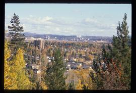
Prince George
2012.13.1.3.135 · Stuk · 12 Oct. 1989
Part of J. Kent Sedgwick fonds

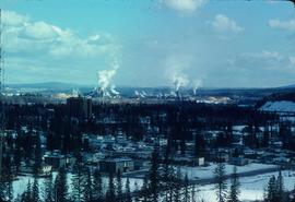
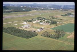
Image depicts Prince George, possibly with the Northwood Pulpmill in the background.

Trees
2012.13.1.6.085 · Stuk · July 1977
Part of J. Kent Sedgwick fonds

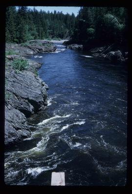
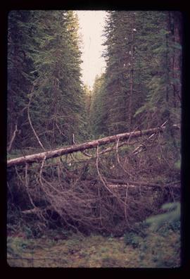
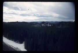
Image depicts numerous trees in an uncertain location; the slide itself is labelled "T.T. Cutting," possibly meaning "Telegraph Trail Cutting."

Houses on Stilts
2012.13.1.6.106 · Stuk · Nov. 1980
Part of J. Kent Sedgwick fonds

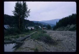
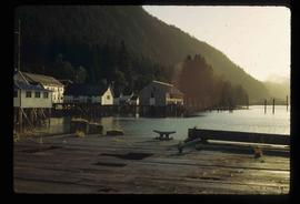
Image depicts a number of houses built on stilts over a body of water in an uncertain location.

Powerline
2012.13.1.3.037 · Stuk · Nov. 1977
Part of J. Kent Sedgwick fonds

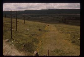
Image depicts power lines east of the pulp mills in Prince George, B.C.

View from Gunn Point
2012.13.1.3.060 · Stuk · Nov. 1979
Part of J. Kent Sedgwick fonds

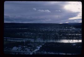
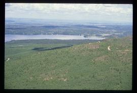
Image depicts a view of Prince George from Gunn Point in the L.C. Gunn Park looking north. Map coordinates 53°54'26.2"N 122°43'35.8"W.

Nechako Cutbanks
2012.13.1.3.090 · Stuk · 12 Oct. 1989
Part of J. Kent Sedgwick fonds

Image depicts the cutbanks on the other side of the Nechako, taken from the nature trail at Island Cache. Map coordinates 53°55'34.6"N 122°45'52.4"W

Nechako Cutbanks Trail
2012.13.1.3.092 · Stuk · 12 Oct. 1989
Part of J. Kent Sedgwick fonds

Image depicts the cutbanks on the other side of the Nechako, taken from the nature trail at Island Cache. Map coordinates 53°55'34.6"N 122°45'52.4"W

2012.13.2.17.34 · Bestanddeel · 1982, 2005
Part of J. Kent Sedgwick fonds

File consists of notes, clippings, and reproductions relating to Mount Robson and the Red Pass. Also includes photographs reproduced in 1982 depicting the Mount Robson Ranch (date of original photographs unknown).

2012.13.2.19.20 · Bestanddeel · 1975-1990
Part of J. Kent Sedgwick fonds

File consists of notes, clippings, and reproductions relating to lava beds in British Columbia, including Aiyansh, also known as the Tseax Cone, in the Nisga'a Memorial Lava Bed Provincial Park. Includes: "Craters of the Moon Guide" special edition newspaper from the United States National Park Service (1990); and "Craters of the Moon: National Monument, Idaho" pamphlet published from the United States National Park Service (1975). File also contains photographs depicting the Nisga'a Memorial Lava Bed Provincial Park.

Prince George cemeteries
2012.13.3.1.01 · Bestanddeel · 1965-2008
Part of J. Kent Sedgwick fonds

File consists of notes, reproductions, and clippings relating to the cemetery in Prince George. Includes: "Landscape of the Past: A brief history of the Prince George municipal cemetery" photocopied essay by Gary McKivett (1999); "RE: SFG cemetery" printed email from Robin and Barbara Fairservice to Kent Sedgwick (8 July 2008); "City of Prince George Memorandum" typescript document from the Heritage Advisory Committee (14 Mar. 1991); "The Prince George Family History Society" brochure (1991); and "City of Prince George by-law no.732" reproduction of a typescript document (Dec. 1953). Also includes "Plan of subdivision of part of Lot 925" a map reproduction depicting the lots beside the Fraser River and the original cemetery (1910).

2012.13.2.01.03 · Bestanddeel · [between 1970 and 1980]
Part of J. Kent Sedgwick fonds

File consists of photocopies and notes relating to the boundary expansions of the city of Prince George since its incorporation. Includes a graph drawn by Kent Sedgwick regarding the addition of land and water each year of the boundary expansion and a "Proclamation" photocopy from the B.C. Gazette (23 Apr. 1953). Also includes 5 maps: "City of Prince George Boundary Expansions since Incorporation in 1915" (1979 or 1980); "City of Prince George" (Feb. 1979); "Map of Prince George" (between 1970 and 1985); "Study Area Boundaries" (Mar. 1977); and "City of Prince George" (Feb. 1972).

Dominion Land Survey system
2012.13.2.02.24 · Bestanddeel · [2007?]
Part of J. Kent Sedgwick fonds

File consists of notes and reproductions relating to the Dominion Land Survey system. File primarily consists of photocopies of original township layout systems between 1881 and 1917 and printed secondary sources on the standardization of the Dominon Land Survey system in British Columbia and Alberta.

Land survey information
2012.13.2.02.25 · Bestanddeel · 1997-2006
Part of J. Kent Sedgwick fonds

File consists of notes, clippings, and reproductions relating to contemporary and historical land surveying in British Columbia, includes material on Hunter Joseph who surveyed Quesnel to Salmon River in 1874; F.P. Burden and the surveying of the Cariboo District; and Mr. J.D. Pemberton, the colonial surveyor in 1851. File primarily consists of Kent Sedgwick's handwritten notes on land surveying in British Columbia and printed search results for the College of New Caledonia and BC Archives on land surveying. Includes: "Owning land: what you should know" pamphlet published by The Canadian Council of Land Surveyors (2004) and "Survey Systems in BC" email chain between Kent Sedgwick and John Whittaker, a B.C. Land Surveyor, discussing past land survey systems and surveyed areas in British Columbia (6 Oct. 2009).

Survey of Prince George
2012.13.2.02.29 · Bestanddeel · 1990
Part of J. Kent Sedgwick fonds

File consists of notes and reproductions relating to the survey of Prince George. Includes material on survey plans, lots in Prince George, original town planning, subdivision plans, and Kent Sedgwick's handwritten notes on surveying and town planning in Prince George. File primarily includes photopied maps depicting town lots and planning in Prince George. Includes: "RE: Title Search for Fairgrounds" typescript letter from Kent Sedgwick to Dr. Dick Rowe (26 Apr. 1990) and "Map showing South Fort George, Fort George (Central) and the additions surveyed in 1910 or later" reproduced map from the Fort George Tribune newspaper.

2012.13.2.02.33 · Bestanddeel · [1990?]
Part of J. Kent Sedgwick fonds

File consists of maps and town surveys of early Prince George. Includes various reproduced 1915 maps and surveys depicting Prince George, Central Fort George, and Fort George: "Subdivision of part of Indian Reserve no. 1 lot 343 Cariboo District BC"; "Parcel Z map 1268"; "Plan of Subdivision lot 933"; "First addition to townsite of Central Fort George"; "Subdivision of lot 1511 Cariboo District BC"; "Townsite of Fort George" map originally made by R.H. Holland; "Plan of Subdivision of lot 1426 Fort George Collins Addition"; "Plan of subdivision of lot 932 Cariboo District"; and "Plan of subdivision of part of lot 2507."

Hatley Park, Victoria
2012.13.2.02.41 · Bestanddeel · 2007
Part of J. Kent Sedgwick fonds

File consists of notes and reproductions relating to Hatley Park, Victoria, which was designed by landscape architects Brett and Hall. Brett and Hall had also assisted in city planning in Prince George. File also contains a CD titled "RRU Archives Brett and Hall Hatley Plans" containing material about the Brett and Hall Hatley plans from the Royal Roads University Archives.

2012.13.2.02.43 · Bestanddeel · 2006
Part of J. Kent Sedgwick fonds

File consists of maps and notes relating to the original Prince George city plans by Brett and Hall. Brett & Hall were landscape architects from Boston, MA who designed the original plan for Prince George, including features such as the Crescents neighbourhood. Includes photographs depicting the original plans by Brett & Hall for Prince George (2006).

Central Fort George townsite
2012.13.2.03.02 · Bestanddeel · 1993-2011
Part of J. Kent Sedgwick fonds

File consists of clippings, notes, and reproductions relating to the Central Fort George townsite. File predominantly includes Kent Sedgwick's handwritten notes regarding land plots and development of Central Fort George. Includes: a map depicting Canadian National Railway plans along Hammond Street and the Fraser River (1936) and "Central Fort George lots" map depicting lot plans for the Central Fort George townsite (reproduced 1990).

2012.13.2.09.04 · Bestanddeel · 1986-2004
Part of J. Kent Sedgwick fonds

File consists of notes, clippings, and reproductions relating to bibliographic references about the central interior of British Columbia. Includes: "Pioneers of the Central Interior" pamphlet from the Prince George Public Library (Nov. 1986) and "Manitoba Department of Tourism and Cultural Affairs" typescript letter from Shirlee Anne Smith to Frank Leonard (9 May 1980).

Maps of Prince George
2012.13.2.11.03 · Bestanddeel · 1987-1996
Part of J. Kent Sedgwick fonds

File consists of notes and reproductions relating to maps and creating maps of Prince George. File predominantly includes photocopies and reproductions of maps of Prince George and neighbourhoods in Prince George. Includes: "Planning division inventory of land use plans and sector plans" typescript document (5 Dec. 1989); "Prince George community planning council" typed letter to Kent Sedgwick attached to multiple maps depicting Prince George (11 Dec. 1996); and "Downtown revitalization committee map loan" typed document and photocopied maps lent to the Downtown Revitalization Committee from Kent Sedgwick (11 Dec. 1996).

2012.13.2.11.04 · Bestanddeel · 1969-1989
Part of J. Kent Sedgwick fonds

File consists of maps and aerial photographs of Prince George. Includes: "Record of gift" typed document to Kent Sedgwick (10 July 1989); "Map showing topography of the incorporated area of Prince George" reproduction of a map depicting topography and lot areas of Prince George, originally drawn 1926; BC5553 No 237" aerial photo reproduction depicting Prince George [ca. 1980]; "Prince George September 1969" aerial photo reproduction (Sept. 1969); and "3rd and Johnson" reproduction of an aerial photo depicting 3rd Avenue and Johnson St in Prince George [ca. 1970]."

2012.13.2.11.05 · Bestanddeel · 1978-2000
Part of J. Kent Sedgwick fonds

File consists of notes and reproductions relating to air photographs of Prince George. File predominantly consists of reproduced air photos and photocopied air photos from the Royal BC Museum and Archives depicting Prince George and region. Includes: "RE: Archive Photos Gd" printed email from Gabrielle Dupuis to Kent Sedgwick (17 Oct. 2000) and "Aerial photograph data sheet" reproduction of a data sheet (27 June 1978).

2012.13.2.11.06 · Bestanddeel · 2007
Part of J. Kent Sedgwick fonds

File consists of notes relating to Kent Sedgwick's collection of maps depicting Prince George and region. File primarily includes handwritten and typed notes from Kent Sedgwick describing and listing various maps he had in his collection.

2012.13.2.11.10 · Bestanddeel · 1983
Part of J. Kent Sedgwick fonds

File consists of notes, clippings, and reproductions relating to the Prince George Rivers Committee. Includes: "Report of the Rivers Committee" spiral bound typescript reports submitted to City Council of the City of Prince George (26 Sept. 1983) and "Submission to Rivers Committee by Heritage Advisory Committee" typescript document by Kent Sedgwick (Apr. 1983).

2012.13.2.14.02 · Bestanddeel · 1973-2010
Part of J. Kent Sedgwick fonds

File consists of clippings, notes, and reproductions relating to the history of Cottonwood Island in Prince George. Includes: "A brief history of cottonwood island" typed draft by Kent Sedgwick (Nov. 2009); "Cottonwood Island area suggestions for street names" typescript document by Kent Sedgwick for the Heritage Advisory Committee; and "Proposal for Cottonwood Island as a park reserve" typescript document by Kent Sedgwick (Aug. 1973). File also includes "Kent Sedgwick - Island Cache / Cottonwood Island" a CD-R containing photographs of the Cottonwood Island and Island Cache area (2009).

2012.13.2.14.10 · Bestanddeel · 2005-2008
Part of J. Kent Sedgwick fonds

File consists of notes, clippings, and reproductions relating to the Cameron Street Bridge in Prince George. Includes: "Oral History Consent Form" document signed by Kent Sedgwick and researcher Angela Quibell (8 Aug. 2007); "What Price Heritage? The Case of the Cameron Street Bridge in Prince George, British Columbia" typed document by Angela Quibell (2007); "Interview with Kent Sedgwick" typed transcript of an oral interview with Kent Sedgwick and Angela Quibell (8 Aug. 2007); and "Nechako Crossing" typed document by Kent Sedgwick (Nov. 2005). Also includes photographs depicting the Nechako bridge model (2008), the plaque describing the history of the 3rd Cameron Street Bridge built in 2009, and the 1st Cameron Street Bridge built in 1916 (photographic reproduction ca. 2008).

East Line slide lists
2012.13.2.17.05 · Bestanddeel · 2000-2002
Part of J. Kent Sedgwick fonds

File consists of lists and printed emails relating to slides and photographs depicting the East Line. Includes a CD that contains slides and photographs depicting the East Line (2000).

East Line photos
2012.13.2.17.06 · Bestanddeel · [between 1999 and 2005]
Part of J. Kent Sedgwick fonds

File consists of notes and printed photographs relating to the East Line. The file includes photographs that depict various areas on the Upper Fraser and within the communities, including Dome Creek; Sinclair Mills; Penny; Grand Canyon; and Crescent Spur (between 1999 and 2005).