2020.08.92
·
Item
·
[between 1909 and 1919]
Parte de Pacific Great Eastern Railway Region Photograph Collection
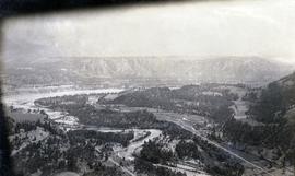
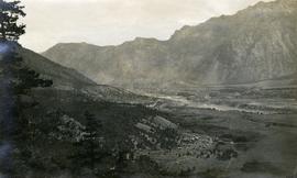
Photograph depicts a view of the Lillooet Indian Reserve in the foreground; the town of Lillooet and the Fraser River are visible beyond.