Affichage de 128 résultats

Archival description
70 résultats avec objets numériques Afficher les résultats avec des objets numériques
Duke of Sutherland
2012.13.2.20.03 · Dossier · 2011
Fait partie de J. Kent Sedgwick fonds

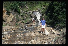
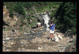
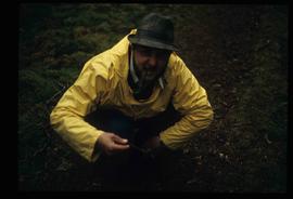
File consists of notes and reproductions relating to the Duke of Sutherland. Also includes photographs depicting the area of White's Landing in Strathnaver (2010).

2012.13.2.14.05 · Dossier · 2009
Fait partie de J. Kent Sedgwick fonds

File consists of notes, clippings, and reproductions relating to the Alexander Mackenzie monument in Prince George. Includes a photograph depicting Judge Howay at the unveiling of the original National Historic Monument to Alexander Mackenzie in Prince George on 13 June 1925 (reproduced 2009).

2012.13.2.02.42 · Dossier · 2009
Fait partie de J. Kent Sedgwick fonds

File consists of printed emails and typed documents relating to Brett & Hall and an exhibit for the National Gallery of Canada. Brett & Hall were landscape architects from Boston, MA who designed the original plan for Prince George, including features such as the Crescents neighbourhood.

4th Duke of Sutherland
2012.13.2.20.21 · Dossier · 2007
Fait partie de J. Kent Sedgwick fonds

File consists of reproductions relating to the 4th Duke of Sutherland, Cromartie Sutherland-Leveson-Gower (1851-27 June 1913).

Fort Alexandria
2012.13.2.19.07 · Dossier · 2007-2010
Fait partie de J. Kent Sedgwick fonds

File consists of notes and reproductions relating to Fort Alexandria (later renamed Alexandria). Fort Alexandria was an HBC trading post, ferry site, and steamboat landing in the North Cariboo, 45 km south of Quesnel. File contains photographs depicting Fort Chilcotin, the landscape and buildings (Sept. 1983 and Aug. 2006).

Prince George urban planning
2012.13.2.02.35 · Dossier · 2006-2010
Fait partie de J. Kent Sedgwick fonds

File consists of notes and reproductions relating to the planning of the Prince George townsite. Includes material on surveyors, Fred Burden, and town planners working with the landscape architects Brett and Hall on the development of the townsite. File predominantly consists of Kent Sedgwick's handwritten notes on townsite planning in Prince George. Includes a clipped article from the Prince George Citizen newspaper "Town planners involved landscape architects" (4 Nov. 2006).

2012.13.2.19.06 · Dossier · 2006-2011
Fait partie de J. Kent Sedgwick fonds

File consists of notes and reproductions relating to bibliographic references about Fort Alexandria (later renamed Alexandria). Fort Alexandria was a trading post, ferry site, and steamboat landing in the North Cariboo, 45 km south of Quesnel.

Royal Engineers and Henry Spencer Palmer
2012.13.2.10.07 · Dossier · 2006
Fait partie de J. Kent Sedgwick fonds

File consists of notes and reproductions relating to the Royal Engineers and Henry Spencer Palmer, a British Army military engineer and surveyor. Henry Spencer Palmer was sent to British Columbia and completed a report in 1863 on Wiliams Lake, the Caribou Districts, and the Fraser River from Fort Alexandria to Fort George. File primarily consists of Kent Sedgwick's handwritten notes on Henry Palmer and his work in British Columbia.

Simon Fraser
2012.13.2.02.55 · Dossier · 2006-2008
Fait partie de J. Kent Sedgwick fonds

File consists of notes, clippings, and reproductions relating to research conducted by Kent Sedgwick on Simon Fraser, Canadian explorer and fur trader. Includes: "Simon Fraser: The Birth of Modern British Columbia" special edition issue of the Vancouver Sun newspaper (3 Jan. 2006).

Mount Sir Alexander
2012.13.2.19.12 · Dossier · 2006-2010
Fait partie de J. Kent Sedgwick fonds

File consists of notes, clippings, and reproductions relating to Mount Sir Alexander, a mountain in the Sir Alexander Area of the Continental Ranges of the BC Canadian Rockies.

2012.13.2.02.50 · Dossier · 2004-2011
Fait partie de J. Kent Sedgwick fonds

File consists of notes, clippings, and reproductions relating to encouraging settlement and immigration to Prince George. Includes material on Dutch settlement in Prince George; the Hornby Plan, a 1933 settlement plan by the Canadian National Railway to develop communities and stimulate business for the railway, particularly in Prince George; promoting Prince George for settlers; reserved land for veterans; and auction of lands to cover delinquent taxes in British Columbia.

2012.13.2.02.53 · Dossier · 2004-2006
Fait partie de J. Kent Sedgwick fonds

File consists of notes and reproductions relating to soldier land settlement in northern British Columbia following the First World War. Includes material regarding the British Columbia Land Settlement Act; the allotment of land for Prince George; and the opening of reserved lands for veterans. Includes a printed article entitled "Soldiers, Settlement and Development in British Columbia, 1915-1930" by Paul Koroscil (2000).

2012.13.2.02.32 · Dossier · 2003-2004
Fait partie de J. Kent Sedgwick fonds

File consists of notes and reproductions relating to the boundary survey done by A.O. Wheeler, who was employed by British Columbia Government as a surveyor in 1922 to survey the boundary between British Columbia and Alberta.

Land surveyors
2012.13.2.02.27 · Dossier · 2003-2009
Fait partie de J. Kent Sedgwick fonds

File consists of notes and reproductions relating to land surveyors working in British Columbia. Includes material on Rupert Williams Haggen who became a land surveyor in 1911 and surveyed Prince George, Quesnel, Bowron River, and the Fraser River area below Quesnel; Henry Fry who worked in Victoria between 1871 and 1897; Otto Julius Klotz who surveyed the Alaska-British Columbia boundary and also surveyed for the Canadian Pacific Railway between 1871 to 1927; James Herrick McGregor who worked in the Kootenays and assisted for the survey of the British Columbia Alberta border between 1891 and 1903; and Forin Campbell who came to Prince George in 1908.

Frank Swannell
2012.13.2.02.31 · Dossier · 2002-2008
Fait partie de J. Kent Sedgwick fonds

File consists of notes, clippings, and reproductions relating to Frank Swannell, who was a surveyor in British Columbia that surveyed many areas across the province between 1898 and 1908.

Father Adrien Morice
2012.13.2.10.06 · Dossier · 2001
Fait partie de J. Kent Sedgwick fonds

File consists of notes, clippings, and reproductions relating to Father Adrien Morice. Father Adrien Morice was a missionary and was ordained as a priest who came to British Columbia in 1880 to complete his ecclesiastical studies. After completing his schooling he was signed to the Williams Lake Mission where he worked closely with the Chilcotin peoples, learning their language and ministering. He continued to learn Chinook before moving to work at Stuart Lake with the Na'Kaztl'Tenneh Band in 1885, working with four divisions of the Carrier Tribes, the Alexandria, Quesnel, Blackwater, and Lhuskuz. Morice continued to use the Cree language and eventually published a monthly newspaper between 1881 and 1884 called "Tsettes Nahivelnik" (meaning "storyteller") using the Cree language. File primarily consists of handwritten notes by Kent Sedgwick regarding Father Adrien Morice and his work.

Hudson's Bay Company subdivision
2012.13.2.02.46 · Dossier · 2001-2005
Fait partie de J. Kent Sedgwick fonds

File consists of notes and reproductions relating to the Hudson's Bay Company subdivision. Includes material on the subdivision, survey, and sale of lands in Fort George owned by the Hudson's Bay Company.

Fred Burden
2012.13.2.02.30 · Dossier · 2001-2006
Fait partie de J. Kent Sedgwick fonds

File consists of notes and reproductions relating to Fred Burden, a surveyor in British Columbia who surveyed tar sands in the Fort McMurray region and returned to Prince George in 1921 to complete a topographical survey of Prince George.

British Columbia Express Company
2012.13.2.15.07 · Dossier · 2001-2004
Fait partie de J. Kent Sedgwick fonds

File consists of notes, clippings, and reproductions relating to the British Columbia Express Company. Barnard's Express, later known as the British Columbia Express Company or BX, was a pioneer transportation company that served the Cariboo and Fraser-Fort George regions in British Columbia, Canada from 1861 until 1921.

2012.13.2.02.54 · Dossier · 2000-2004
Fait partie de J. Kent Sedgwick fonds

File consists of notes and reproductions relating to the North Coast Land Company, Russel Walker, and Rattenbury Lands. The North Coast Land Company owned and sold many plots of land alongside the developing Pacific Great Eastern Railway line in Fort George and Prince George. The company had an office on George Street. Russel Walker was a sales agent and manager of the North Coast Land Company in Fort George and Prince George, Walker had also become the publisher and editor of the Fort George Herald newspaper. Russel Walker worked in Prince George between 1910 and 1916. Rattenbury Lands was a company that held and sold land in the Prince George area during the 1910s and 1920s, as they had taken over most of the land from The North Coast Land Company. File primarily consists of photocopied newspaper clippings, including articles and advertisements for the North Coast Land Company.

Carrier Lake brigade trail
2012.13.4.12 · Dossier · [1999?]
Fait partie de J. Kent Sedgwick fonds

File consists of notes and a reproduced map relating to Carrier Lake in the Omineca region, 35 km east from Fort St. James.

Salmon River Portage photographs
2012.13.4.08 · Dossier · 1999-2000
Fait partie de J. Kent Sedgwick fonds

File consists of photographs depicting the Salmon River Portage. Includes depictions of potential past mill sites, overgrown fields, and derelict buildings.

David Thompson
2012.13.2.13.07 · Dossier · 1998, 2004-2011
Fait partie de J. Kent Sedgwick fonds

File consists of notes, clippings, and reproductions relating to David Thompson, surveyor, cartographer, and fur trader with the Hudson's Bay Company and North West Company.

2012.13.2.02.40 · Dossier · 1998-2006
Fait partie de J. Kent Sedgwick fonds

File consists of reproductions and photocopies of articles on the history of city planning in North America. File predominantly consists of printed articles: "Encyclopedia of Urban Planning" by Arnold Whittick; "Radburn and the American Planning Movement: The Persistence of an Idea" by Eugenie Ladner Birch; "The Making of Urban America: A History of City Planning in the United States" by John W. Reps; and "The Story of the Planner's Journal 1915-1980" by Donald A. Krueckberg.

2012.13.2.02.34 · Dossier · 1996-1998
Fait partie de J. Kent Sedgwick fonds

File consists of notes and reproductions relating to Brett & Hall landscape architecture and urban planning in Canada. File predominantly consists of photocopies of articles relating to urban planning, including "The Influence of Thomas Adams and the British New Towns Movement in the Planning of Canadian Resource Communities" by Oiva Saarinen; "Thomas Adams and the Commission of Conservation" by Alan H. Armstrong; "The Laying Out of Towns" by W.H. Dorsey; "The Relation of the City Engineer to Public Parks" by John C. Olmsted; "The Planning of Company Communities in the Lake Superior Mining Region" by Arnold R. Alanen; and "Planning the Canadian Environment" by L.O. Gertler.

2012.13.2.02.36 · Dossier · 1996-2003
Fait partie de J. Kent Sedgwick fonds

File consists of notes and reproductions relating to Brett and Hall city planning work for Prince George. Brett & Hall were landscape architects from Boston, MA who designed the original plan for Prince George, including features such as the Crescents neighbourhood.

Two People, Two Dogs
2012.13.1.84.06 · Pièce · 1994
Fait partie de J. Kent Sedgwick fonds

Image depicts two individuals and two dogs standing by a stream at an uncertain location, possibly somewhere in Bear Glacier Provincial Park. The woman in purple is possibly Sue Sedgwick.

Three People, Three Dogs
2012.13.1.84.04 · Pièce · 1994
Fait partie de J. Kent Sedgwick fonds

Image depicts three individuals and three dogs standing by a stream at an uncertain location, possibly somewhere in Bear Glacier Provincial Park. The woman in purple is possibly Sue Sedgwick.

Two People, Three Dogs
2012.13.1.84.05 · Pièce · 1994
Fait partie de J. Kent Sedgwick fonds

Image depicts two individuals and three dogs standing by a stream at an uncertain location, possibly somewhere in Bear Glacier Provincial Park. The woman in purple is possibly Sue Sedgwick.

Simon Fraser
2012.13.2.13.06 · Dossier · 1993, 2007-2008
Fait partie de J. Kent Sedgwick fonds

File consists of notes, clippings, and reproductions relating to Simon Fraser, Canadian explorer and North West Company fur trader who charted much of what is now the Canadian province of British Columbia and founded a number of BC communities, including Prince George (Fort George). Includes a photograph depicting a bicentennial celebration at Fort George Park (1993).

Survey of Prince George
2012.13.2.02.29 · Dossier · 1990
Fait partie de J. Kent Sedgwick fonds

File consists of notes and reproductions relating to the survey of Prince George. Includes material on survey plans, lots in Prince George, original town planning, subdivision plans, and Kent Sedgwick's handwritten notes on surveying and town planning in Prince George. File primarily includes photopied maps depicting town lots and planning in Prince George. Includes: "RE: Title Search for Fairgrounds" typescript letter from Kent Sedgwick to Dr. Dick Rowe (26 Apr. 1990) and "Map showing South Fort George, Fort George (Central) and the additions surveyed in 1910 or later" reproduced map from the Fort George Tribune newspaper.

Land exploration in British Columbia
2012.13.2.02.61 · Dossier · 1989
Fait partie de J. Kent Sedgwick fonds

File consists of notes and reproductions relating to land exploration and surveying in British Columbia by Alfred R.C. Selwyn, who was a British geologist and public servant, director of the Geological Survey of Victoria from 1852 to 1869, director of the Geological Survey of Canada from 1869 to 1894, and President of the Royal Society of Canada from 1895 to 1896. Includes: "Photography: Mirror of the Past" American History magazine special edition (Sept. 1989) and a photocopied article "Ninety Years Later" by F.C. Swannell from The Beaver magazine (1956). File also includes reproduced photographs depicting scenes from Selwyn's exploration around British Columbia (1989).

"Arrival of Steel" CN Rail plaque
2012.13.2.14.07 · Dossier · 1987-1989
Fait partie de J. Kent Sedgwick fonds

File consists of notes, letters, and reproductions relating to the "Arrival of Steel" CN Railway plaque in Prince George. Includes: "Invitation" from the City of Prince George for the unveiling of the CN plaque (27 Jan. 1989) and correspondence letters between CN and the City of Prince George (1987-1989). Also includes photographs depicting the CN plaque and the unveiling ceremony (Jan. 1989).

Mackenzie, BC
2012.13.2.19.13 · Dossier · 1985, 2002
Fait partie de J. Kent Sedgwick fonds

File consists of a note and reproduction relating to Mackenzie, BC.

2012.13.2.14.06 · Dossier · 1985-1993
Fait partie de J. Kent Sedgwick fonds

File consists of notes, clippings, and reproductions relating to the new Alexander Mackenzie monument in Fort George Park (renamed Lheidli T'enneh Memorial Park). Includes: "British Columbia Heritage Brigade Journey" pamphlet from Parks Canada and Canoe Sport B.C. (1985); "Alexander Mackenzie Trail Association" newsletter No. 9 (1987); "Alexander Mackenzie Voyageur Association" newsletter No. 36 (1994); and correspondence letters between John D. Adams, Supervisor of Interpretation and Heritage Site operations for the Province of British Columbia and Kent Sedgwick (Apr.- May 1986). Also includes photographs depicting the new Alexander Mackenzie monument and people at the unveiling (1985).

Luther Collins Gunn and L.C. Gunn Park
2012.13.3.1.55 · Dossier · 1985-1990, 2006
Fait partie de J. Kent Sedgwick fonds

File consists of notes and reproductions relating to Luther Collins Gunn and L.C. Gunn Park. Luther Colins Gunn was a survey engineer who had done work for the Grand Trunk Pacific Railway and the Pacific Great Eastern Railway when he arrived in Prince George. The L.C. Gunn trail follows the same route used by Gunn when surveying the rail routes in the Prince George area. Includes: "Gunn Point" typescript document by Ted Williams for the Heritage Advisory Committee (1985); "A Proposal - The L.C. Gunn Viewpoint" typescript letter to Mr. Mac Norris, president of the B.C.R. Company from Ted Williams and the Heritage Advisory Committee (27 Jan. 1987); and "Item of business, proposed use of District Lot # 486" typescript letter from the Heritage Advisory Committee to Beverley Pitman, Planning Assistant (31 May 1979). Also includes photographs depicting the Moffat farm (2005).

2012.13.3.3.02 · Dossier · 1985
Fait partie de J. Kent Sedgwick fonds

File consists of bound documents, plans, and reproductions. Includes: "Public input summary" spiral bound book from Parks Canada (Dec. 1985) and "Alexander Mackenzie Heritage Trail" bound book published by Parks Canada (17 July 1985).

2012.13.2.02.57 · Dossier · 1984-2002
Fait partie de J. Kent Sedgwick fonds

File consists of notes and reproductions of Frank Leonard's writings and research for his 1984 BC Studies article "Grand Trunk Pacific and the Establishment of the City of Prince George, 1911-1915". Includes: "Grand Trunk Pacific and the Establishment of Prince George 1911-1915" typescript document by Frank Leonard for his PhD dissertation (Feb. 1984) and "The Grand Trunk Pacific Railway Company and the Development of Northern British Columbia, 1902-1919" outline of dissertation chapters typescript document by Frank Leonard (1984).

2012.13.2.02.62 · Dossier · 1983-1986, 2001
Fait partie de J. Kent Sedgwick fonds

File consists of notes and reproductions relating to George Dawson and the Geological Survey of Canada. Includes: "Museum Mirror" Fraser-Fort George Regional Museum newsletter vol. 1 no. 2 (June 1986). File also includes photographs depicting various sights around British Columbia from George Dawson's explorations (1983 reproduced).

Cemetery
2012.13.1.78.21 · Pièce · 1982
Fait partie de J. Kent Sedgwick fonds

Image depicts an individual crouching in an old cemetery located somewhere in the coastal forest on Haida Gwaii, B.C.

Kent Sedgwick and a Slug
2012.13.1.78.53 · Pièce · 1982
Fait partie de J. Kent Sedgwick fonds

Image depicts Kent Sedgwick crouching and holding a stick; the slug on the end is barely visible. Located somewhere on Haida Gwaii.

Historic trails
2012.13.2.13.03 · Dossier · 1982-1986
Fait partie de J. Kent Sedgwick fonds

File consists of notes, clippings, and reproductions relating to historic trails in British Columbia. Includes material on The Okanagan Brigade Trail; the exploration trails of Jean Caux (better known as Cataline); and Hudson's Bay Company brigade trails. Includes: "The Okanagan Brigade Trail" pamphlet from the Okanagan Historical Society (1986); "The Okanagan Brigade Trail in the South Okanagan" pamphlet by Bob Harris, Harley Hatfield, and Peter Tassie (1989); and "Historic Routes '82" symposium program (1982).