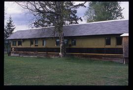
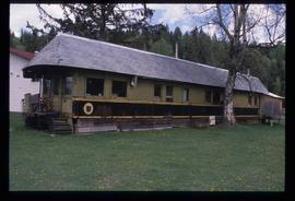
Aperçu avant impression Fermer

Affichage de 1595 résultats

Archival description
Log House
2012.13.1.6.270 · Pièce · [2006?]
Fait partie de J. Kent Sedgwick fonds

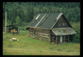
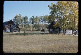
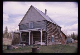
Image depicts a log house at an uncertain location.

Dunlevy Barn
2012.13.1.50.146 · Pièce · 2006
Fait partie de J. Kent Sedgwick fonds

Image depicts an old barn located somewhere near Dunlevy Creek in the Dawson Creek area.

Shed
2012.13.1.6.273 · Pièce · [2006?]
Fait partie de J. Kent Sedgwick fonds

Image depicts a shed in an unknown location.

Old Cabins
2012.13.1.6.271 · Pièce · [2006?]
Fait partie de J. Kent Sedgwick fonds

Image depicts several old log cabins, possibly at McLeod Lake.

McBride - Engine Services
2012.13.1.85.59 · Pièce · [2004?]
Fait partie de J. Kent Sedgwick fonds

Image depicts a machine shop somewhere in McBride, B.C. The sign above the door reads "McBride Air Cooled Engine Services Ltd."

Penny - Hiking Trail Signs
2012.13.1.88.49 · Pièce · 2004
Fait partie de J. Kent Sedgwick fonds

Image depicts two signs for hiking trails in Penny, B.C. One reads: "Hiking trail to Red Mt. Lake (Grizzly Bear Mt.) expect to meet wild animals."

Rail Car House
2012.13.1.20.29 · Pièce · [between 2002 and 2004]
Fait partie de J. Kent Sedgwick fonds

Image depicts a house made from a rail car in an uncertain location. It could be in Hixon, Red Rock, or Woodpecker, B.C.

McBride - Church
2012.13.1.85.62 · Pièce · [2004?]
Fait partie de J. Kent Sedgwick fonds

Image depicts a church somewhere in McBride, B.C. The sign in front possibly reads "St. Patrick's Church."

McBride - Abandoned Corner Store
2012.13.1.85.64 · Pièce · [2004?]
Fait partie de J. Kent Sedgwick fonds

Image depicts an abandoned building on the corner of a street in McBride, B.C. The faded letters on the side read: "McBride Trading Co. Mens Wear, Drugs, Equipment."

Hansard Bridge
2012.13.1.89.182 · Pièce · 2004
Fait partie de J. Kent Sedgwick fonds

Image depicts the new Hansard Bridge. Map coordinates 54°04'57.9"N 121°51'10.1"W

Hansard Bridge
2012.13.1.89.183 · Pièce · 2004
Fait partie de J. Kent Sedgwick fonds

Image depicts the new Hansard Bridge. Map coordinates 54°04'57.9"N 121°51'10.1"W

Rail Car House
2012.13.1.20.27 · Pièce · [between 2002 and 2004]
Fait partie de J. Kent Sedgwick fonds

Image depicts a house made from a rail car in an uncertain location. It could be in Hixon, Red Rock, or Woodpecker, B.C.

Mellos House
2012.13.1.88.51 · Pièce · 2004
Fait partie de J. Kent Sedgwick fonds

Image depicts a house with torn-up siding. The slide is labelled: "Mellos house relocated from Penny." The location is uncertain.

Two People and a Mobile Home
2012.13.1.89.181 · Pièce · 2004
Fait partie de J. Kent Sedgwick fonds

Image depicts two unidentified individuals speaking to each other in the doorway of what appears to be a mobile home. The location is uncertain.

Hansard Rail Bridge
2012.13.1.89.184 · Pièce · 2004
Fait partie de J. Kent Sedgwick fonds

Image depicts the Hansard railroad bridge taken from the new Hansard vehicle bridge. Map coordinates 54°04'58.1"N 121°50'58.0"W

Rail Car House
2012.13.1.20.28 · Pièce · [between 2002 and 2004]
Fait partie de J. Kent Sedgwick fonds

Image depicts a house made from a rail car in an uncertain location. It could be in Hixon, Red Rock, or Woodpecker, B.C.

Studio 2880 Arts Complex
2012.13.1.3.170 · Pièce · Apr. 2003
Fait partie de J. Kent Sedgwick fonds

Image depicts Studio 2880 Arts Complex in Prince George, B.C. Map coordinates 53°54'36.9"N 122°46'30.3"W

Spruceland
2012.13.1.5.24 · Pièce · Mar. 2003
Fait partie de J. Kent Sedgwick fonds

Image depicts a Lakewood view of Spruceland in Prince George, B.C.

College Heights
2012.13.1.5.25 · Pièce · Mar. 2003
Fait partie de J. Kent Sedgwick fonds

Image depicts College Heights, particularly along Gladstone Drive, in Prince George, B.C.

Trailer Park
2012.13.1.5.27 · Pièce · Mar. 2003
Fait partie de J. Kent Sedgwick fonds

Image depicts a trailer park by either the Fraser or Nechako River in Prince George, B.C.