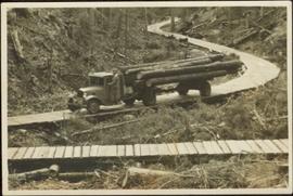
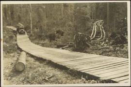
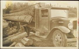
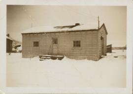
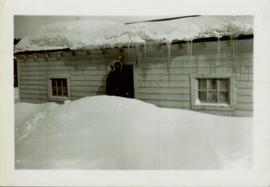
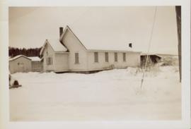
Showing 57 results

Archival description
2011.12.05 · Item · [ca. September 1950- June 1951]
Part of Giscome, BC Historical Photograph collection

Photograph of various plant life with Eagle Lake visible in the background. Handwritten annotation in pen on verso reads: “Eagle Lake from the top of the bluff. Eagle Lake is about 7 miles long & about 1 mile wide. It is a fair sized lake.”

Open Field in Giscome
2012.13.1.87.068 · Item · [between 1975 and 1995]
Part of J. Kent Sedgwick fonds

Image depicts a field in Giscome, B.C. On the right side of the image, in the background, is a grey strip that appears to be a mine, possibly the quarry at Eaglet Lake in Giscome, B.C. Map coordinates 54°03'52.9"N 122°22'10.0"W

Open Field in Giscome
2012.13.1.87.069 · Item · [between 1975 and 1995]
Part of J. Kent Sedgwick fonds

Image depicts a field in Giscome, B.C. On the right side of the image, in the background, is a grey strip that appears to be a mine, possibly the quarry at Eaglet Lake in Giscome, B.C. Map coordinates 54°03'52.9"N 122°22'10.0"W

Giscome Landscape
2012.13.1.87.071 · Item · [between 1975 and 1995]
Part of J. Kent Sedgwick fonds

Image depicts an open area with Eaglet Lake in the background. It depicts the previous site of the mill at Giscome, B.C. Map coordinates 54°04'19.7"N 122°22'04.7"W

Giscome Quarry
2012.13.1.87.074 · Item · [between 1975 and 1995]
Part of J. Kent Sedgwick fonds

Image depicts what is possibly the quarry located at Eaglet Lake in Giscome, B.C.

Giscome Dairy Farm
2012.13.1.87.083 · Item · [between 1975 and 1995]
Part of J. Kent Sedgwick fonds

Image depicts a large, old and collapsing barn, as well as a nearby house of the dairy farm in Giscome, B.C. Map coordinates 54°03'53.3"N 122°21'22.6"W

2012.13.1.87.087 · Item · [between 1975 and 1995]
Part of J. Kent Sedgwick fonds

Image depicts the Giscome mill site in Giscome, B.C. The railroad tracks are in the foreground. Map coordinates 54°04'17.6"N 122°22'06.1"W

Giscome - Eaglet Lake
2012.13.1.87.090 · Item · [between 1980 and 2000]
Part of J. Kent Sedgwick fonds

Image depicts mill site and dock in Giscome, B.C. with Eaglet Lake in the background covered in ice. There is a large crowd of people gathered near the dock. Map coordinates 54°04'34.9"N 122°21'50.0"W

Giscome - Power Poles
2012.13.1.87.098 · Item · [between 1975 and 1995]
Part of J. Kent Sedgwick fonds

Image depicts the remains of a street of houses in Giscome, B.C. The quarry is slightly visible in the background. Map coordinates 54°04'20.9"N 122°21'53.1"W

Giscome Dairy Farm
2012.13.1.87.141 · Item · [between 1975 and 1995]
Part of J. Kent Sedgwick fonds

Image depicts the dairy farm in Giscome, B.C. Map coordinates 54°03'53.3"N 122°21'22.6"W

Giscome Dairy Farm
2012.13.1.87.152 · Item · [between 1975 and 1995]
Part of J. Kent Sedgwick fonds

Image depicts the dairy farm in Giscome, B.C. Map coordinates 54°03'53.3"N 122°21'22.6"W

Giscome Bunkhouse
2012.13.1.87.158 · Item · [between 1975 and 1995]
Part of J. Kent Sedgwick fonds

Image depicts the Giscome bunkhouse in Giscome, B.C. Map coordinates 54°04'17.6"N 122°22'06.1"W

House in Giscome
2012.13.1.87.159 · Item · [between 1975 and 1995]
Part of J. Kent Sedgwick fonds

Image depicts a house in Giscome, B.C. Map coordinates 54°04'17.6"N 122°22'06.1"W

Giscome Community Hall
2012.13.1.87.160 · Item · [between 1975 and 1995]
Part of J. Kent Sedgwick fonds

Image depicts the Giscome Community Hall in Giscome, B.C. Map coordinates 54°04'18.5"N 122°21'57.7"W

Giscome CN Station
2012.13.1.87.161 · Item · [between 1975 and 1995]
Part of J. Kent Sedgwick fonds

Image depicts the old CN station in Giscome, B.C. Map coordinates 54°04'20.7"N 122°22'01.1"W