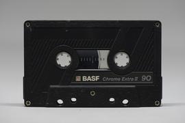
Affichage de 3113 résultats

Archival description
Dunlevy Creek?
2012.13.1.50.138 · Pièce · 2006
Fait partie de J. Kent Sedgwick fonds

Image depicts the Dunlevy Creek area somewhere near Dawson Creek, B.C. The slide is simply labelled "Dunlevy irrigation" for uncertain reasons.

Shed
2012.13.1.6.273 · Pièce · [2006?]
Fait partie de J. Kent Sedgwick fonds

Image depicts a shed in an unknown location.

Soda Creek
2012.13.1.50.139 · Pièce · 2006
Fait partie de J. Kent Sedgwick fonds

Image depicts rail road tracks through a forest, as well as a river; located in Soda Creek, B.C.

Old Cabins
2012.13.1.6.271 · Pièce · [2006?]
Fait partie de J. Kent Sedgwick fonds

Image depicts several old log cabins, possibly at McLeod Lake.

2009.6.1.707 · Pièce · [12 October 2006]
Fait partie de The Honourable Iona Campagnolo fonds

Campagnolo sits in centre, wearing black and green. Photograph is one of 13 images printed from digital format on a CD-R featuring members of a group referred to as 'Terracites' (see item 2009.6.1.697) pictured in the gardens; see also items 2009.6.1.698 - 2009.6.1.710.

Dunlevy Creek?
2012.13.1.50.137 · Pièce · 2006
Fait partie de J. Kent Sedgwick fonds

Image depicts the Dunlevy Creek area somewhere near Dawson Creek, B.C. The slide is simply labelled "Dunlevy irrigation" for uncertain reasons.

2006.18.1.12 · Dossier · 2006-2007
Fait partie de Aleza Lake Research Forest Society fonds

File consists of:

  • David Mills, "Aleza Lake Research Forest Historical Internship Summary" (2 Jan. 2007), 26 p. - In print and original digital .doc file
  • David Mills, "Aleza Lake Forest Experiment Station Socio-Economic Time Line 1905-1937" (2007), 68 p. - In print and original digital .doc file
  • ALRFS employment paperwork for David Mills, the ALRFS Natural Resource History Intern
  • Research notes, including a copy of a map of the town of Aleza Lake in the 1920s
Hansard Bridge
2012.13.1.89.182 · Pièce · 2004
Fait partie de J. Kent Sedgwick fonds

Image depicts the new Hansard Bridge. Map coordinates 54°04'57.9"N 121°51'10.1"W

Hansard Bridge
2012.13.1.89.183 · Pièce · 2004
Fait partie de J. Kent Sedgwick fonds

Image depicts the new Hansard Bridge. Map coordinates 54°04'57.9"N 121°51'10.1"W

Origin of Yellowhead Highway
2012.13.1.85.49 · Pièce · Oct. 2004
Fait partie de J. Kent Sedgwick fonds

Image depicts an old road through the trees near Yellowhead Pass. The slide labels it as the origin of the Yellowhead highway.