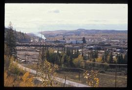
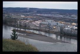
Image depicts Prince George, possibly with the Northwood Pulpmill in the background.
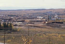
Image depicts the Lakeland Sawmill in Prince George, B.C, identified by the beehive burners; the one with white smoke belonged to Pas Lumber Co. which was bought out by Lakeland in 1987.
Image depicts the Lakeland Sawmill in Prince George, B.C.
Image depicts the Northwood pulpmill in Prince George B.C.
Image depicts Prince George, possibly with the Northwood Pulpmill in the background.
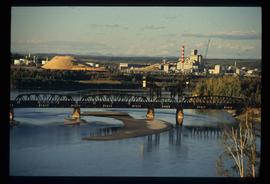
Image depicts two mills; the Intercontinental Pulp Mill is on the right in the foreground, and the Prince George Pulp and Paper Mill is on the left in the background. The picture is taken from the South, possibly off Yellowhead Bridge in Prince George, B.C.
Tourist map of Prince George depicts city area, including railway trackage.
Image depicts a sawmill, possibly Lakeland Sawmill, in Prince George B.C.
Image depicts a pulpmill, likely Northwood, in Prince George, B.C.
Image depicts the Prince George Sawmill from the Northwood Bridge.
File consists of an audio recording of an interview with Earl Lousier and Harry Gairns. Includes two original recorded audio cassettes.
File consists of a transcript of an oral history interview with Earl Lousier and Harry Gairns.
File consists of a transcript of an oral history interview with Jack Boudreau. Also includes photocopies of Jack Boudreau's personal records, such as the Diary of Ada (Adelia) Sykes.
File consists of an audio recording of an interview with Jack Boudreau. Includes one original recorded audio cassette and one copy.
File consists of a transcript of an oral history interview with Ivan Andersen.
File consists of an audio recording of an interview with Ivan Andersen. Includes one original recorded audio cassette and one copy.
File consists of a transcript of an oral history interview with Bob Harkins/
File consists of an audio recording of an interview with Bob Harkins. Includes two original recorded audio cassettes and one copy.
Image depicts the Northwood Pulpmill in Prince George, B.C. taken from above the Nechako River looking east. Map coordinates 53°56'00.0"N 122°44'29.7"W
Image depicts a sawmill in Prince George, B.C.
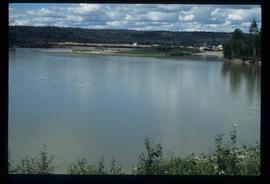
Image depicts Prince George Sawmill taken from across the Nechako River looking southwest. Map coordinates 53°56'00.0"N 122°44'29.7"W
Image depicts Prince George Sawmill taken from across the Nechako River looking southwest. Map coordinates 53°56'00.0"N 122°44'29.7"W
File consists of a transcript of an oral history interview with Lea Gobbi and Kate Anderson.
File consists of an audio recording of an interview with Lea Gobbi and Kate Anderson. Includes two original recorded audio cassettes and two copies.
File consists of a transcript of an oral history interview with Carl Strom.
File consists of an audio recording of an interview with Carl Strom. Includes one original recorded audio cassette and one copy.
File consists of an audio recording of an interview with Bill Wade. Includes one original recorded audio cassette and one copy.
File consists of a transcript of an oral history interview with Bill Wade.
File consists of a transcript of an oral history interview with Andre Laquerre.
File consists of an audio recording of an interview with Andre Laquerre. Includes one original recorded audio cassette.
File consists of an audio recording of an interview with Lawrence Grinde. Includes two original recorded audio cassettes and four copies.
File consists of a transcript of an oral history interview with Lawrence Grinde.
File consists of a transcript of an oral history interview with Myra and Glen Hooker.
File consists of a transcript of an oral history interview with Jim and Dianne Humphreys.
File consists of an audio recording of an interview with Myra and Glen Hooker. Includes one original recorded audio cassette and one copy.
File consists of an audio recording of an interview with Jim and Dianne Humphreys. Includes one original recorded audio cassette and one copy.
File consists of an audio recording of an interview with Horst Sander. Includes two original recorded audio cassettes and two copies.
File consists of a transcript of an oral history interview with Horst Sander. Also includes photocopies of Horst Sander's personal records, such as a tree farm license.
File consists of an audio recording of an interview with John and Bernice Trick. Includes one original recorded audio cassette and one copy.
File consists of a transcript of an oral history interview with John and Bernice Trick.
File consists of a transcript of an oral history interview with Doug Homme. Also includes photocopies of Doug Homme's personal records, such as photographs.
File consists of a transcript of an oral history interview with Jim Burbee.
File consists of an audio recording of an interview with Jim Burbee. Includes one original recorded audio cassette and one copy.
File consists of an audio recording of an interview with John Broderick. Includes one copy of the original recorded audio cassette; the original recording is not held by the archives.
File consists of a transcript of an oral history interview with John Broderick.
File consists of an audio recording of an interview with Terry Johnson. Includes one original recorded audio cassette and one copy.
File consists of a transcript of an oral history interview with Terry Johnson.
File consists of a transcript of an oral history interview with John Gaal.
File consists of an audio recording of an interview with John Gaal. Includes one original recorded audio cassette and one copy.
File consists of a transcript of an oral history interview with Ray Williston.

