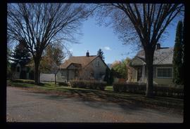
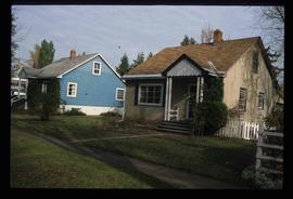
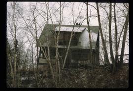
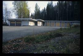
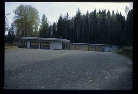
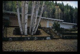
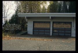
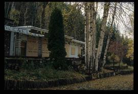
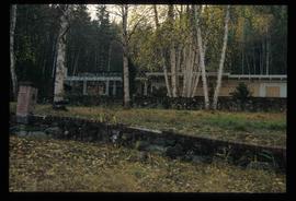
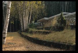
Showing 2244 results

Archival description
950 results with digital objects Show results with digital objects
Millar Addition
2012.13.1.024 · Subseries · [between 1979 and 2000]
Part of J. Kent Sedgwick fonds

File contains slides depicting the Millar Addition suburb in Prince George, B.C.

2012.13.2.21.03 · File · 1973-2001
Part of J. Kent Sedgwick fonds

File consists of records created and collected by Kent Sedgwick regarding Cottonwood Island. Includes: "Welcome to Cottonwood Island Nature Park" brochure [197-?]; "A Brief History of Cottonwood Island Park" by Kent Sedgwick (2001); "History of Cottonwood Island Park and Side Channel Restoration" (2001?); a Regional District of Fraser-Fort George "Notice of Public Hearing" (1973); an outline for "Cottonwood Island Brief" (1973); an original copy of the "Cottonwood Island Study" by the Regional District of Fraser-Fort George (1975); annotated hand-drawn small maps of Cottonwood Island; photocopied aerial photographs; and photocopied newspaper clippings about Cottonwood Island and Island Cache. Also includes 15 colour photographic prints and accompanying negatives taken of Cottonwood Island by Bob Nelson.

2012.13.2.21.04 · File · 1973-1978
Part of J. Kent Sedgwick fonds

File consists of proposals and documents by Kent Sedgwick regarding Cottonwood Island. Includes: "Proposal for Cottonwood Island as a Park Reserve" and "Some Comments on the Cottonwood Island Park Designation of the Official Community Plan".

Highway 97
2012.13.1.3.022 · Item · Oct. 1975
Part of J. Kent Sedgwick fonds

Image depicts Highway 97 at 15th Ave. looking north. Map coordinates 53°54'42.1"N 122°46'53.1"W

Trailers for Sale
2012.13.1.3.027 · Item · Oct. 1975
Part of J. Kent Sedgwick fonds

Image depicts mobile homes for sale on Cowart Road looking northeast with Simon Fraser Bridge in background. Map coordinates 53°52'39.3"N 122°46'13.1"W

Woodwards
2012.13.1.3.029 · Item · Oct. 1975
Part of J. Kent Sedgwick fonds

Image depicts Parkwood Place taken from Connaught Hill looking west with the hospital in the background. Map coordinates 53°54'39.9"N 122°45'02.5"W

Prince George
2012.13.1.3.042 · Item · Nov. 1977
Part of J. Kent Sedgwick fonds

Image depicts downtown Prince George looking northwest across Dominion Street. Map coordinates 53°54'48.7"N 122°44'45.6"W

View from City Hall
2012.13.1.3.045 · Item · Jan. 1978
Part of J. Kent Sedgwick fonds

Image depicts a view of Prince George from City Hall looking northeast with the pulp mills in the background. Map coordinates 53°54'46.3"N 122°44'41.9"W

View from Gunn Point
2012.13.1.3.058 · Item · Nov. 1979
Part of J. Kent Sedgwick fonds

Image depicts a view of Prince George from Gunn Point in the L.C. Gunn Park looking north. Map coordinates 53°54'26.2"N 122°43'35.8"W.

View from Gunn Point
2012.13.1.3.062 · Item · Nov. 1979
Part of J. Kent Sedgwick fonds

Image depicts a view of Prince George from Gunn Point in the L.C. Gunn Park looking north. Map coordinates 53°54'26.2"N 122°43'35.8"W.

View from Gunn Point
2012.13.1.3.063 · Item · Nov. 1979
Part of J. Kent Sedgwick fonds

Image depicts a view of Prince George from Gunn Point in the L.C. Gunn Park looking north. Map coordinates 53°54'26.2"N 122°43'35.8"W.

View from Gunn Point
2012.13.1.3.066 · Item · Nov. 1979
Part of J. Kent Sedgwick fonds

Image depicts a view of Prince George from Gunn Point in the L.C. Gunn Park looking north. Map coordinates 53°54'26.2"N 122°43'35.8"W.

View from Gunn Point
2012.13.1.3.067 · Item · Nov. 1979
Part of J. Kent Sedgwick fonds

Image depicts a view of Prince George from Gunn Point in the L.C. Gunn Park looking north. Map coordinates 53°54'26.2"N 122°43'35.8"W.

Downtown Prince George
2012.13.1.3.079 · Item · May 1984
Part of J. Kent Sedgwick fonds

Image depicts downtown Prince George taken from City Hall looking northwest. Map coordinates 53°54'46.2"N 122°44'43.9"W

Beehive Burner
2012.13.1.3.089 · Item · 12 Oct. 1989
Part of J. Kent Sedgwick fonds

Image depicts a Beehive Burner along the Nechako on River Road. Map coordinates 53°55'34.1"N 122°44'58.0"W.

Nechako Cutbanks Trail
2012.13.1.3.091 · Item · 12 Oct. 1989
Part of J. Kent Sedgwick fonds

Image depicts the cutbanks on the other side of the Nechako, taken from the nature trail at Island Cache. Map coordinates 53°55'34.6"N 122°45'52.4"W

2012.13.1.3.108 · Item · 12 Oct. 1989
Part of J. Kent Sedgwick fonds

Image depicts 4th Ave at Quebec St, showing the following businesses: The Yarn Barn, Golden Chalice Jewellers, Dandy Lines, Ultrasport, and Saveco. Map coordinates 53°54'58.6"N 122°44'47.5"W

Ginter House
2012.13.1.14.03 · Item · Dec. 1997
Part of J. Kent Sedgwick fonds

Image depicts the Ginter House and the surrounding woods, in Prince George, B.C.

Trains and People
2012.13.1.19.07 · Item · 1979
Part of J. Kent Sedgwick fonds

Image depicts a train and a group of unknown individuals at the GTP roundhouse in Prince George, B.C.

A House
2012.13.1.22.18 · Item · 1970
Part of J. Kent Sedgwick fonds

Image depicts a house in Island Cache. There are several cars parked outside it.