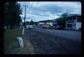
Image depicts two bridges over the Fraser River, located somewhere in Lillooet, B.C.
Image depicts a view of Lillooet, B.C.
Image depicts an old church located somewhere in Lillooet, B.C.
Image depicts Lillooet, B.C.
Image depicts the remains of an old bridge, somewhere near Pavilion Mountain.
Image depicts the First Nations village of Pavilion, B.C.
Image depicts some farmland in Lillooet, B.C.
Image depicts three unknown individuals in a kitchen somewhere in Lillooet, B.C. They are possibly archaeology students.
Image depicts a gathering of people for an uncertain event at an uncertain location, possibly in Lillooet, B.C. A few tents are set up in the picture.
Image depicts a view of the Fraser River and the mountains surrounding Lillooet, B.C.
Image depicts a view of the Fraser River in Lillooet, B.C.
Image depicts several old buildings at an uncertain location. The slide is simply labelled "Spring house?"
Image depicts an old building at an uncertain location. The slide is simply labelled "Spring house."
Image depicts a view of Canoe Creek.
Image depicts a house located somewhere in or near Canoe Creek.
Image depicts a church and several other buildings in Canoe Creek.
Image depicts a house and numerous rundown vehicles in Dog Creek, B.C.
Image depicts the Alkali Lake Ranch in Alkali Lake, B.C.
Image depicts a bridge over the Fraser River in the Upper Fraser Canyon; possibly near Gang Ranch.
Image depicts Gang Ranch in the Upper Fraser Canyon.
Image depicts the Gang Ranch House in the Upper Fraser Canyon.
Image depicts Gang Ranch in the Upper Fraser Canyon.
Image depicts the Upper Fraser Canyon from what appears to be the entrance to Gang Ranch.
Image depicts Gang Ranch, with a sign warning that the area is patrolled by Range and Logging Patrols, in the Upper Fraser Canyon.
Image depicts the grave of W.L. Meason in the upper Fraser Canyon.
Image depicts a wooden structure at Gang Ranch. It is possibility an elevated water trough.
Image depicts the general store and post office on Gang Ranch.
Image depicts the house of the owner of Gang Ranch.
Image depicts the Gang Ranch house.
Image depicts the Gang Ranch office.
Image depicts the Chimney Lake Lodge.
Image depicts Chimney lake with a number of houses near the shore, and a child in the foreground.
Image depicts a boat dock on the Nechako Reservoir at Kenny Dam.
Image depicts a boat on the Nechako Reservoir at Kenny Dam.
Image depicts a section of land on the east end of Francois Lake. The lake is visible in the distance.
Image depicts Francois Lake.
Image depicts Nautley and the Nautley River near Fraser Lake, B.C.
Image depicts a view of Fraser Lake.
Image depicts an old, boarded up store in Isle Pierre, B.C.
Image depicts the Telkwa river in Telkwa, B.C.
Image depicts two bridges in Telkwa, B.C. One is for trains.
Image depicts a street in Telkwa, B.C.
Image depicts the Royal Bank of Canada in Telkwa, B.C.