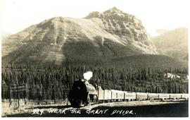
Postcard depicts lower Kicking Horse Canyon, Golden B.C.
Postcard depicts Kicking Horse Canyon.
Postcard depicts lower Kicking Horse Canyon near Golden, B.C,
Postcard depicts Stoney Creek Bridge.
Postcard depicts Macdonald Range, near Glacier B.C.
Postcard depicts Glacier House, CPR, and Hermirt Range, Selkirk Mountains.
Postcard depicts Hermit Range and Rogers' Pass, CPR.
Postcard depicts the east portal of the Connaught Tunnel.
Postcard depicts Glacier Station.
Postcard depicts Illecillewaet Valley and Loop near Glacier, BC
Postcard depicts Illecillewaet Valley from Lookout Point on Mt. Abbott, near Glacier B.C.
Postcard depicts "The Four Tracks."
Postcard depicts Imperial Limited on the Great Loop in the Selkirks, near Glacier, BC
Postcard depicts the Illecillewaet Valley, near Glacier, BCThe view shows the end of the descent over Rogers Pass, if travelling westerly. The scar in the foreground was believed to be the track between the 1st (Glacier Hotel) and 2nd (Loop Brook) loops.
Postcard depicts "The Loop," CPR, Selkirk Mountain.
Postcard depicts the west portal of the Connaught Tunnel, near Glacier, BCDavies noted the ventilation engine house above the entrance.
Postcard depicts the Kamloops CPR depot and gardens.
Postcard depicts Main Street (Victoria West) Kamloops in 1910.
Postcard depicts a "4-4-0 woodburning locomotive at Shuswap Station, east of Kamloops, at the turn of the century. The completion of the CPR across the Continent, guaranteed B.C.'s entry into Cinfederation, as well as reg economic and cultural connection to the East."
Plan depicts "scheme B" of the proposed 6 stall addition to the roundhouse at Kamloops, BC.
File consists of a pamphlet published by the City of Vancouver Archives commemorating the arrival of the first trans-Canada train from Montreal to Vancouver.
Postcard depicts Mt. Stephen. Train entering a lower spiral tunnel.
Postcard depicts totem poles at Wapla Lake Camp. The lake was the headwaters of the Kicking Horse River.
Postcard depicts Mt. Stephen and Field, BC.
Postcard depicts Cathedral Mountain near Field, BC.
Postcard depicts Field, BCand Mt. Stephen in the Canadian Rockies. "The gateway to the wonderfuk Yoho Valley. Here is situated the spacious and comfortable Mount Stephen House of the CPR."
Postcard depicts the CPR 'Transcanada Limited' near Field, BC
File consists of a photocopied 1938 work by A. McCulloch entitled "The Railway Development in Southern British Columbia from 1890 on, and, Some Reasons for Building the Kettle Valley Railway, and the lines of the Vancouver, Victoria and Eastern Railway and Navigation Company in British Columbia".
Plan depicts the CNR rail yard in Kamloops. The plan was originally drafted on March 6, 1928 and updated to July 1937.
Plan depicts the Canadian Pacific Railway yards in Kamloops and the proposed connection between CPR and CNR. Includes a CPR track profile, profiles of street crossing, and enlargements.
Postcard depicts the Lake Louise CPR depot.
Postcard depicts Cathedral Mountain.
Postcard taken on Field Hill, along the CPR line.
Postcard depicts a train exiting a tunnel along the CPR line.
Postcard depicts the Great Divide between Alberta and British Columbia, along the CPR line.
Postcard depicts Field Hill at Yoho National Park.
Postcard depicts Mt. Stephen and Field, BC
Postcard depicts Kicking Horse Canyon.
Postcard depicts Mt. Stephen, Field, BC
Postcard depicts the Canadian Pacific Railway line where the Great Divide between BC and Alberta.
Postcard depicts Castle Mountain found along the Canadian Pacific Railway line.
Postcard depicts one of the upper sprial tunnels in Field, BC
Postcard depicts a train entering a lower spiral tunnel. Mount Stephen visible.
Postcard depicts a lower spiral tunnel along the CPR line near Field, BC
Postcard depicts Kicking Horse Canyon.
Postcard taken at the Laggan Subdivision, the most famous photograph location on the CPR system due to its official photographer, Nicholas Morrant, 1910-1986. Possibly a 1920's view. From 1978, this location became known as 'Morant's Curve.' This view was a rarity in showing no train on the track.
Plan depicts sections, elevations, and floor plans for the addition to the Kamloops roundhouse.
Architectural block plan depicts a proposed addition to the CNR roundhouse in Kamloops.