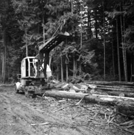
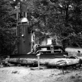
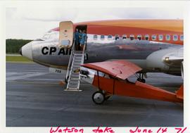
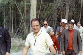
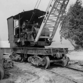
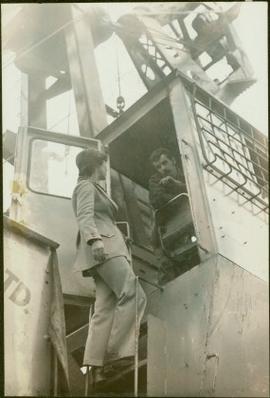
Campagnolo stands on ladder of machine.
Image depicts a small model of the old prospecting process in what is likely Barkerville, B.C.
Image depicts an 80 tonne truck full of rocks at the Gibraltar mine site north of Williams Lake, B.C.
Image depicts an 80 tonne truck at a mine site somewhere in Granisle, B.C.
Image depicts a drill for blasting holes at a mine site somewhere in Granisle, B.C.
Image depicts numerous bags of blasting powder at a mine site somewhere in Granisle, B.C.
Image depicts a large, electric shovel at a mine site somewhere in Granisle, B.C.
Image depicts a group of people at a mine somewhere near Hazelton, B.C.
Photograph depicts flowing water believed to be Troutline Creek which ran south of Cassiar, B.C. Tailings pile and plant buildings visible behind forest in midground, northern mountain range in background. Handwritten annotation on verso of photograph: "Cassiar June 15 71".
Photograph depicts fenced church building with what appears to be speakers mounted on roof above main entry. Road and trees in foreground, mountains in background. Handwritten annotation on verso of photograph: "Cassiar June 15 71".
Photograph depicts part of a brown and white building similar to the "Director's Lodge" at Cassiar, B.C. (see items 2000.1.1.3.19.88 and 2000.1.1.3.19.89). Unidentified individuals visible inside greenhouse in fenced back yard. Forest in background. Handwritten annotation on verso of photograph: "Cassiar June 15 71".
Photograph depicts three women wearing matching attire in doorway of CP Air plane on runway. Small plane in foreground, field and trees in background. Handwritten annotation on verso of photograph: "Watson Lake June 14 71".
Photograph depicts two lawn chairs in front of building with front deck. Trees visible in foreground and background. Handwritten annotation on verso of photograph: "Directors Lodge Cassiar June 15 71". Building also known as "House 130".
Photograph depicts long bunkhouse buildings located between the Cassiar plant and townsite. They were originally used seasonally by university students, or by new employees on waiting lists for the more accommodating panabode "Winter Bunkhouses" (see item 2000.1.1.3.19.113). These buildings are speculated to be bunkhouses number 86, 87, and 88. Trees cross midground; new mill building, tailings pile, and mountains visible in background. Handwritten annotation on verso of photograph: "Cassiar June 15 71".
Photograph depicts tramline buckets and tower on plantsite. Vehicles, building materials, and unidentified buildings also visible on plantsite (including what appears to be a water tower). Mountains and valley in background. Handwritten annotation on verso of photograph: "Cassiar June 15 71".
Photograph depicts two-story yellow and orange office building. Unidentified individual stands with garden hose in foreground near what appears to be a lawnmower. Warehouse semi-visible in left background; blue truck and new mill building visible in right background. Handwritten annotation on verso of photograph: "Cassiar Office June 15 71".
Photograph depicts two unidentified men on front deck of building behind trees. Road and car in foreground, mountains visible in background. Handwritten annotation on verso of photograph: "Directors Lodge Cassiar June 15 71". Building also known as "House 130".
Photograph depicts brown and white building similar to the "Director's Lodge" at Cassiar, B.C. (see items 2000.1.1.3.19.88 and 2000.1.1.3.19.89). Station wagon parked in driveway behind short fence in foreground. Trees in foreground, forest and mountains visible in background. Handwritten annotation on verso of photograph: "Cassiar June 15 71".
Image depicts a Hydraulic Placer mining location in Barkerville which has been completely deforested.
Photograph of Prime Minster Pierre Trudeau standing with a group of men looking over the Cassiar valley. Trudeau stands in the middle wearing a yellow shirt.
Photograph depicts Trudeau wearing a white hardhat with his name on the front.
Photograph depicts Trudeau standing outside with a group of men.
Photograph depicts Trudeau standing by trees and brush with a group of men on his Cassiar tour.
Photograph of Prime Minster Pierre Trudeau standing with two other men at the Cassiar Mine.
Photograph depicts an unknown woman kissing Trudeau on the cheek in a crowd of people.
Photograph depicts Trudeau walking outside with a group of men and women on his tour of the Cassiar operation.
Photograph depicts Trudeau being shown the Cassiar mine from outside by Cassiar employees
Photograph depicts Trudeau standing outdoors with three unknown RCMP constables. Cassiar valley is in the background.
Photograph depicts Trudeau standing outdoors and speaking with an unknown man.
Photograph depicts a general view, looking north, of Westview Harbour with the Powell River paper plant smoking in the background.
Photograph depicts the newsprint plant of MacMillan, Bloedell, and Powell River Ltd. In Powell River, B.C. The view is looking northwards and shows that the plant is working on Easter Day/
Photograph depicts a steam crane in a lumber yard on the north side of Porpoise Bay in Sechelt on the Sechelt Peninsula. The steam crane has been converted to diesel and was made by the Brown Hoisting Co. from Cleveland, Ohio. It lifts 21 tons at a 12ft radius and 5 tons at 35ft radius, and is in daily use. The 200 yards of rail track form a "Y" with the bottom piece onto the wharf.
Photograph depicts a once used booming boat made of log sections at a log dump on seashore about 5 miles north of Powell River, and opposite Harwood Island. Stern at left with prop guard.
Photograph depicts a log dump on seashore about 5 miles north of Powell River and opposite Hardwood Island. The view is looking north.
Photograph depicts a logging bridge over Lois River between Saltery Bay and Lang bay, south of Powell River.
Photograph depicts a lumber yard on the north side of Porpoise Bay in Sechelt on the Sechelt Peninsula. The tank in the photograph is about 8 to 10 feet in diameter.
Photograph depicts logging on a side road on the Sechelt Peninsula about 2 miles southeast of Halfmoon Bay.
Photograph depicts the Hedley Gold Mine, 26 miles east of Princeton. Crusher workings.
Photograph depicts Ross Duddy with back to photographer, working at table in lab. Unidentified woman stands in right foreground operating unidentified machinery. Miscellaneous equipment and supplies throughout. Handwritten annotation on recto of photograph: "ROSS DUDDY / LAB SUPER".
Photograph depicts men seated at dining tables and standing in line for food. Two individuals have been circled with pen. Handwritten annotations on recto of photograph: "1. ALBERT KUCHE / 2. LARRY SPAZINSKI".
Photograph depicts two men purchasing items in foreground, facing away from photographer. Unknown woman stands at till behind counter in midground, wearing long white professional jacket. Stocked shelves on wall in background. Store appears to be stocked with groceries and general supplies.
Photograph depicts unknown men entering back of bus, second bus on left. Old Mine Dry Change House in right background; power lines, vehicles, and trees in left background. These buses transported workers from the plant to the mine. Small pickup trucks called "crummies" with cabin mounted in box were used when traveling on the steeper road to the South Peak.
Photograph depicts group of twenty-four men standing on front steps of main office building. Handwritten annotations on recto of similar photograph: "OFFICE STEPS APPROX 1965 / TOP L-R / JULIEN ST. GEORGES / GEORGE TROWSDALE / HANS VELTMEYER / BOB LOVETT / KARL SHULTZ / LOTHAR TISCHLER / - "; "2ND / FRANK CLEMENTS [i.e Kliment?] / BILL PLUMB / HEWETT / - "; "3RD - / - / RENE PASIAUD / DICK [Stevens]"; "4TH / DOC NAVIN / VIC SARAKOSKI / - "; "5TH / CHARLIE GANDER / GORDON EDWARDS / AL FLANIGAN [i.e. Flanagan?] / ANDRE BEGUIN / CHARLIE BRONSON / JACK THORNICROFT". Information in above annotation supplemented with insight from individuals who contributed to Northern BC Archives Facebook Photo ID Project, contact archivist for more information in research file pertaining to item 2000.1.1.3.19.75.
Photograph depicts woman in right foreground with shopping cart, selecting an item from shelf. Unidentified men, women and child can be seen in background. Store appears to be stocked with groceries and general supplies. Handwritten annotation on recto of photograph: "RIGHT MARG MCKENZIE".
Photograph depicts an early spool donkey at the Cowichan Valley Forest Museum
Photograph depicts a scow with chips landing on the north shore of Vancouver harbour. There are Saskatchewan wheat elevators in the background.
Photograph depicts a general view of a Horne Bros. Ltd. shingle mill on #305 West Esplanade Rd. in North Vancouver.
Photograph depicts a view of the booming ground of the Horne Bros. Shingle Co. Ltd. On #305 West Esplanade Rd. in North Vancouver.
Photograph depicts an oxen powered log carrier with wheels that are approximately 10 feet in diameter. It is at Pioneer Park and Museum near Totem Lake, 3 miles north of Yahk and 30 miles east of Creston.
Photograph depicts a mine car at Moyie mine, at Moyie, 20 miles south of Cranbrook. The mine produced silver, zinc, and lead, and worked principally from 1900-1910. It is now disused.