The item is a photograph slide depicting a church tower with a cross on top on the church at Indian Reserve No. 2 in Shelley.
The item is a photograph slide depicting the church tower with a cross on the top of the church at Indian Reserve No. 2 in Shelley.
The item is a photograph slide depicting the front middle section of the church at Indian Reserve No. 2 in Shelley.
The item is a photograph slide depicting a stained-glass window from the church at Indian Reserve No. 2 in Shelley. The window depicts a saint holding a chalice and a book.
The item is a photograph slide depicting a stained-glass window from the church at Indian Reserve No. 2 in Shelley. The window depicts a saint holding a chalice and a book.
The item is a photograph slide depicting a stained-glass window from the church at Indian Reserve No. 2 in Shelley. The window depicts a saint holding a sword.
The item is a photograph slide depicting a stained-glass window from the church at Indian Reserve No. 2 in Shelley. The window depicts a saint holding an olive branch and a lamb.
The item is a photograph slide depicting a stained-glass window from the church at Indian Reserve No. 2 in Shelley. The window depicts a saint holding a staff and three golden balls.
The item is a photograph slide depicting a stained-glass window from the church at Indian Reserve No. 2 in Shelley. The window depicts a saint holding a staff and three golden balls.
The item is a photograph slide depicting a stained-glass window from the church at Indian Reserve No. 2 in Shelley. The window depicts a saint holding a sword.
The item is a photograph depicting a stained-glass window from the church at Indian Reserve No. 2 in Shelley. The window is titled "Saint Agnes" and depicts a saint holding an olive branch and a lamb.
The item is a photograph depicting a stained-glass window from the church at Indian Reserve No. 2 in Shelley. The window is titled "Saint Joseph" and depicts a saint holding an olive branch.
The item is a photograph depicting a stained-glass window from the church at Indian Reserve No. 2 in Shelley. The window is titled "Saint John" and depicts a saint holding a chalice and a book.
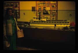
Image depicts a woman standing next to a model of a ship in glass case in what appears to be a museum. The location is uncertain.
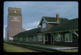
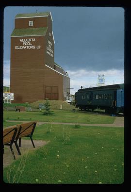
Image depicts the Station Museum and the "Alberta Pool Elevators Ltd." building in Dawson Creek, B.C.
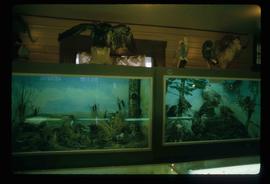
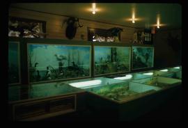
Image depicts stuffed wildlife exhibits inside the Station Museum in Dawson Creek, B.C.
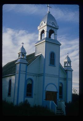
The item is a photograph slide depicting the front of the church at Indian Reserve No. 2 in Shelley.
The item is a photograph slide depicting the front of the church at Indian Reserve No. 2 in Shelley.
The item is a photograph slide depicting a church tower with a cross on top on the church at Indian Reserve No. 2 in Shelley.
The item is a photograph slide depicting the side of the church at Indian Reserve No. 2 in Shelley.
The item is a photograph slide depicting a stained-glass window from the church at Indian Reserve No. 2 in Shelley. The window depicts a saint holding a chalice and a book.
The item is a photograph slide depicting a stained-glass window from the church at Indian Reserve No. 2 in Shelley. The window depicts a saint holding an olive branch.
The item is a photograph slide depicting a stained-glass window from the church at Indian Reserve No. 2 in Shelley. The window depicts a saint holding an olive branch.
The item is a photograph slide depicting a stained-glass window from the church at Indian Reserve No. 2 in Shelley. The window depicts a saint holding a staff and three golden balls.
The item is a photograph slide depicting a stained-glass window from the church at Indian Reserve No. 2 in Shelley. The window depicts a saint holding a shepherd's staff and a lamb.
The item is a photograph depicting a stained-glass window from the church at Indian Reserve No. 2 in Shelley. The window is titled "Saint Nicholas" and depicts a saint holding a staff and three golden balls.
The item is a photograph depicting a stained-glass window from the church at Indian Reserve No. 2 in Shelley. The window is titled "Saint Peter" and depicts a saint holding keys and a scroll.
The item is a photograph depicting a crucifix from the church at Indian Reserve No. 2 in Shelley.
The item is a photograph depicting a stained-glass window from the church at Indian Reserve No. 2 in Shelley. The window is titled "Saint Agnes" and depicts a saint holding a lamb and an olive branch.
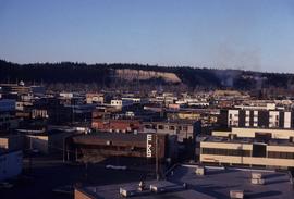
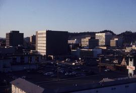
Image depicts downtown Prince George taken from City Hall looking north. Map coordinates 53°54'46.2"N 122°44'43.9"W
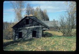
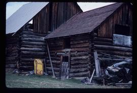
Image depicts an old barn and a collapsing cabin somewhere in the Fort George Canyon Provincial Park, B.C.
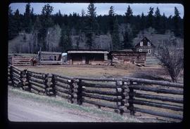
Image depicts a barnyard of cattle and chicken on a farm or ranch in Meldrum Creek, B.C.
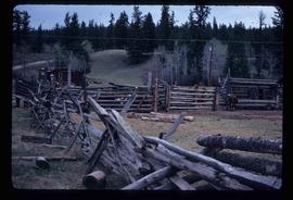
Image depicts fenced-in cattle on a farm or ranch in Meldrum Creek, B.C.
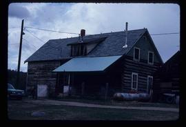
Image depicts a ranch house in Meldrum Creek, B.C.
Image depicts an old, collapsing shack in Meldrum Creek, B.C.
Image depicts what appears to be a saw mill belonging to Northwood. The location is uncertain.
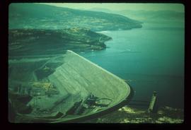
Image depicts the W.A.C. Bennett Dam on the Peace River in Hudson's Hope, B.C.
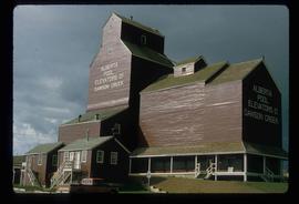
Image depicts a large building which is labelled "Alberta Pool Elevators Ltd. Dawson Creek," located in Dawson Creek, B.C.
Image depicts a large building which is labelled "Alberta Pool Elevators Ltd. Dawson Creek," located in Dawson Creek, B.C.
Image depicts stuffed wildlife exhibits inside the Station Museum in Dawson Creek, B.C.
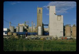
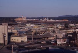
Image depicts a view of Prince George from City Hall looking northeast with the pulp mills in the background. Map coordinates 53°54'46.3"N 122°44'41.9"W
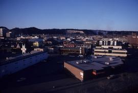
Image depicts downtown Prince George taken from City Hall looking north. Map coordinates 53°54'46.2"N 122°44'43.9"W
Image depicts downtown Prince George taken from City Hall looking northwest. Map coordinates 53°54'46.2"N 122°44'43.9"W
Image depicts a Catholic church at an unknown location.
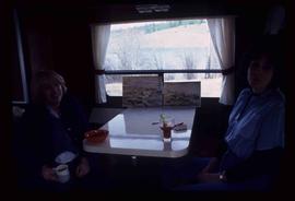
Image depicts two women at a table; the one on the right is possibly Sue Sedgwick. The image may have been taken in Meldrum Creek, B.C.
The item is a photograph depicting the front of the church at Indian Reserve No. 2 in Shelley.
The item is a photograph slide depicting a stained-glass window from the church at Indian Reserve No. 2 in Shelley. The window depicts a saint with their hands on their breast.
The item is a photograph slide depicting a stained-glass window from the church at Indian Reserve No. 2 in Shelley. The window depicts a saint holding keys and a scroll.
The item is a photograph slide depicting a stained-glass window from the church at Indian Reserve No. 2 in Shelley. The window depicts a saint holding a shepherd's staff and a lamb.
The item is a photograph slide depicting a stained-glass window from the church at Indian Reserve No. 2 in Shelley. The window depicts a saint holding an olive branch and a lamb.
