Mostrar 135 resultados

Archival description
131 resultados com objetos digitais Mostrar resultados com objetos digitais
Bob Harkins interviews Ted Williams
2002.12.29.1 · Item · c.1970-c.1989
Parte de Bob Harkins fonds

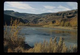
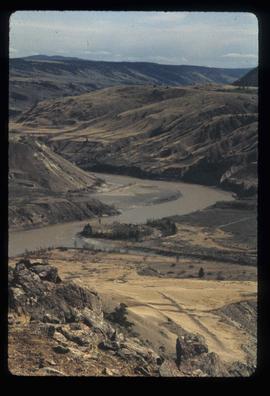
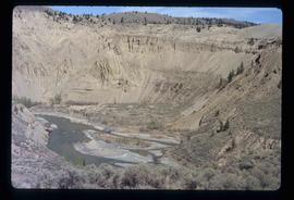
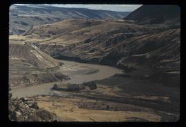
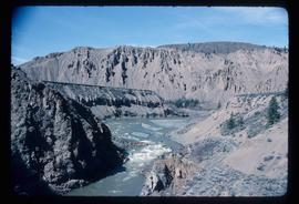
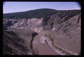
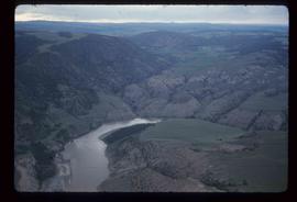
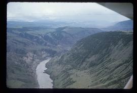
Item consists of transcript and taped summary of recorded interview with long-time resident Ted Williams who discusses his father' Chuck Williams early years in Prince George c.1920s. He also discusses river transportation, steam boats on the Fraser River and river scowing adventures on the Grand Canyon (BC) and fatalities that occurred.

Sem título
Moran Canyon
2012.13.1.53.48 · Item · July 1982
Parte de J. Kent Sedgwick fonds

Image depicts a view of Moran Canyon in the Lillooet area. The Fraser River is visible on the left.

Lillooet - Bridges
2012.13.1.53.44 · Item · July 1982
Parte de J. Kent Sedgwick fonds

Image depicts two bridges over the Fraser River, located somewhere in Lillooet, B.C.

Lillooet - Bridges
2012.13.1.53.45 · Item · July 1982
Parte de J. Kent Sedgwick fonds

Image depicts two bridges over the Fraser River, located somewhere in Lillooet, B.C.

Lillooet - Bridges
2012.13.1.53.46 · Item · July 1982
Parte de J. Kent Sedgwick fonds

Image depicts two bridges over the Fraser River, located somewhere in Lillooet, B.C.

Moran Canyon
2012.13.1.53.50 · Item · July 1982
Parte de J. Kent Sedgwick fonds

Image depicts the Moran Canyon; the Fraser River is visible near the bottom.

Fraser River - Bridge
2012.13.1.52.44 · Item · [1980?]
Parte de J. Kent Sedgwick fonds

Image depicts a bridge over the Fraser River in the Upper Fraser Canyon; possibly near Gang Ranch.

Gang Ranch - Fraser River
2012.13.1.52.34 · Item · [1980?]
Parte de J. Kent Sedgwick fonds

Image depicts the Fraser River, and a sign pointing towards Gang Ranch with an unknown individual hugging it, in the Upper Fraser Canyon.

Upper Fraser Canyon
2012.13.1.52.30 · Item · 1980
Parte de J. Kent Sedgwick fonds

Image depicts a view of the upper Fraser Canyon. The Fraser River is visible on the left side of the image.

Upper Fraser Canyon
2012.13.1.52.31 · Item · 1980
Parte de J. Kent Sedgwick fonds

Image depicts a view of the upper Fraser Canyon. The Fraser River is visible on the left side of the image.

Fraser Valley
2012.13.1.50.066 · Item · 1978
Parte de J. Kent Sedgwick fonds

Image depicts the Fraser Valley, looking north, possibly from Marguerite, B.C.

Fraser River
2012.13.1.50.065 · Item · 1978
Parte de J. Kent Sedgwick fonds

Image depicts the Fraser River, looking south from Marguerite, B.C.

Farm
2012.13.1.50.067 · Item · 1978
Parte de J. Kent Sedgwick fonds

Image depicts a farm on the west side of the Fraser, south of Quesnel, B.C.

Rock Formations
2012.13.1.65.52 · Item · [1976?]
Parte de J. Kent Sedgwick fonds

Image depicts ridge-like rock formations at an uncertain location, though possibly somewhere near the Fraser River.

Fraser River?
2012.13.1.65.46 · Item · May 1976
Parte de J. Kent Sedgwick fonds

Image depicts what is possibly a section of the Fraser River.

Moran Canyon
2012.13.1.53.23 · Item · Mar. 1975
Parte de J. Kent Sedgwick fonds

Image depicts the Fraser River running through the Moran Canyon near Lillooet, B.C.

Slump or Mining
2012.13.1.65.34 · Item · June 1975
Parte de J. Kent Sedgwick fonds

Image depicts an aerial view of a section of land, likely near the Fraser River, that is possibly either a slump or part of a mining operation. The slide is labelled "slump or mining."

Landscape - Fraser River
2012.13.1.65.38 · Item · June 1975
Parte de J. Kent Sedgwick fonds

Image depicts an aerial view of the land near the Fraser River. The Fraser River is barely visible on the right side of the image.

Moran Canyon
2012.13.1.53.19 · Item · Mar. 1975
Parte de J. Kent Sedgwick fonds

Image depicts the Fraser River running through the Moran Canyon near Lillooet, B.C.

Moran Canyon
2012.13.1.53.24 · Item · Mar. 1975
Parte de J. Kent Sedgwick fonds

Image depicts the Fraser River running through the Moran Canyon near Lillooet, B.C.