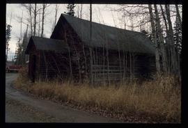
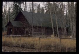
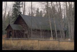
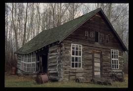
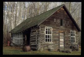
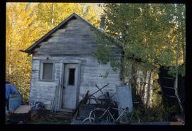
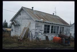
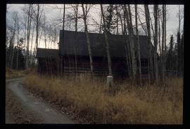
Mostrar 2444 resultados

Archival description
1595 resultados com objetos digitais Mostrar resultados com objetos digitais
Log Cabin
2012.13.1.2.009 · Item · Nov. 2001
Parte de J. Kent Sedgwick fonds

Image depicts a log cabin, possibly in Beaverly.

Log Cabin
2012.13.1.2.010 · Item · Nov. 2001
Parte de J. Kent Sedgwick fonds

Image depicts a log cabin, possibly in Beaverly.

Salmon School
2012.13.1.2.015 · Item · 30 Oct. 2002
Parte de J. Kent Sedgwick fonds

Image depicts the Salmon School in the Prince George vicinity.

Farmhouse
2012.13.1.3.012 · Item · Apr. 1972
Parte de J. Kent Sedgwick fonds

Image depicts a farmhouse on Old Summit Road in Prince George, B.C.

Peden Hill
2012.13.1.3.020 · Item · Oct. 1975
Parte de J. Kent Sedgwick fonds

Image depicts a view of Peden Hill in Prince George, B.C.

Highway 97
2012.13.1.3.021 · Item · Oct. 1975
Parte de J. Kent Sedgwick fonds

Image depicts Highway 97 at 15th Ave. looking north. Map coordinates 53°54'36.0"N 122°46'55.5"W

Highway 97
2012.13.1.3.022 · Item · Oct. 1975
Parte de J. Kent Sedgwick fonds

Image depicts Highway 97 at 15th Ave. looking north. Map coordinates 53°54'42.1"N 122°46'53.1"W

Sprawl
2012.13.1.3.026 · Item · Oct. 1975
Parte de J. Kent Sedgwick fonds

Image depicts a few houses, most likely near the airport in Prince George, B.C.

Trailers for Sale
2012.13.1.3.027 · Item · Oct. 1975
Parte de J. Kent Sedgwick fonds

Image depicts mobile homes for sale on Cowart Road looking northeast with Simon Fraser Bridge in background. Map coordinates 53°52'39.3"N 122°46'13.1"W

Woodwards
2012.13.1.3.029 · Item · Oct. 1975
Parte de J. Kent Sedgwick fonds

Image depicts Parkwood Place taken from Connaught Hill looking west with the hospital in the background. Map coordinates 53°54'39.9"N 122°45'02.5"W

Pipeline
2012.13.1.3.033 · Item · Nov. 1975
Parte de J. Kent Sedgwick fonds

Image depicts a pipeline at Shelley, B.C.

Prince George
2012.13.1.3.042 · Item · Nov. 1977
Parte de J. Kent Sedgwick fonds

Image depicts downtown Prince George looking northwest across Dominion Street. Map coordinates 53°54'48.7"N 122°44'45.6"W

View from City Hall
2012.13.1.3.045 · Item · Jan. 1978
Parte de J. Kent Sedgwick fonds

Image depicts a view of Prince George from City Hall looking northeast with the pulp mills in the background. Map coordinates 53°54'46.3"N 122°44'41.9"W

Prince George
2012.13.1.3.046 · Item · Jan. 1978
Parte de J. Kent Sedgwick fonds

Image depicts a view of Prince George from City Hall looking northeast along George Street. Map coordinates 53°54'46.3"N 122°44'41.9"W

Central Business District
2012.13.1.3.057 · Item · July 1979
Parte de J. Kent Sedgwick fonds

Image depicts the Central Business District of Prince George looking north from Connaught Hill. Map coordinates 53°54'41.4"N 122°44'58.5"W

Fort George Regional Museum
2012.13.1.3.071 · Item · Oct. 1983
Parte de J. Kent Sedgwick fonds

Image depicts the Fort George Regional Museum (now known as The Exploration Place) in Prince George, B.C. Map coordinates 53°54'18.6"N 122°44'09.8"W