Mostrar 167 resultados

Archival description
94 resultados com objetos digitais Mostrar resultados com objetos digitais
Miscellaneous Community Photos
2000.1.1.3.24 · Dossiê/Processo · 1952 - 1992
Parte de Cassiar Asbestos Corporation Ltd. fonds
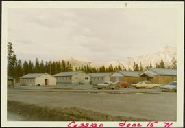
  • File contains photographs done to item level description, depicting miscellaneous people and locations at or around Cassiar, B.C. This includes a photograph of renowned prospector William (“Bill”) Storie, Bill Pratt with a fox, a community gathering in a someone's home, and a hockey game.
  • Also included but not to item level is a photo of "David Madore" as part of his application to Cassiar, photo of "William Field" a local hire maintenance mechanic, and photos of a RNWMP Post sign (Royal North West Mounted Police) that depicts annotations "Indian grave" , "Miners Cabin" , "Road House" , "Customs House" , "St. James Church" , "Swansons Store" etc., and 15 negatives of various individuals at what appears to be someone's home.
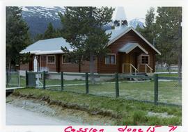
  • Also included is cabin at Boya Lake, which used to be named Chain lake, located off the Stewart-Cassiar highway. This land of this cabin may have been involved legal issues , which was related to people at Cassiar.
Gravel Pit
2000.1.1.3.18.013 · Item · June 1987
Parte de Cassiar Asbestos Corporation Ltd. fonds

Photograph depicts close up view of gravel pit, ruler displayed for scale. Photograph speculated to have been taken at the plant or near the Cassiar airstrip. Stamped annotation on recto of photograph: "JUN. 1987".

Water in Gravel Pit
2000.1.1.3.18.011 · Item · June 1987
Parte de Cassiar Asbestos Corporation Ltd. fonds

Photograph depicts an unidentified man standing to left of large puddle in gravel pit, mountain peaks in background. Photo speculated to have been taken on the plant, or near the Cassiar airstrip, facing south west. Stamped annotation on recto of photograph: "JUN. 1987".

Conveyor & Dump Truck at Gravel Pit
2000.1.1.3.18.012 · Item · June 1987
Parte de Cassiar Asbestos Corporation Ltd. fonds

Photograph depicts yellow conveyor belt in foreground over gravel pit, dump truck behind in midground. Mountains visible in background. Photo speculated to have been taken at the plant or near the Cassiar airstrip. Stamped annotation on recto of photograph: "JUN. 1987".

Maintenance Projects
2000.1.1.2.07 · Dossiê/Processo · 1977 - 1981, predominant 1977-1978
Parte de Cassiar Asbestos Corporation Ltd. fonds

Photographs depict different construction projects at separate locations in Cassiar. Photographs were originally housed in envelopes with the following annotations: "POLICE STATION. July 15, 1977."; "Aggregates and Concrete (PERMASTEEL)"; "Fibre Storage and Handling"; "Powerhouse Expansion"; "Sewage Collection Plant."; "Sewage Treatment Plant"; "Single Person Accommodations - Site Work."; "Outside Work - Camp Nos. 1,2,3." Photos generally feature the work sites, supplies, vehicles, machinery, and work in progress at each location.

Additional photographs integrated into file include maintenance project on lining of tubes, lining of aspiration hood, and lining of willow fiberizer. Also five photographs of maintenance in the townsite to fix in ground piping.

Community Album - Town Office
2000.1.1.3.19.110 · Item · [ca. 1980]
Parte de Cassiar Asbestos Corporation Ltd. fonds

Photograph depicts unidentified man walking up front steps to building with the following sign: "TOWN ADMINISTRATION / MOTOR VEHICLE BRANCH / HCBC AGENCY / DISTRICT REGISTRAR / CDN CITIZENSHIP COURT / FISH & GAME LICENCES". Vehicles parked in foreground and behind at unknown building in midground. Power line and mountains in background.

Community Album - Fire Hall
2000.1.1.3.19.120 · Item · [ca. 1980]
Parte de Cassiar Asbestos Corporation Ltd. fonds

Photograph depicts two fire trucks semi-visible in garage with the sign "FIRE HALL". House and snowmobile can be seen in left midground, truck and power pole in right foreground. Mountains in background. Warning visible on front of trucks: "KEEP BACK 500m".

Community Album - Main Office, Warehouse & Mill
2000.1.1.3.19.122 · Item · [ca. 1980]
Parte de Cassiar Asbestos Corporation Ltd. fonds

Photograph depicts two-story main office building in right midground behind sign reading "CASSIAR ASBESTOS CORPORATION Ltd / CASSIAR MINE / MAIN OFFICE". Building believed to be warehouse can be seen behind raised Canadian flag on pole in left midground. New mill building and tailings pile visible behind warehouse and office, mountains in background.

Community Album - Machinery at New Mine Garage
2000.1.1.3.19.127 · Item · [ca. 1980]
Parte de Cassiar Asbestos Corporation Ltd. fonds

Photograph depicts the new mine garage behind machinery, mountains in background. Mobile blast hole drill can be seen in left foreground (manufactured by Robbins with Caterpillar undercarriage). Two 50-tonne Wabco "haul paks" in right foreground (ore haulage trucks).

Bill Storie on Limestone Mountain
2000.1.1.3.24.01 · Item · [ca. 1980]
Parte de Cassiar Asbestos Corporation Ltd. fonds

Photograph depicts William (Bill) Storie at location known as Limestone Mountain, southwest of Cassiar, B.C. Photo features profile of Bill, hands in pocket, Cassiar valley and mountains in background. Storie was a renowned prospector in the Cassiar area, and the new school at Cassiar was named for him in 1992.

Community Album - Bunkhouse
2000.1.1.3.19.112 · Item · [ca. 1980]
Parte de Cassiar Asbestos Corporation Ltd. fonds

Photograph depicts an unidentified man walking in front of orange and brown two-story building speculated to be bunkhouse residences. Second unknown individual can be seen unloading car in left foreground. Trees and mountains visible in background.

Workplace Album - Tramline & Mine Road
2000.1.1.3.19.194 · Item · [ca. 1980]
Parte de Cassiar Asbestos Corporation Ltd. fonds

Photograph depicts ore cars on cables running between tramline towers on left. Road in right foreground, building and McDame mountain in background. Tramline ran through mine valley, between loading station in mine and dump station at mill on plantsite.

Community Album - Tramline
2000.1.1.3.19.126 · Item · [ca. 1980]
Parte de Cassiar Asbestos Corporation Ltd. fonds

Photograph depicts ore cars on cables running between tramline towers. Flowers in foreground, mine valley and McDame mountain in background. Tramline ran through mine valley, between loading station (2000.1.13.19.197) in mine and dump station at mill on plantsite (2000.1.1.3.19.124)

Workplace Album - Conveyor Gallery
2000.1.1.3.19.198 · Item · [ca. 1980]
Parte de Cassiar Asbestos Corporation Ltd. fonds

Photograph depicts tramline conveyor in centre of image (located west of mine). Conveyor ran from crusher plant to tramline loading station. Building on left believed to be the crusher reject plant. Mine valley and northwestern mountain range in background.

Workplace Album - Tramline & Mine Road
2000.1.1.3.19.195 · Item · [ca. 1980]
Parte de Cassiar Asbestos Corporation Ltd. fonds

Photograph depicts ore cars on cables running between tramline towers on left. Road in right foreground, building and McDame mountain in background. Tramline ran through mine valley, between loading station in mine and dump station at mill on plantsite.

Official Tours
2000.1.1.4.1 · Dossiê/Processo · ca. 1968; 1978
Parte de Cassiar Asbestos Corporation Ltd. fonds

File contains photographs depicting four different tours that took place at the mine, plant, and towns owned by Cassiar Asbestos Corporation Ltd. Tours include Prime Minister Pierre Trudeau's visit to Clinton Creek in 1968 and Member of Parliament Iona Campagnolo's visit to Cassiar in 1978. Photographs also depict a party of ambassadors touring Cassiar in 1970, and the dedication of a building in the Cassiar plant in the late 1970s.

Tramline
2000.1.1.3.17 · Dossiê/Processo · [ca. 1955] - 1977
Parte de Cassiar Asbestos Corporation Ltd. fonds

File contains photographs featuring the tramline at Cassiar which ran from the crushing plant at the mountain mine to the plantsite in the valley (a drop of 427 meters). The first ore was originally transported by truck to the plant until the gravity chute was built in 1953. This chute was replaced with the first aerial tramline model in 1956, which was succeeded by the second model in 1975. This file also includes one photo of the original gravity chute, and one photo depicting a tramline worker.

Additionally there is a collection of eighteen photographs of tramline cars that were being surveyed for damage and condition, and another collection of six photographs of tramline study. The results of this study determined that there was variances in load sizes of the buckets caused by extra material falling off the panfeeder.

Helicopter Trip - Aerial View of West Peak
2000.1.1.3.19.101 · Item · [ca. 1975]
Parte de Cassiar Asbestos Corporation Ltd. fonds

Photograph depicts the West Peak of the Cassiar mine on McDame Mountain. Pit area visible between West Peak and road in foreground. Mine valley and north mountain range in background. Photo speculated to have been taken from a point on or near the South or North Peak.

1971 - Troutline Creek, Cassiar, BC
2000.1.1.3.19.079 · Item · 15 June 1971
Parte de Cassiar Asbestos Corporation Ltd. fonds

Photograph depicts flowing water believed to be Troutline Creek which ran south of Cassiar, B.C. Tailings pile and plant buildings visible behind forest in midground, northern mountain range in background. Handwritten annotation on verso of photograph: "Cassiar June 15 71".

1971 - Summer Bunkhouses
2000.1.1.3.19.084 · Item · 15 June 1971
Parte de Cassiar Asbestos Corporation Ltd. fonds

Photograph depicts long bunkhouse buildings located between the Cassiar plant and townsite. They were originally used seasonally by university students, or by new employees on waiting lists for the more accommodating panabode "Winter Bunkhouses" (see item 2000.1.1.3.19.113). These buildings are speculated to be bunkhouses number 86, 87, and 88. Trees cross midground; new mill building, tailings pile, and mountains visible in background. Handwritten annotation on verso of photograph: "Cassiar June 15 71".

1971 - Troutline Creek, Cassiar, BC
2000.1.1.3.19.080 · Item · 15 June 1971
Parte de Cassiar Asbestos Corporation Ltd. fonds

Photograph depicts flowing water believed to be Troutline Creek which ran south of Cassiar, B.C. Tailings pile and plant buildings visible behind forest in midground, northern mountain range in background. Handwritten annotation on verso of photograph: "Cassiar June 15 71".

1971 - Troutline Creek, Cassiar, BC
2000.1.1.3.19.081 · Item · 15 June 1971
Parte de Cassiar Asbestos Corporation Ltd. fonds

Photograph depicts flowing water speculated to be Troutline Creek which ran south of Cassiar, B.C. Forest on opposite shore and mountains in background. Handwritten annotation on verso of photograph: "Cassiar June 15 71".