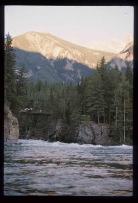
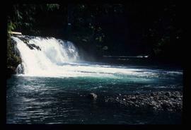
Image depicts an unidentified individual diving into a pool of water at an uncertain location.
Image depicts a small waterfall at an uncertain location.
Image depicts what is possibly Hospital Beach in Kitimat, B.C. The facility in the background is possibly the Alcan smelter.
Image depicts a dog on a road, and a view of the mountains in Bear Glacier Provincial Park.
Image depicts a small section of the Bear Glacier.
Image depicts a house with a vehicle in a garage and the number 40 on it; location is uncertain.
File contains slides depicting places in and between McBride and the Yellowhead Pass via the Yellowhead Highway.
Image depicts Mt. Robson.
Image depicts the Rearguard Falls in Rearguard Falls Provincial Park near Tête Jaune Cache along the Yellowhead Highway.
Image depicts a view of what is possibly the Yellowhead Pass on the British Columbia-Alberta border, west of Jasper A.B.
Image depicts the Rocky Mountain Trench from McBride, B.C.
Image depicts what is either the Rocky Mountains or possibly the Columbia Mountains, from McBride, B.C.
Image depicts the Rocky Mountain Trench from McBride, B.C.
Image depicts a view of either the Rocky Mountains or possibly the Columbia Mountains near McBride, B.C.
Image depicts a house located somewhere near McBride, B.C.
Image depicts a view of what is either the Rocky Mountains or possibly the Columbia Mountains near McBride, B.C.
Image depicts a view of what is either the Rocky Mountains or possibly the Columbia Mountains in the background of a small section of McBride, B.C.
Image depicts several houses in McBride, B.C. A mountain is visible in the background.
Image depicts a view of what is either the Rocky Mountains or possibly the Columbia Mountains from McBride, B.C.
Image depicts a view of what is either the Rocky Mountains or possibly the Columbia Mountains near McBride, B.C.
Image depicts a view of what is most likely the Rocky Mountains near McBride, B.C.
Image depicts Mt. Robson.
Image depicts a view of a mountain range near Valemount, B.C. Valemount is barely visible among the trees on the right side of the image.
Image depicts a view of Valemount with numerous mountains in the background.
Image depicts a distant view of what appears to be a body of water, with numerous mountains in the background. The slide is labelled "Valemount reservoir."
Image depicts a view of Valemount, with numerous mountains in the background.
Image depicts the peak of Mt. Robson.
Image depicts Mt. Robson.
Image depicts a river somewhere in Mt. Robson Provincial Park, with a bridge running over it. The slide itself is labelled "Robson station."
Image depicts a view of the Rocky Mountain Trench somewhere near McBride, B.C.
Image depicts the ranch house of the Ranch of the Vikings, originally owned and operated by Bjorger Pettersen, a member of the Canadian Ski Hall of Fame, from 1970 until 1985. It is located somewhere west of McBride, B.C.
Image depicts a view of an area somewhere near McBride in the Rocky Mountain Trench.
Image depicts a view of McBride in the Rocky Mountain Trench.
Image depicts a view of the Rocky Mountain Trench.
Image depicts Portal Lake, located near the Yellowhead Pass on the British Columbia-Alberta border, west of Jasper, A.B.
Image depicts the boundary line between British Columbia and Alberta at the Yellowhead Pass.
Image depicts numerous lily pads on the surface of Portal Lake, located near the Yellowhead Pass on the British Columbia-Alberta border, west of Jasper, A.B.
Image depicts Yellowhead Lake, located near the Yellowhead Pass.
Image depicts a vehicle on a gravel road somewhere near Tête Jaune Cache, B.C.
Image depicts a collapsing shack somewhere near Tête Jaune Cache, B.C.
Image depicts a forest service cabin somewhere near Tête Jaune Cache, B.C.
Image depicts a mountain at an uncertain location.
Image depicts an old road through the trees near Yellowhead Pass. The slide labels it as the origin of the Yellowhead highway.